- Jan 14 - "漁船改良丸の好果" - 山陰新聞(Sanin-Shinbun)
New Japanese Boat Visits Ulleungdo - Feb 18 - "朝鮮竹島探検(松江佐藤狂水生投)" - 山陰新聞(Sanin-Shinbun)
Article on an Ulleungdo Inspection
- Feb 24 - ”隠岐の新島” - 山陰新聞(Sanin-Shinbun)
Takeshima Incorporated into Shimane Prefecture - Jul 3 - "海鮮紀念絵葉書" - 山陰新聞(Sanin-Shinbun)
Postcards to Commemorate Naval Battle - Aug 6 - ”竹島渡航” - 山陰新聞(Sanin-Shinbun)
Japanese Officials to Visit Takeshima - Aug 22 - "松永知事の竹島観察" - 山陰新聞(Sanin-Shinbun)
Governor Matsunaga Inspects Takeshima - Aug 22 -”県庁内に海豚放養” - 山陰新聞(Sanin-Shinbun)
"Sea Pigs" Near Takeshima
1906
- Mar 11 - "竹島行決定" - 山陰新聞(Sanin-Shinbun)
Voyage to Takeshima Decided - Apr 1 - "竹島土産" - 山陰新聞(Sanin-Shinbun)
Japanese Tell Koreans of Takeshima Incorporation - Apr 8 - "竹島渡海日記" - 山陰新聞(Sanin-Shinbun)
Description of Japanese Officials' Visit to Ulleungdo
- June 28 - July 08 - "日本海のアシカ狩" - 朝日新聞(Asahi Sinbun)
Featured Articles in "Seal Hunting in the Sea of Japan"
- March 07 - "竹島に日本領の確証 回船問屋が発見 由来記伝える大谷家" - 朝日新聞(Asahi Sinbun)
Discovery of the 'Chronicle of the Ohtani Clan' and Two Other Documents proving Japan's sovereignty over Takeshima
- Apr 28 - May 02 - "竹島に波高し 見出し一覧" - 山陰中央新報 (San-in Chuo Shinpo) cache List of the Featured Articles in "A High Wave on Takeshima"
- March 02 - "米子・山陰歴史館に竹島渡海資料"- 日本海新聞(Nihonkai Sinbun) cache
Sanin History Museum in Yonago (米子市立山陰歴史館) possesses Edo-era historical material on the "Takeshima Operation," which was donated by the Oya and Murakawa clans. - March 27 - "竹島と独島 これを「友情島」に…の夢想" - 朝日新聞 (Asahi Shinbun) cache
Editorial - Jul 27 - Nov 06 - "発信竹島 ~真の日韓親善に向けて~" 見出し一覧 - 山陰中央新報 (San-in Chuo Shinpo) cache
List of the Featured Articles in "Message from Takeshima - Towards Genuine Friendship Between Two Countries-" - Sep. 07 - "韓国領主張の絵図、江戸幕府が「地理相違」" - 山陰中央新報 (San-in Chuo Shinpo) cache
Associate Professor of Shimane University, Dr. Funasugi found the court decision by Tokugawa Shogunate which tells about the "Map of Three Countries (三国通覧輿地路程図説) by Hayashi Shihei(林子平) in 1785." The map was banned from being published and Hayashi was punished because of the "disparity of the geography of the map"(「地理相違の絵図」). - Dec 06 - "伊能図に竹島?" - 山陰中央新報 (San-in Chuo Shinpo) cache
"Takeshima Described on Inoh's Map?"
2006
- Jul 12 - "竹島領有権で新事実" - 山陰中央新報 (San-in Chuo Shinpo) cache
1894 Japanese naval document, "Watersways of Joseon" (朝鮮水路誌)" cleary defines the eastern boundary of Joseon at a longitude of 130 degrees, 35 minutes. - June 21 - 竹島関連資料の目録をウェブサイトで公開 - 山陰中央新報 (San-in Chuo Shinpo) cache
An associate professor of Shimane compiled the list of Takeshima issue resources and made them available to the public on a website. - Aug 04 - "大正期の「隠岐全図」に竹島" - 山陰中央新報 (San-in Chuo Shinpo) cache
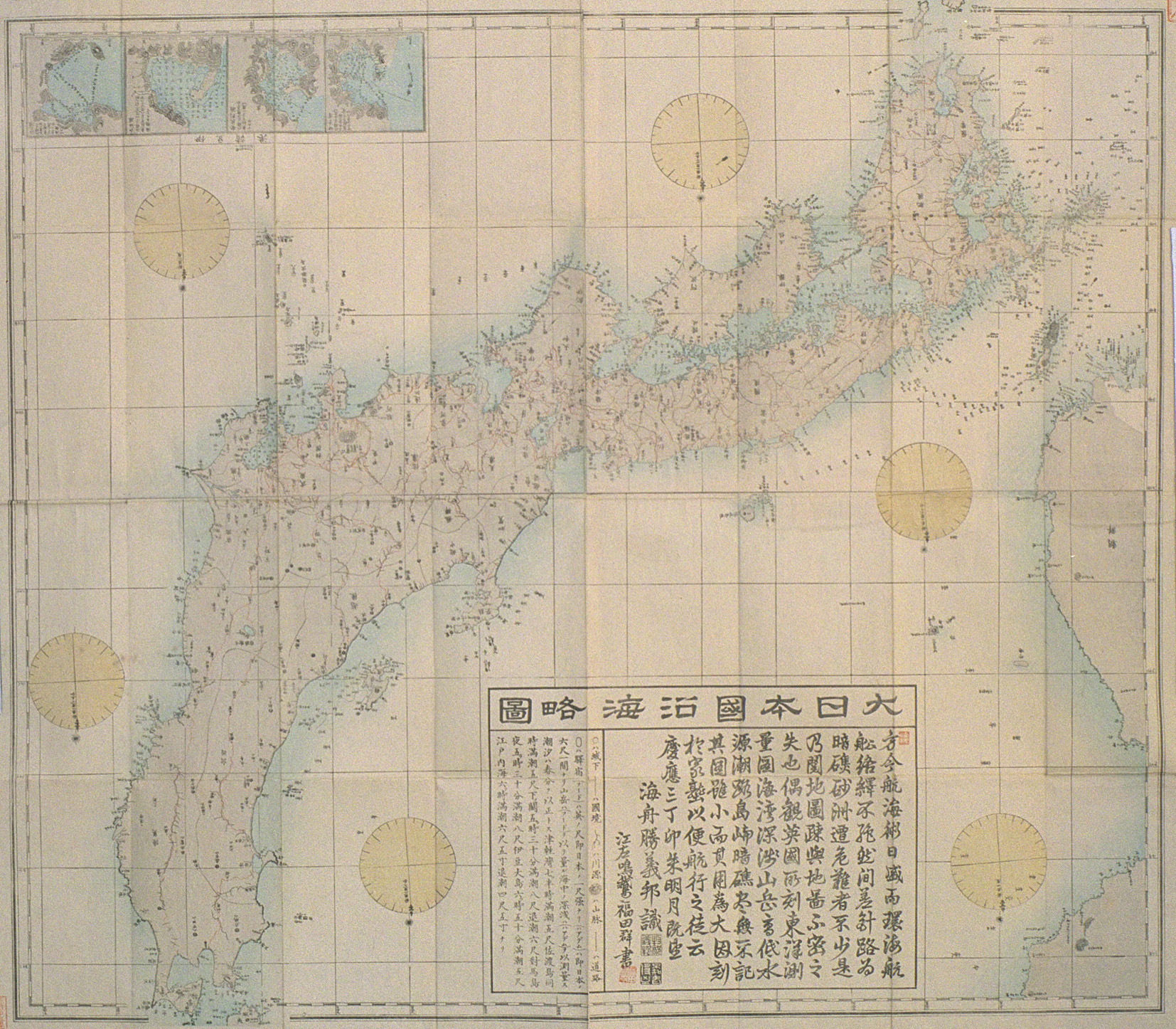
Takeshima Appears on Oki Map Made in Taisho Era - Oct 31 - "陸地測量部の地図に「竹島」記載" - 山陰中央新報 (San-in Chuo Shinpo) cache
Takeshima on a Department of Land Survey Map - Nov 23 - "中井養三郎の「竹島」聞き取り文書見つかる" - 山陰中央新報 (San-in Chuo Shinpo) cache
Document on an Audio Recording of Yosaburou Nakai Found - Nov 28 - "竹島問題研究会が韓国側論拠の誤り指摘" - 山陰中央新報 (San-in Chuo Shinpo) Takeshima Research Team Points Out Mistakes in Korean Argument
2007
- Jan 23 - "竹島問題研究会が聞き取り調査" - 山陰中央新報(San-in Chuo Shinpo)
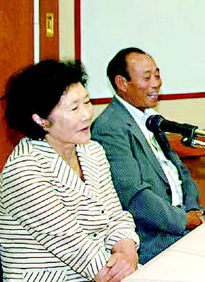
Ninety-five-year-old Oki Island fisherman, Yoshiyama Yakeshi (吉山武), says he hunted sea lions on Takeshima in 1934. He says he hunted on west island and slept on the east island. - Feb 09 - "竹島所管を記す大正期の地図2枚見つかる" - 山陰中央新報 (San-in Chuo Shinpo) cache
Two Taisho Era Maps Found Showing Japan's Ownership of Takeshima - Feb 16 - "江戸時代作製の「松島絵図」複写見つかる" - 山陰中央新報 (San-in Chuo Shinpo) cache
Picture of an Edo Era Map of Matsushima Found - Feb 22 - "竹島問題で韓国側主張覆す古地図見つかる" - 山陰中央新報 (San-in Chuo Shinpo) cache
Old Korean Map that Overturns Korea's Claim on Takeshima Found - Feb 25- "もみ合い一時騒然 「竹島の日」式典会場周辺 " - 山陰中央新報 (San-in Chuo Shinpo) cache
- Feb 25- "韓国の竹島領有論に反論 松江でフォーラム " - 山陰中央新報 (San-in Chuo Shinpo) cache
- Mar 07-13 - "波頭を越えて-竹島レポート-第1部" - 産経新聞(Sankei Shinbun) cache
"Beyond the Crest of the Wave - Takeshima Report - Part I" - Mar 13 - "「古地図」報道裏付ける韓国史料発見 " - 山陰中央新報 (San-in Chuo Shinpo ) cache
Old Korean Document Found that Backs Up Coverage of Old Korean Map - Mar 29 - "「Web竹島問題研究所」開設へ" - 山陰中央新報(San-in Chuo Shinpo) cache
Shimane prefecture governor, Mizoguchi Zenbei(溝口善兵衛), announced a plan to establish a Web-based "Takeshima Research Center" that will employ twenty to thirty people. The official launch is scheduled for the fall. - Apr 20 - " 「竹島資料室」がオープン" - 山陰中央新報(San-in Chuo Shinpo) cache
Takeshima Reference Room Opens in Shimane - May 05 - "初歩的ミス?歪曲?独島博物館の竹島位置に誤り" - 産経新聞(Sankei Shinbun)
"Dokdo Museum admits Usando was misplaced on the relief of the 1581 「八道総図」 map in the museum for educational purposes and says there are plans to correct it" - May 10 - "李ライン翌年竹島にニホンアシカ多数生息" - 山陰中央新報(San-in Chuo Shinpo) cache
Former teacher of Fisheries at Oki High School said there were still lots of sea lions on Takeshima when he went there in 1953. He said that the Korean fishermen on the island exchanged sea lions for rice and tabacco, which they were unable to get from the peninsula due to bad weather. - May 15-18 - "波頭を越えて-竹島レポート-第2部" - 産経新聞(Sankei Shinbun) cache
"Beyond the Crest of the Wave - Takeshima Report - Part II" - June 06 - "竹島問題研究会が最終報告 韓国側の主張には多くの誤り" - 山陰中央新報 (San-in Chuo Shinpo) cache
Final report submitted by the Takeshima Research Team claims there are many mistakes in Korean claims
translation provided by ZERO - June 07 - "竹島記載の日本図屏風見つかる" - 山陰中央新報 (San-in Chuo Shinpo) cache
Two maps on an Edo era folding screen, which described Takeshima/Liancourt Rocks has been found. One is a Japanese map and the other is a world map which seems to be copied from The World map (坤輿万国全図) by Matteo Ricci in 1602. An island which seems like Ulleungdo was coloured the same as Japan. - July 04 - "邑南で韓国主張覆す竹島地図見つかる" - 山陰中央新報 (San-in Chuo Shinpo) cache
A copy of a map by Nagakubo Sekisui, which shows Takeshima (today's Ulleungdo) and Matsushima (today's Takeshima/Liancourt Rocks) coloured in the same red as the Japanese mainland, has recently been found in Shimane. Mr. Tsukamoto, from National Diet Library in Japan, confirmed that the original 1789 map, which is stored in the library, has the same colour on both islands. It proved that Nagakubo recognised both islands as Japanese territory, and he didn't intend to exclude nor recognise those as Choson territory in his 1779 map in which he left both islands were left uncoloured. - July 05 - "島根出身の韓国抑留経験者が竹島研究顧問に証言" - 山陰中央新報 (San-in Chuo Shinpo) cache
The former captain of a Japanese fishing boat who was illegally captured and detained in Korea by Korean the navy for three and a half years has testified how viciously a Korean military ship raked the Japanese civilian (fishery boats) with machine-gun fire to threaten them. He was appalled to hear the head engineer of the Korean naval vessel say, "It's going to be a massacre," while they were still machine-gunning two Japanese fishing boats. - July 20 - "【やばいぞ日本】第1部 見えない敵(5)モノいわず静かに静かに" - 産経新聞(Sankei Shinbun) cache
- Aug 04 - "「竹島」描いた海図の複写見つかる" - 山陰中央新報 (San-in Chuo Shinpo) cache
A copy of an 1897 British sea chart, which showed Liancourt Rocks (Takeshima) off the Japanese coast, was found in Shimane. The original (which is missing) was given to the Waki (和木) villagers by the sailors of the Russian naval ship, Irtysh, as a token of their gratitude for their rescue. A total of 235 lives were saved from the sinking Russian vessel. - Aug 04 - "24日に「Web竹島問題研究所」が初会議" - 山陰中央新報 (San-in Chuo Shinpo) cache
The new organization, "WEB Takeshima Research Center," will hold their first conference on 24th of this month. - Aug 23 - "島根県が竹島啓発用パンフ製作" - 山陰中央新報 (San-in Chuo Shinpo) cache
A new brochure designed to educate the public on Takeshima has been published by Shimane Prefecture. The brochure was written based on the research of the Takeshima Research Group. - Aug 25 - " 「Web竹島研究所」が始動 " - 山陰中央新報 (San-in Chuo Shinpo) cache
"The WEB Takeshima Research Center" began operations on the 24th of this month. The web site will present objective information on Takeshima [Liancourt Rocks], so that visitors from all over the world can learn and understand the issues. They will present newly discovered information, and the staff will answer visitors questions or objections. - Aug 25 - "隠岐で「竹島の領土権確立を求める集い」 " - 山陰中央新報 (San-in Chuo Shinpo) cache
A meeting was held in Oki on the 25th of Auguest to urge the establishment of territorial rights over Takeshima. It was planned by the Japan Trade Union Confederation and Shimane Prefecture. Two hundred people attended the meeting to adopt an urgent appeal to the government to immediately install an organization that would have jurisdiction over the Takeshima issue. - Aug 27 - "平田でJCが竹島問題勉強会" - 山陰中央新報 (San-in Chuo Shinpo) cache
The Junior Chamber International of Japan held a study session in Shimane, where Professor Shimojou was invited to help people understand how to solve the Takeshima issue. - Sep 14 - "竹島の隠岐所属示す彩色地図見つかる " - 山陰中央新報 (San-in Chuo Shinpo) cache
- Sep 17-20 - "波頭を越えて-竹島レポート-第3部" - 産経新聞(Sankei Shinbun) cache "Beyond the Crest of the Wave - Takeshima Report - Part III"
- Nov 06 - "竹島の北に北前船航路を描いた絵図確認 " - 山陰中央新報 (San-in Chuo Shinpo) cache
- Nov 27 - "「石島は独島」説否定 最古の鬱陵島絵図2枚確認" - 山陰中央新報 (San-in Chuo Shinpo) cache
- Dec 12 - 国土地理院が地形図に竹島の詳細を初表示" - 山陰中央新報 (San-in Chuo Shinpo) cache
2008
- Jan 18- "竹島の詳細地図を初作製 次は北方領土も?" - 産経新聞 (Sankei Shinbun) cache
- Jan 19- "「于山島=竹嶼」を文献で初めて実証 " - 山陰中央新報 (San-in Chuo Shinpo) cache
- Jan 22- "「竹島の日」記念行事の概要決まる" - 山陰中央新報 (San-in Chuo Shinpo) cache
- Feb 18- "県土・竹島を守る会が街頭アピール" - 山陰中央新報 (San-in Chuo Shinpo) cache
- Feb 18- "「竹島の日」でPR広告塔" - 中国新聞 (Chugoku Shinbun) cache
- Feb 21- "松江駅前で竹島広告塔除幕式" - 山陰中央新報 (San-in Chuo Shinpo) cache
- Feb 22- "「石島=独島」説否定の記述見つかる"- 山陰中央新報 (San-in Chuo Shinpo) cache
- Feb 22- "「竹島」条例の影響は沈静化" - 中国新聞 (Chugoku Shinbun) cache
- Feb 22- "「竹島の日」3度目でようやく土産コーナー出現 "(1/3ページ) - 産経新聞 (Sankei Shinbun) cache
- Feb 22- "「竹島の日」3度目でようやく土産コーナー出現 "(2/3ページ) - 産経新聞 (Sankei Shinbun) cache
- Feb 22- "「竹島の日」3度目でようやく土産コーナー出現 "(3/3ページ) - 産経新聞 (Sankei Shinbun) cache
- Feb 22- "竹島の日 まず関心持つことから" - 中国新聞 (Chugoku Shinbun) cache
- Feb 23 - "「竹島の日」、松江で特別展示" - 産経新聞 (Sankei Shinbun) cache
- Feb 23 - "韓国、「竹島の日」巡り遺憾表明" - 朝日新聞 (Asahi Shinbun) cache
- Feb 23- "「竹島の日」記念行事 世論喚起訴え"- 山陰中央新報 (San-in Chuo Shinpo) cache
- Feb 23- "竹島返せ! 韓国総領事館前で抗議デモ" - 産経新聞 (Sankei Shinbun) cache
- Feb 23- "竹島問題啓発の寄付を検討" - 中国新聞 (Chugoku Shinbun) cache
- Feb 23- "「竹島の日」~領有権問題 なお重く" - 朝日新聞 (Asahi Shinbun) cache
- May 18 - "中学社会の指導要領解説書に「竹島は日本領」と明記 - 読売新聞(Yomiuri Shinbun) cache
- May 18 - "「竹島は日本の領土」 学習指導要領解説書に明記へ" - 産経新聞(Sankei Shinbun) cache
- May 20 - "竹島「固有の領土」を歓迎" - 中国新聞(Chugoku Shinbun) cache
- May 20 - "島根県が竹島問題で連続講座" - 中国新聞(Chugoku Shinbun) cache
- May 23 - "竹島で小中生用副教材作り" - 中国新聞(Chugoku Shinbun) cache
- May 24 - "「日本の中高教科書7種に“竹島は日本領”」" - 朝鮮日報(Choson Online) cache
- May 24 - "【主張】竹島 「固有の領土」明記は当然 - 産経新聞(Sankei Shinbun) cache
- May 27 - "竹島領土記述は「未定」 韓国に政府回答" - 共同通信(Kyodo News Agency) cache
- June 6 - "島根県が竹島明記を要望" - 毎日新聞(Mainichi Shinbun) cache
- June 24 - "竹島問題:「韓国側一部で危機感」新政権で変化--Web研究所スタッフ会議" - 毎日新聞(Mainichi Shinbun) cache
- June 24 - "「竹島問題は拉致問題と同じ」 松江で領土問題講演会" - 産経新聞(Sankei Shinbun) cache


