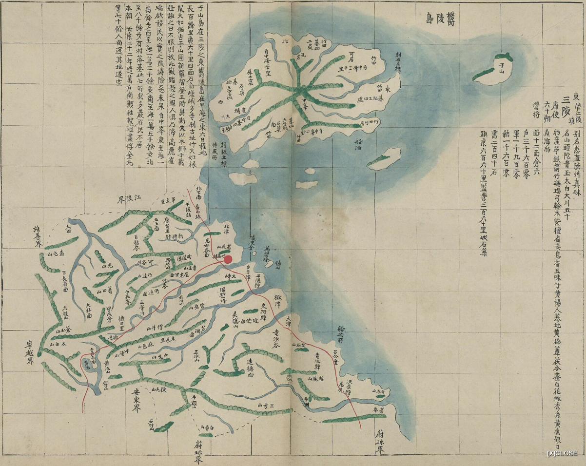
 Below is a Korean map of the Samcheok (三陟) administrative district and Ulleungdo (鬱陵島), which suggests that Ulleungdo was under the authority of Samcheok at the time. The map comes from an atlas entitled "地圖 江原道 咸鏡道," which simply means that it is an atlas of maps of Gangwondo (江原道) and Hamgyeongdo (咸鏡道), which are Korean provinces. The atlas was made sometime between 1888 and 1895. The front cover of the atlas is pictured on the left.
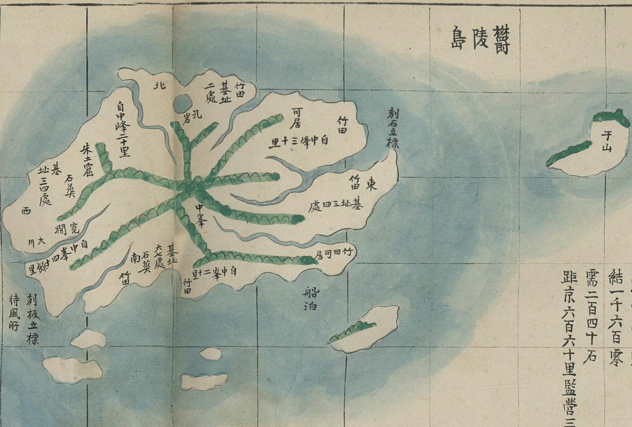
The map was drawn on ruled paper to give perspective. An island labeled as 于山 (Usan) is mapped less than two grid lines off the east coast of Ulleungdo, suggesting that it is just a few kilometers offshore. That would mean that it would almost certainly be Ulleungdo's neighboring island of Jukdo, which is about 2.2 kilometers off Ulleungdo's east coast. Koreans claim that Usando was an old Korean name for "Dokdo" (Liancourt Rocks), but this map and many others show Usando to be a neighboring island of Ulleungdo, not Liancourt Rocks. Notice that this map also shows Ulleungdo with five other neighboring islands off its southern shore. This was most likely a mapping error since most of Ulleungdo's "rock islets" (石島) are off its northern shore.
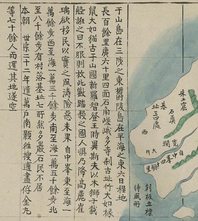
The writing to the left of Ulleungdo is a standard description of the island that can also be found on many other maps showing the island. The map is stored in Korea's Koryo University Library.
You can click on the maps and choose to see larger versions.
Gerry Bevers,
ReplyDeleteYou wrote "An island labeled as 于山 (Usan) is mapped less than two grid lines off the east coast of Ulleungdo, suggesting that it is just a few kilometers offshore. That would mean that it would almost certainly be Ulleungdo's neighboring island of Jukdo, which is about 2.2 kilometers off Ulleungdo's east coast."
The base for your certainty Usan in this map is Jukdo isn't clear. Please explain it clearly if you can.