
After intensive debates inside the Ministry of Foreign Affairs (MOFA), prompted by petitions to develop the so-called island of "Matsushima" (松島), Foreign Minister Terajima Munenori (寺島宗則) finally ordered an on-site survey of Ulleungdo in 1880 and dispatched the warship
Amagi (軍艦天城) to the area to clear up the name confusion concerning the islands in the region.
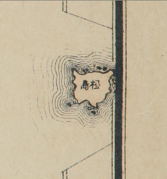
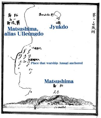
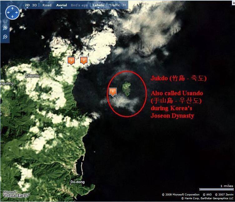
The
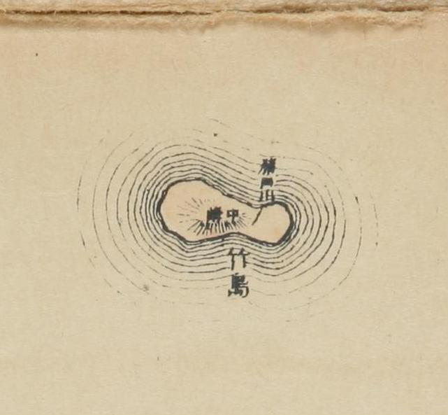
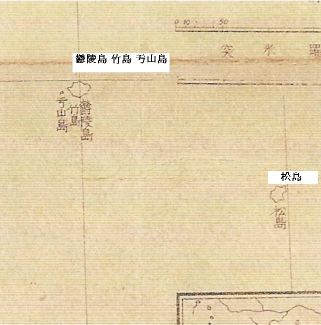
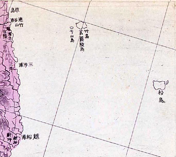
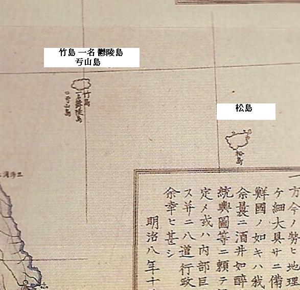
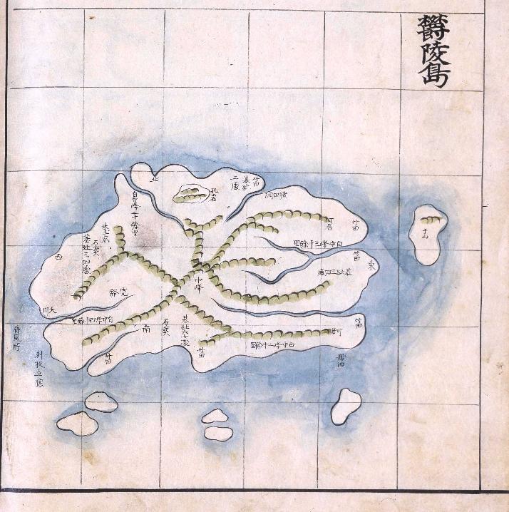
Amagi discovered that the "Matsushima" (松島) being referred to in the petitions was actually the Korean island of Ulleungdo (鬱陵島), which also had a small island appoximately two kilometers off its northeast shore named "Takeshima" (竹嶼 = 죽서). The map to the left shows Takeshima (竹嶼) to the north of the spot the
Amagi anchored off the east shore of Ulleungdo.
Kitazawa Masanari (北澤正誠), of the MOFA (外務省書記官), was ordered to investigate the situation, so he perused the related documents and historical books and wrote an account of this investigation in the "Takeshima Kosho" (竹島考証 - "A Study of Takeshima"). In his account, he concluded that "Matsushima" was Ulleungdo, and that the island that was being called "Takeshima" was Ulleungdo's neighboring island of Jukdo, which is about two kilometers off Ulleungdo's northeast shore. He said that the two islands were not Japanese territory.
Here is a translation of Mr. Kitazawa's findings.
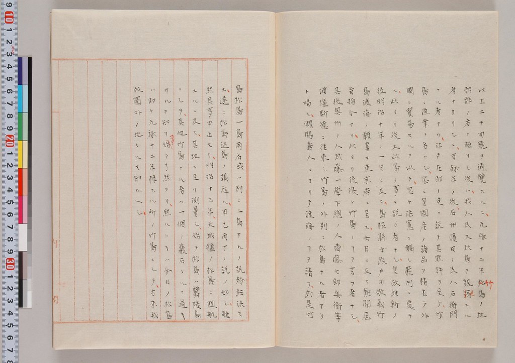
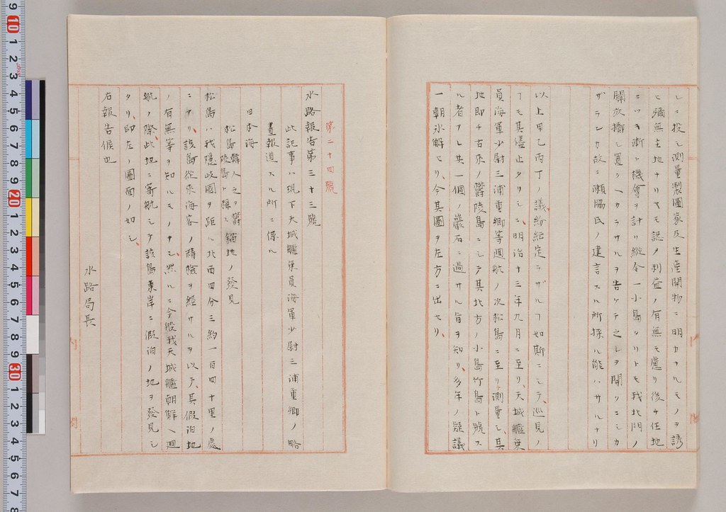
以上二十四號ヲ通覧スルニ元録十二年竹島ノ地朝鮮ノ者ト極リシ後ハ我人民又此覬覦スル者ナカリシニ百余年ノ後石州浜田ノ民八右衛門ナル者アリ 江戸在邸ノ吏ニ説テ其黙許ヲ受ケ竹嶋ニ漁業ヲ名トシ陰ニ皇国産ノ諸品ヲ積去テ外国ニ貿易セルヲ以テ忽チ法憲ニ触レ厳刑ニ処ラル 此ヨリ後又此島ノ事ヲ説ク者無シ 皇政維新ノ後明治十年ノ一月ニ及ヒ島根県士族戸田敬義竹島渡海ノ願書ヲ東京府ニ呈ス 六月ニ及ヒ難聞届旨指令アリ 此ヨリ後復タ竹島ノコトヲ言フ者無シ 其後奥州ノ人武藤一学下総ノ人斉藤七郎兵衛等浦塩斯徳ニ往来シ竹島ノ外別ニ松島ナル者アリト唱ヒ瀬脇寿人ニヨリテ渡海ノ事ヲ請フ 於是竹島松島一島両名或ハ別ニ二島アルノ説粉粉決セス 遂ニ松島巡島ノ議起ル 甲乙丙丁ノ説ノ如シ 雖然其事中止セリ 明治十三年天城艦ノ松島ニ廻航スルニ及ヒ其地ニ至リ測量シ始テ松島ハ欝陵島ニシテ其他竹島ナル者ハ一個ノ岩石タルニ過キサルヲ知リ事始テ了然タリ 然ルトキハ今日ノ松島ハ即チ元録十二年称スル所ノ竹島ニシテ古来我版図外ノ地タルヤ知ルヘシ
---------------------------------------------
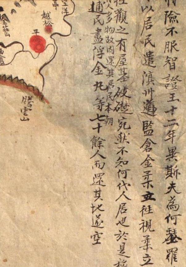
After having studied all twenty-four documents thoroughly, it is now clear to me that after Takeshima (Ulleungdo) was determined to be Choson's in 1699, no Japanese had an eye for the island, but about 100 years later, Hachiemon of Hamada, Sekishu (石州浜田) talked the domain official, who was stationed in Edo, into giving him tacit consent (to travel to the island). On the pretext of engaging in fishing, Hachiemon loaded many Imperial products and set sail to trade with foreign countries. Because of his illegal foreign trading, he was severely punished. After this incident, there was no one who talked about this island.
After the Imperial Political Reformation, Toda (戸田敬義), a former samurai family member of the Shimane Domain, submitted a petition to to Tokyo Metropolitan Government in January 1877 to voyage to Takeshima (竹島渡海ノ願書), but in June he received a rejection notice. Since then, no one talked about Takeshima, except for Mutoh Ichigaku (武藤一学) of the Oshu(奥州) Domain and Saito Shichirobee (斉藤七郎兵衛), who claimed that, in addition to Takeshima, there was an island called "Matsushima" (松島) on the route to Vladivostok. (Mutoh) submitted a petition for Sewaki Hisato (瀬脇寿人) to voyage there. As a result, there was so much argument about whether Takeshima and Matsushima were one island with two names or two islands that it was difficult to reach a decision. In the end, opinions on whether to send a survey team to Matsushima was received, as can see in the four opinions (甲, 乙, 丙, and 丁).
There was so much argument about the matter and it was difficult to reach a decision. Although all the talk about conducting a survey had been halted, later in 1880, Warship Amagi (天城) was sent to Matsushima, and I finally came to understand the situation when I learned that "Matsushima" (松島) was Ulleungdo, and the other island, which was called Takeshima (竹島), was just a rock (竹嶼 - Jukdo or Boussole Rock). Thus, today's Matsushima is the island that was called "Takeshima" in 1699 (元禄十二年), and they (Ulleungdo and Jukdo) are not historically Japanese territory."
Since Warship
Amagi only sailed to Ulleungdo and surveyed the area there and did not go to today's Takeshima (Liancourt Rocks), it is apparent that Takeshima, which was described as not being much bigger than a rock," was definitely not referring to today's "Takeshima" (Liancourt Rocks/Dokdo), but rather was referring to Ulleungdo's neighboring island of Jukdo. After this discovery, Japan's MOFA and the navy started referring to Ulleungdo as "Matsushima," and today's Takeshima as "Liancourt Rocks."
Takeshima Kosho (竹島考証)
"
Takeshima Kosho" is a 3-volume set of books that detailed the debates in the the MOFA. The first volume (上) contains the study of many historical records and documents from Choson, China, and Japan. The second volume (中) focuses on the "Takeshima Incident" (竹島一件), which happened between 1692-1699 and involved Ahn Yong-bok's trips to Japan. The last volume (下) starts with the Aizuya Hachiemon case, "Takeshima Incident in Tenpo (天保の竹島一件)," and continues with the numerous petitions (submitted by Japanese civilians and officials between 1876-78 ) calling for development of Matsushima. Then it describes the debates between officials inside the MOFA, the survey by the
Amagi, and finally the conclusion of the investigation. Here is a brief explanation for the last volume, which is the most important of all.
Contents of the third volume(下)
No.1-3 : The incident of Aizuya Hachiemon Case
No.4-7 : "A petition to develop Takeshima(Ulleungdo)(竹島渡海之議)" by Toda Takayoshi(戸田敬義), a former samurai class of Shimane, to the governor of Tokyo in Jan. 1877
No.8 : "A petition to develop Matsushima(Ulleungdo) (松島開拓之議)" by Muto Heigaku (武藤平学) to MOFA in July 1876
No.9-10 : "A petition by Kodama Sadaaki (児玉貞陽建白)" Kodama submitted petition to develop Matsushima(Ulleungdo) to MOFA in July 1876.
No.11 : "Concerning Matsushima I (松島之議一)" Watanabe Kouki (渡辺洪基) claims if Matsushima in concern is Hornet Rocks(Liancourt Rocks), it is Japanese territory.
No.12 : "Concerning Matsushima II (松島之議二)" Watanabe Kouki (渡辺洪基) claims Matsushima(Liancourt Rocks) in old Japanese documents is Japanese territory.
No.13 : "An application and petition to develop Matsushima (Ulleungdo)(松島開拓願書並建言)" Saito Shichirobee(斉藤七郎兵衛) to Sewaki Hisato (瀬脇寿人) in Dec. 1876
(Attached Note by Tanabe : "Matsushima is Choson's Ulleungdo")
No.14 : "Official Correspondence No.1 , 1877 (明治十年 平信第一)" by Sewaki Hisato (瀬脇寿人) to Terajima Munenori (寺島宗則) in April 1877
No.15 : "Official Correspondence No.2, appendix A, 1877 (明治十年 平信第二 番外 甲号)" by Sewaki Hisato (瀬脇寿人) to Terajima Munenori (寺島宗則) in May 1877
No.16 : "A petition to open Matsushima(Ulleungdo)(松島開島之建白)"by Muto(武藤平学) in May 1877
No.17 : "Official Correspondence No.3 in June 1877 (公信第三号 明治十年六月 )" by Sewaki to Terajima
(Attached Note by Tanabe : "Matsushima is Choson's Ulleungdo")
No.18 : "Correspondence No.8 1877(明治十年第八号)" by Sewaki to Terajima in July 1877
No.19 : "Different Opinion on Matsushima(松島異見)" by Sakata Morotoo(坂田諸遠), a MOFA official one of the author of "Compilation of Japanese Diplomatic Documents in Edo Era (続通信全覧)", claims Takeshima(Ulleungdo) and Matsushima(Hornet Rocks/Liancourt Rocks) are under Japanese Oki's jurisdiction in Aug. 1877.
No.20 : "A petition for Development of Matsushima(Ulleungdo) (松島開拓願)" by Shimomura Linhachiro(下村輪八郎) and Saito Shichirobee (斉藤七郎平衛) to Sewaki in Aug. 1878
No.21 : "Arguments on the Pros and Cons of Inspecting Matsushima(松島巡視要否ノ議)" Tanabe Taichi(田邉太一) states opinion A, B and C (甲乙丙)
No.22 : "Middle Opinion by Watanabe(渡邉洪基)"
No.23 : "Opinion D(議論丁)" Tanabe claimed that Matsushima is Japanese name and it is actually Usan, a neighbouring island of Ulleungdo. He claims that though the belonging of Matsushima(Usan) is not clear, sending warship to survey may cause conflict between Choson. (Usan in concern is Ahn's so-called Japanese Matsushima (Jukdo), not today's Takeshima/Liancourt Rocks, apparently.)
No.24 : "Waterway Report No. 33 (水路報告第三十三號)" by Yanagi Narayoshi(柳楢悦)
Conclusion by Kitazawa : Matsushima was Ulleungdo and the island then called Takeshima was today's Jukdo, about two kilometers away from Ulleungdo, are not Japanese territory.
Referenced documents in the book (竹島考證引用書) :
Choson Documents(朝鮮書) : 東國通鑑, 東國輿地勝覽, 高麗史, 通文館志
Chinese Documents(支那書) : 武備志, 登壇必究, 圖書篇, 八篇類纂, 朝鮮賦
Japanese Documents(國書) : 大日本史, 竹島雜志, 竹島圖説, 朝鮮通交大記, 善隣通書, 竹島紀事, 竹島考, 磯竹島覺書, 因府年表, 通航一覽,
Japanese Correspondent Documents(公信類) : 竹島書類雜纂, 松島之議, 松島關係書類, 浦潮斯德來信, 浦潮港日記
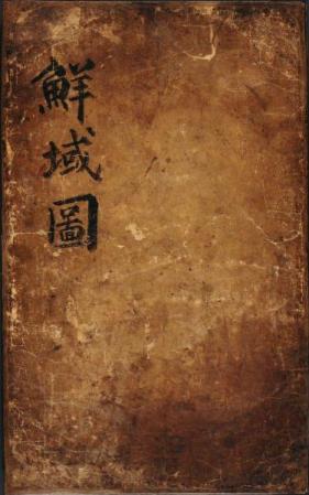
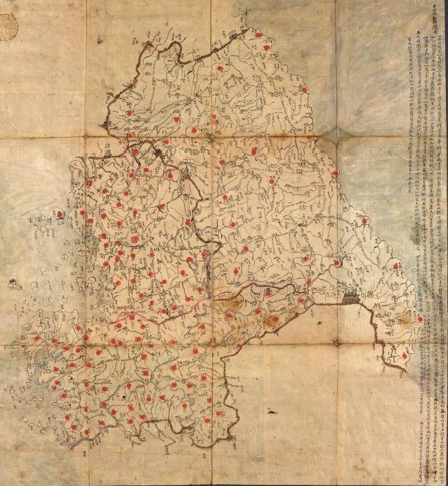
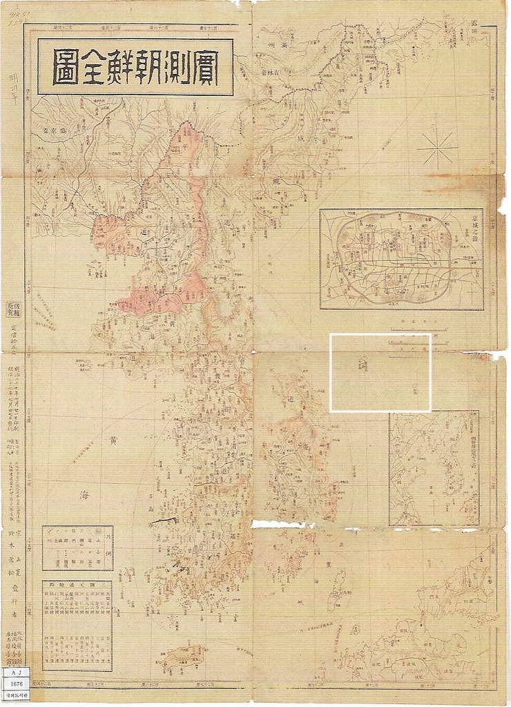
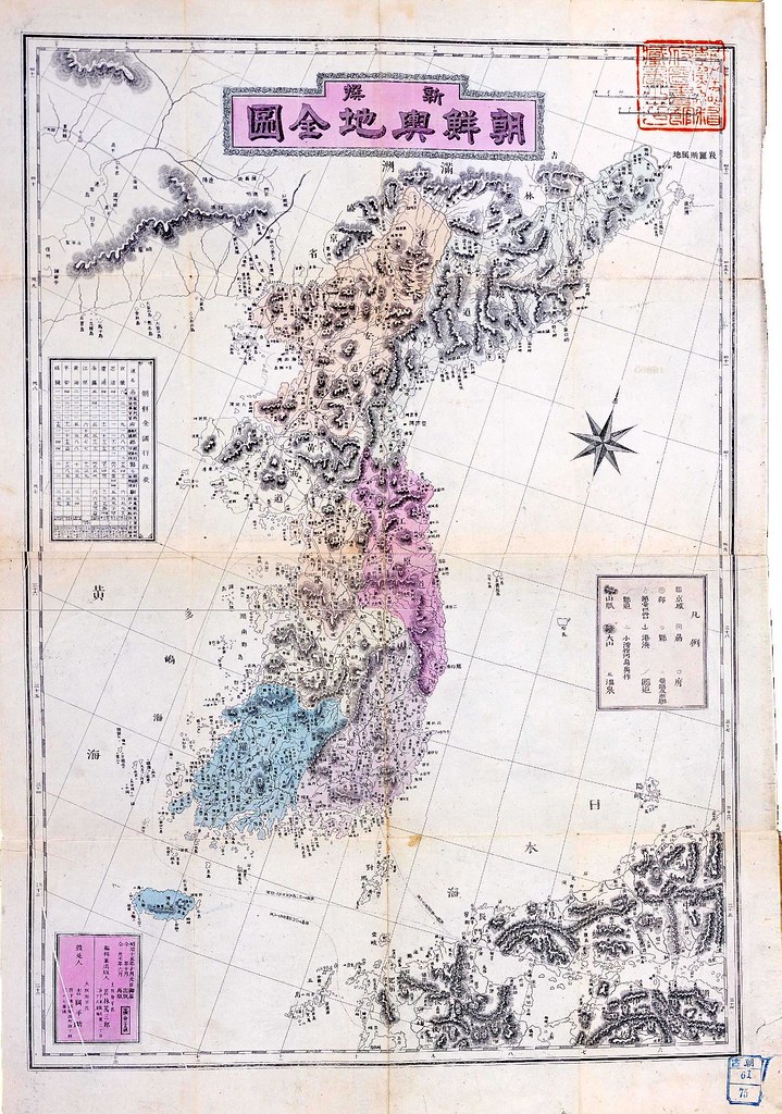
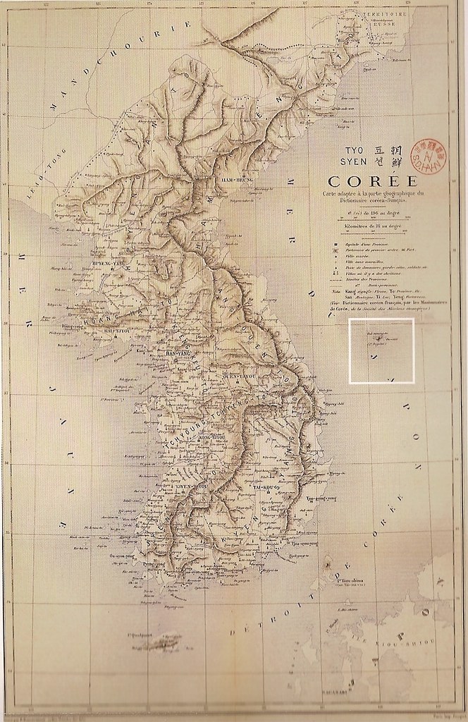
 Below is a map of Korea published in Japan in 1894. The map is called Chosen Yochizu (朝鮮輿地図), and was originally brought to Japan by Kim Ok-gyun (金玉均 - 김옥균) in 1884.
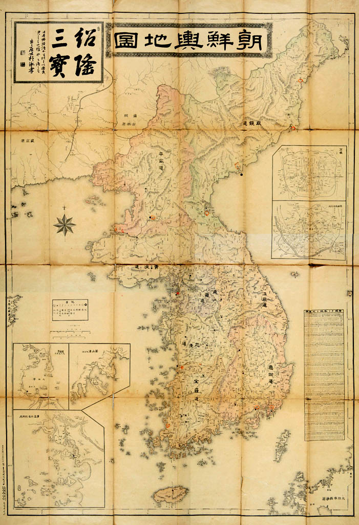


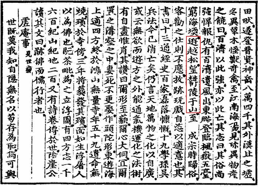
 Heo Mok
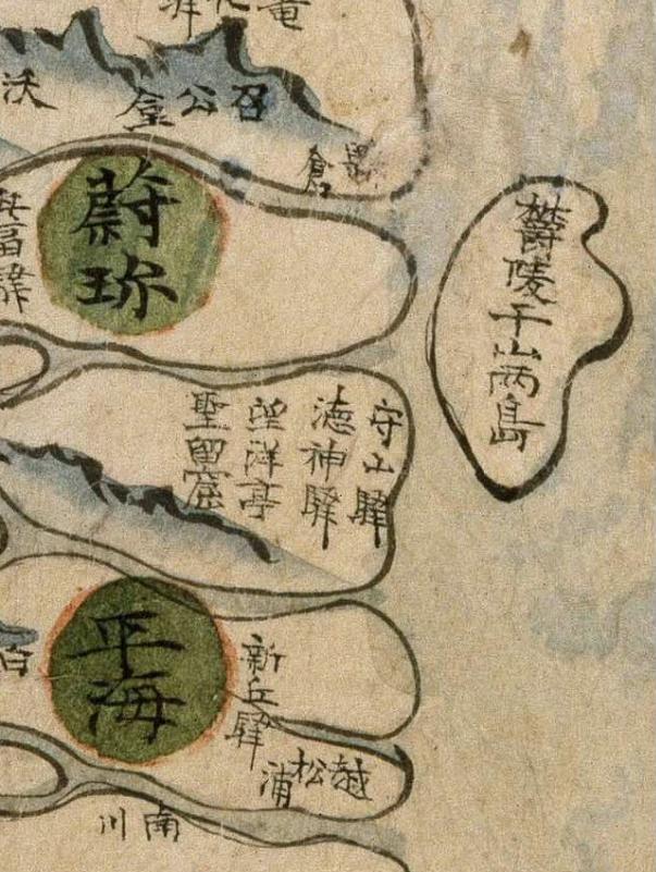
