Uldo
Uldo is Ulleungdo, which is in the middle of the sea about 400 ri away from Pyeonghae County’s Weolsong-po. In the third year of Gwangmu (1900), Uldo County was established and a magistrate was assigned. Its northern latitude is from 130 degrees 45 minutes to 53 minutes. Its eastern longitude is from 37 degrees 34 minutes to 31 minutes [The names for "latitude" and "longitude" are reversed.] The area is about 504 square ri. A tall mountain stands out in the center of the island. Its height is 4,000 cheok. There are no harbors on the shoreline, so it is extremely difficult for ships to tie up.
Flat ground is scarce on the whole island, but layers of fallen leaves and dried grass have accumulated and decomposed into dark, fertile soil, making it possible to have an abundant harvest without fertilizing. The annual output of soybeans, which is the island’s main product, is as much as 400 to 500 seok. The wood products include oak, paulownia, pine, and sandalwood. Grapes are also produced. On the shores, there is good production of sedum, which is clearly big. In the autumn, there are many flocks of woodcocks that are used as supplemental food. The fat is dissolved and supplied as lamp oil.
The residents of the island total about 500 families. About 300 Japanese families come to live on the island temporarily, which has caused the government to issue a standing order for them all to vacate and return home. There is a spring on the island that gushes out water that tastes slightly sour, but the island residents call it mineral water. They drink it when they are sick and it seems to have a good effect. This is the source of carbonated water.
About 300 ri to the southeast of this island is an island commonly called “Yang-ko” Island. It has an area of about thirty ri. The shoreline is indented, so it is good for anchoring fishing boats, but there is still no firewood or drinking water available, so it is uninhabited. There are many sea lions and various sea products.
---------------
鬱島鬱島는 平海郡 越松浦 四百餘里海中에 在한 鬱陵島니 光武三年에 鬱島郡을 設하고 守를 寘하니 北緯 百三十度 四十五分乃至 五十三分. 東徑三十七度 三十四分乃至 三十一分 間에 在하야. 面積이 五百四 方里許며 中央에 高山이 屹立하야 고 – 四千 尺이며 沿岸의 港灣이 無하야 船舶의 碇繫가 甚難하니라
全島에 平地가 稀少하나 其地質은 落葉枯草가 堆積腐化한 黑土를 成함으로 膏腴하야 肥料를 不施하야도 農物이 豊碩하야 主産物의 大豆는 每年産額이 四五百石에 至하며 林産에는 欅, 桐, 松, 白檀香等이 有하며 또 葡萄가 産出하며 沿海에 良好한 石菜의 産額이 亦 大하니라. 秋季에 山鷸類가 多하야 副食物을 作하며 脂肪은 溶解하야 燈油에 供給하나니라.
本島住民은 五百餘戶며 日本人 三百餘戶가 一時에 來住함으로 政府에서 退去하란 命令이 有하야 至今에 盡歸하니라 島中의 一泉이 湧出하야 其味가 微酸하나 島民이 藥水라 稱하야 疾病時에 藥餌로 服用하면 効驗이 著見하니 此는 炭酸水의 源流니라.
本島東南約三百里에 一島가 유하야 俗稱 “양고”島라 云하니 長이 三十餘里오 沿岸이 屈曲하야 漁船의 碇泊이 便宜하나 薪材及 飮料水를 아즉 不得함으로 居人이 無하며 海馬와 各種海産이 多하니라.
Could someone please give me the English pronunciation for 田淵友彦?
ReplyDeleteHe was the Japanese author of 韓國新地理.
gerry,
ReplyDelete아래의 글도 검증을 부탁드립니다.
-----
일본은 1905년(광무9년) "시마네현" 고시 40호로 독도를 "다께시마"로 개칭하고 시마네현에 편입시킨 다음 한일의정서(韓日議定書)에 의하여 한국에 대한 세력을 얻은후 1906년(광무10년) 4월8일 이 사실을 울릉군수 심흥택(沈興澤)에 통고하였다. 그러나 이때의 한국정부는 이미 실질적인 주권을 잃은 때였으므로 아무 항의도 제기하지 못하였다.
일본이 과연 독도가 일본 고유의 영토라고 한다면 1903년 "나까이"가 독도를 일본에 편입시켜 자기에게 대하(貸下)해 주도록 신청할 필요도 없거니와 일본이 1905년 일개 현(縣)의 고시로 독도를 일방적으로 시마네현에 편입시킨 후 울릉군수를 찾아와 독도가 일본에 편입되었다는 사실을 통고할 이유가 없는 것이다.
이같이 일본은 독도를 점유하려 하였으나 지리상 일본에서 멀리 떨어져 있고 우리나라와 가까와 그 후에도 일본인은 독도를 우리나라 영토로 인식하였다. 즉, 다부찌(田淵友彦)의 한국지리지(제국백과저서 134편) 1908년(융희2년)에 간행된 한국수산지(水産誌)등에도 독도를 울릉도와 같이 한국영토로 표시하였다.
그러나 1952년 1월 18일 한국정부가 "인접해양의 주권에 관한 대통령 선언을 선포하자(이승만라인) 1월 24일 일본은 외무성 각서로 이를 항의하고 독도의 일본 소속을 주장함으로써 영속권(領屬權) 문제가 발생하였다. 일본은 선점권(先占權)을 내세우나 국제법상 선점권의 효과가 발생하려면 그 지역이 무주물(無主物)이어야 하며 영토취득의 국정의사(國定意思)와 대외공포가 있어야 하고 그 지역을 실질적으로 지배 점유하고 있어야한다.
독도가 무주(無主)의 지역이 아님은 이미 앞에서 밝힌 바와 같이 독도는 서기 512년 이래 한번도 한국 영토에서 분리되거나 타국의 지배를 받은 바도 없었고, 사람이 상주하고 있지 않았다 해서 주인없는 지역으로 삼을 수 있는 하등의 이유가 없는 것이다. 또한 일본은 영토 취득의 국정의사를 표명하였다 하나, 1905년 남의 영토를 상대국으로 가장 가까운 한국 정부와 상의도 없이 1개 지방관청의 고시로 처리함은 상식밖의 일로서 그 고시는 국가를 상대로 한 대외적 의사표시로서는 효과가 없는 것이다.
pacifist,
ReplyDelete위에 언급한 글에 대하여 반박할 수 없다면, 당신의 "독도가 소유권이 없는 섬"이라는 주장은 한국에서 받아들여지지 않을 것입니다.
In Korean version 1907, it didn’t exclude Dokdo(양고島). The translator knew Dokdo belonged to Korea.
ReplyDeleteLook at the below text.
(日本民族の新發展場萬韓露領地誌, 罔部福藏 著, 1905)
Geography of Manchuria, Korea and Russia Region - New Prospering Area for Japanese Race, written by 罔部福藏, 1905)
http://hosting.ohseon.com/hanmaum/seokdo/5-9.jpg
竹島ハ明治三十八年二月日本新領土トナリ隱岐島司ノ管下ニ歸ス
Takeshima became a Japanese territory at February 1905 and got returned under the Oki prefecture.
http://hosting.ohseon.com/hanmaum/seokdo/5-6.jpg
(You can find the text in the upper middle part.)
This 竹島 below means Dokdo(Liancourt Rocks), NOT “てっせみ島(댓섬,竹嶼)”.
In both this book(translated, 1907) and the original (韓國新地理, 1905), Dokdo looks like some food bowl in a doghouse(Ulleungdo) of the K’s house(Korea).
This is my novel. :
J’s dog forcefully came over and robbed the food from the bowl of K’s dog. One day, J secretly put it in his doghouse(Oki) without notice to K, and sometime later, J noticed to a K’ child on the fact that J took the bowl. Weak K couldn’t fight against J because J was very strong. Some time later, J took K’s house. But, J wanted to broaden his area and began to fight against A. After all, J was severely beaten almost to death. So, K took his own house again and claimed the doghouse. And, K openly asserted the doghouse is his own. But, J claimed that K forcefully took the J’s doghouse and demanded some evidence of the possession right.
Some decisive evidences began to be discovered that J had regarded the bowl as a K’s property and K regarded it as his own property. Now, J begins to assert that the bowl was a ownerless one, and demand K that he should give any evidence which proves he used it as his property.
p.s. : I both love dog and enjoy dogmeat. And, sorry for my Konglish.
Sorry.
ReplyDeleteMy mis-wording :
So, K took his own house again and claimed the doghouse. And, K openly asserted the doghouse is his own. But,...
corrected one :
So, K took his own house again and claimed the dogbowl. And, K openly asserted the dogbowl is his own. But,...
Thank you Gerry, this is very interesting.
ReplyDeleteThe name of the author in Japanese pronunciation is Tabuchi Tomohiko.
lord and myCoree,
The important thing is that Korea's insistency lacks evidence.
They tell you that they knew Liancourt Rocks from the ancient times but no evidence. They once insisted that Usando is Liancourt Rocks but as every reader of this forum knows, it was NOT.
Japan once held Liancourt Rocks from the 17th century but they were lost in the turmoil of Meiji Restoration and the name confusion of western maps.
So again, Japan reconfirmed that Liancourt Rocks were terra nullius (no other countries traces discovered) and incorporated them in 1905.
So if Korea refutes, she has to show the evidence Korea really used the rocks and controlled them but there is NO such evidence, as USA confirmed (Rusk's Letter).
Gerry
ReplyDelete"田淵友彦" is pronounced as Tabuchi Tomohiko
This is the firm evidence that Korean around 1900 didn't consider Takeshima(Yanko-to) as Seokdo in 1900 Imperial Ordinance nor their territory. Because we know Korean in 1907 definately knew "Yanko-to" is Japanese Takeshima and where it is, since there were some Korean who were hired by Japanese businessmen and went to Takeshima. There are many records that Japanese called Takeshima as Yanko-to until recently.
Good job as always.
Pacifist & Kaneganese,
ReplyDeleteThanks. I do not think I will ever learn how to read Japanese names.
As Kaneganese pointed out, Seokdo in the 1900 Edict seems to be different island from "Yang-ko" island (definitely Liancourt Rocks, today's Takeshima/Dokdo).
ReplyDeleteAt least, the name of Yang-ko was written as Japanese used to call it. One can assume that Yang-ko island and Seokdo were completely different islands. Then, was Seokdo really today's Takeshima/Dokdo? It was highly possibly not.
Then, why didn't they change the name Yang-ko island to Dokdo in this Korean version of the book? It may be because the name of Dokdo was not so popular in those days (only fishermen who were hired by Japanese knew it) - it became popular after WWII especailly after 1952 when Rhee Syngman took it.
Gerry,
ReplyDeleteThe grammer of Korean language and one of Japanese language are almost in common. So I think you will be a good speaker of Japanese only if you remember pronunciation of Japanese.
Gerry,
ReplyDeleteDo they mention about Korean eastern limit in this book? In "韓国新地理(1905)" by 田淵友彦, it was defined as 130º 58' E. longitude (東経130度58分).
Although Korean claim Tabuchi's book as some kind of proof of "Japanese recoginition of Takeshima/Dokdo as Korean territory", simply because Takeshima was written in Ulleungdo section, but the book actually defines Takeshima/Dokdo as outside of the territory, in fact.
In the early 1900s, Takeshima was sometimes considered to be within the economical zone of Ulleungdo, since many Japanese went to Takeshima from Ulleungdo. But those recognition is totally different from the territorial recognition, since Takeshima/Dokdo was clearly written as outside of Korean territory. And many maps also prove it was considered to be Japanese territory or the island with no concrete owner around 1900.
Hi Kaneganese,
ReplyDeleteThe book gave Korea's farthermost eastern boundary as being between the Russian border and the Tuman River at an eastern longitude of 130 degrees 58 minutes (極東은 露國境을 豆滿江에 隔하야 東經一百三十度五十八分에 在하니...).
That longitude is farther east than the one given for Ulleungdo at 130 degrees, 53 minutes, which was probably why it was given as the farthermost boundary.
By the way, if I correct some of the English in Pacifist's translation, will you prepare a post on the Japanese document? There is not much to correct, but there are just a few things I want to smooth out.
Kaneganese & Pacifist,
ReplyDeleteI have proofread Pacifist's translation. Please make sure I did not change something that should not have been changed.
---------------------
第3編 第5章 「江原道」より
(From "江原道" of Chapter 5, Volume 3)
欝陵島 ウーリャントー
Ulleungdo
本島は北緯百三十度四十五分乃至五十三分、東経三十七度三十四分乃至三十一分の間に位し、平海郡越松浦の南四十余里の海中に在る孤島にして面積五百四方里許、中央は高山屹立し高さ四千呎。
This island is an isolated island about 40 ri south of Pyeonghae County’s Weolsong-po. Its northern latitude stretches from 130 degrees 45' to 53', and its eastern longitude stretches from 37 degrees 34' to 31'. Its area is about 500 square ri. There is a high moutain towering in the center of the island at 4,000 feet. [The author reversed the names for latitude and longitude.]
沿岸港湾に乏しく船舶の碇繋頗る困難なり。全島平地稀なりと雖其地質は古来落葉枯草の堆積腐化したる黒土の一種より成り土地膏●にして肥料を施さざるも農耕を為すを得、大豆は本島の主産物にして年々の産額四五百石に及び本邦に輸出するもの多し。
There are no harbors along its shoreline, so it is extremely difficult to tie up boats. Level ground is scarce, but the layers and layers of decaying leaves and dried grass over time has created a rich, dark soil that can be farmed without fertilizing. The annual yield of soybeans, which is the island’s main product, is as high as 400-500 koku, and much of it is exported to Japan.
林産には欅、桐、松、白檀等あり。就中欅は経六尺の巨材を産し桐は本邦にて松島桐と称して珍とするものなり。往時は此種の樹木全島に繁茂して殆んど無儘の観ありしも近年本邦人の濫伐によりて漸く減少せり。
Forest products include zelcova, paulownia, pine and sandalwood. Above all, the zelcova is big with a diameter of 6-shaku. Also, the paulownia is valued highly in Japan, where it is known as "Paulownia of Matsushima". In the past, these kinds of tree grew thick and it seemed as if they were inexhaustible, but these days they are decreasing because of reckless deforestation by Japanese.
其他山葡萄の産出あり又沿海に産出する石花菜(てんぐさ)は種類良好にして産額亦大なり。秋季山鷸の類非常に多く島民は之れを撲殺し肉は乾燥貯蔵して年中の副食物とし脂肪は溶解して燈油に供す。本島天産物の饒多なるは韓国中多く其此類を見ず。
The other products include wild grapes and agar. The latter is of good quality and rich in yield. In the autumn there are many kinds of wild snipe. The islanders beat them to death and dry them for storage to be used for side dishes. The fat is dissolved and used as lamp oil. This island is rich in such various natural products, which is rare in Korea.
本島の住民は往時極めて稀少なりしも近年韓人及び本邦人の移住する者漸く多く韓人の戸数約四五百戸に及び本邦人亦一時三百以上に達したりしも先年本邦政府府より退去の命ありたる為め●々減少したり。
The population of this island was very few in the past, but lots of Koreans and Japanese immigrated in recent years - Korean families reached between 400 and 500. Japanese families once reached over 300, but they decreased after the order of Japanese government to withdraw from the island a few years ago.
其本邦居留者は概ね鳥取県人の直接渡航したるものにして木材大豆及び石花菜の輸出を営み或は雑貨日用品を販売し純然たる日本村を形成せり。
Japanese residents are almost all from Tottori prefecture. They made voyages directly to this island and many of them engage in the business of exporting woods, soybeans, and agar or run general stores, thereby, forming a Japanese communities.
島中一泉の湧出するあり少しく酸味を帯び島民之れを薬白水と称し疾病の際服用して薬餌に代ゆるに其効験見るべきものあり。或は本邦の平野水、金山水等と同種なる炭酸水にはあらずやといふ。
There is one fountain on the island that gushes water that tastes slightly sour. The islanders call this water "medicinal white water" and drink it instead of taking medicines when they are sick. It seems to be somewhat effective. Some says that it is the same as carbonated water, like "Hirano-sui" or "Kinzan-sui" in Japan.
本島は昔時新羅が我出雲地方と交通したる時隠岐島と共に寄港地たりし所にして中古倭寇の一時根拠地となしたることあり。
This island was once used as a port of call along with Oki island when Silla was exchanging communications with the Izumo district of Japan in the past. It was once also a base for Japanese pirates in ancient times.
貝原益軒の如き本邦の属地なりと断じたる程なれ共明治十五六の交本邦人の伐木に従事するものありしを韓廷の抗議により我邦之れを韓廷に譲り所属初めて判明するに至れり。
As Kaibara Ekiken had decided that this island was Japanese territory, it has been familiar to our country; however, there was a claim from the Korean Imperial Court that Japanese were engaging in deforestation about the 15th or 16th year of Meiji, so Japan returned it to Korean Imperial Court. As a result, the ownership of this island was determined for the first time.
然れ共邦人の依然居住して伐木を営むもの多かりしが明治三十一年一時露人が本島の伐木植林の権利を得たることあり韓廷に照会してして日本人の盗伐及び居住を禁ぜんことを迫り我公使は外部の照会を受け一時本邦人の立退を命ずることとなりしも其後急に同島を退去せしむるは事情の許さざるものあるを以って其事由を韓廷に復●したり。
However, many Japanese still lived and engaged in logging. In the 31st year
of Meiji (1898), when Russians got the right to harvest the trees on the island, they asked the Korean Imperial Court to forbid Japanese living there from cutting down trees there without a license. The Minister of Japan asked Japan’s Foreign Ministry to have the Japanese residents to leave, but some of the residents could not obey the sudden order for various reasons. These reasons were explained to the Korean Imperial Court.
本島より東南方約三十里我が隠岐島との殆ど中央に當り無人の一島あり。俗にこれをヤンコ島と称す。長さ殆ど十町余沿岸の屈曲極めて多く漁船を泊するに宜しと雖薪材及び飲料水を得るに困難にして地上を穿つも数尺の間容易に水を得ず此付近には海馬多く棲息し又海産に饒なりといふ。
There is a uninhabited island at about 30 ri southeast of this island (Ulleungdo), almost halfway to Oki island. It is commonly called Yanko Island. Its length is about 10 cho, and its shoreline bends and twists, so it is a good place for fishing boats to anchor. However, it is difficult to get firewood and drinking water there. Even if you dig down several shakus, you will not find any water. They say there are lots of sea lions around the island and that it is rich in sea products.
Gerry,
ReplyDeleteI think the text is almost right.
To write precisely, "伐林植林" of the sentence "露人が本島の伐木植林の権利を得たることあり"(when Russians got the right to harvest the trees on the island) is "to cut trees and to plant trees" (so I wrote deforestation and afforestation).
Gerry,
ReplyDelete"By the way, if I correct some of the English in Pacifist's translation, will you prepare a post on the Japanese document? There is not much to correct, but there are just a few things I want to smooth out."
You mean in English? Sure, no problem. I'll check your proofread version and prepare the post.
Gerry,
ReplyDeleteI think I'm going to write what I wrote in previous comment in the post.
Gerry,
ReplyDeleteIf you'll post the text with the Japaenese text, could you please use the following one (corrected one)? (chaamiey gave us the Chinese charcters I couldn't find.)
Thank you. Also thanks to Kaneganese for proof reading.
第3編 第5章 「江原道」より
欝陵島 ウーリャントー
本島は北緯百三十度四十五分乃至五十三分、東経三十七度三十四分乃至三十一分の間に位し、平海郡越松浦の南四十余里の海中に在る孤島にして面積五百四方里許、中央は高山屹立し高さ四千呎。
沿岸港湾に乏しく船舶の碇繋頗る困難なり。全島平地稀なりと雖其地質は古来落葉枯草の堆積腐化したる黒土の一種より成り土地膏腴
にして肥料を施さざるも農耕を為すを得、大豆は本島の主産物にして年々の産額四五百石に及び本邦に輸出するもの多し。
林産には欅、桐、松、白檀等あり。就中欅は経六尺の巨材を産し桐は本邦にて松島桐と称して珍とするものなり。往時は此種の樹木全島に繁茂して殆んど無儘の観ありしも近年本邦人の濫伐によりて漸く減少せり。
其他山葡萄の産出あり又沿海に産出する石花菜(てんぐさ)は種類良好にして産額亦大なり。秋季山鷸の類非常に多く島民は之れを撲殺し肉は乾燥貯蔵して年中の副食物とし脂肪は溶解して燈油に供す。本島天産物の饒多なるは韓国中多く其此類を見ず。
本島の住民は往時極めて稀少なりしも近年韓人及び本邦人の移住する者漸く多く韓人の戸数約四五百戸に及び本邦人亦一時三百以上に達したりしも先年本邦政府府より退去の命ありたる為め稍々減少したり。
其本邦居留者は概ね鳥取県人の直接渡航したるものにして木材大豆及び石花菜の輸出を営み或は雑貨日用品を販売し純然たる日本村を形成せり。
島中一泉の湧出するあり少しく酸味を帯び島民之れを薬白水と称し疾病の際服用して薬餌に代ゆるに其効験見るべきものあり。或は本邦の平野水、金山水等と同種なる炭酸水にはあらずやといふ。
本島は昔時新羅が我出雲地方と交通したる時隠岐島と共に寄港地たりし所にして中古倭寇の一時根拠地となしたることあり。
貝原益軒の如き本邦の属地なりと断じたる程なれ共明治十五六の交本邦人の伐木に従事するものありしを韓廷の抗議により我邦之れを韓廷に譲り所属初めて判明するに至れり。
然れ共邦人の依然居住して伐木を営むもの多かりしが明治三十一年一時露人が本島の伐木植林の権利を得たることあり韓廷に照会してして日本人の盗伐及び居住を禁ぜんことを迫り我公使は外部の照会を受け一時本邦人の立退を命ずることとなりしも其後急に同島を退去せしむるは事情の許さざるものあるを以って其事由を韓廷に復喋したり。
本島より東南方約三十里我が隠岐島との殆ど中央に當り無人の一島あり。俗にこれをヤンコ島と称す。長さ殆ど十町余沿岸の屈曲極めて多く漁船を泊するに宜しと雖薪材及び飲料水を得るに困難にして地上を穿つも数尺の間容易に水を得ず此付近には海馬多く棲息し又海産に饒なりといふ。
Pacifist & Kaneganese,
ReplyDeleteThank you. Anyway, I have already posted my corrected version of Pacifist's translation above.
Yes, I corrected the English, not the Japanese. :)
Gerry,
ReplyDeleteIn this blog, interesting sources are presented.
http://blog.goo.ne.jp/takeshima-2005/c/80fd36a94e087a70fe71530a8388ee0a
Thanks, Opp.
ReplyDeleteActually, I know about that site and have linked to it from our blog, but I had not seen some of the new stuff on the site.
THIS MAP, which shows Ulleungdo and Usando as the same island while also showing a small neighboring island, is interesting since the map is believed to have been made in the 19th century.
The map reminds me of the 1882 conversation between King Kojong and Ulleungdo Inspector Lee Gyu-won, who said that Usando was just another name for Ulleungdo and that there was one neighboring island called "Songjukdo" (松竹島). It is too bad that the neighboring island on that map was not labeled.
Opp,
ReplyDeleteI just looked a little more closely at the map to which I linked. It seems to have been made as a historical map, which would explain why Ulleungdo was also labeled as Usando. Still it showed Ulleungdo's neighboring island to the east of Ulleungdo, which is a little different from other such maps.
you said
ReplyDelete"Moreover, the coordinates given for Uldo (鬱島 - 울도) excluded Liancourt Rocks."
I can't know what do you mean in this mention.
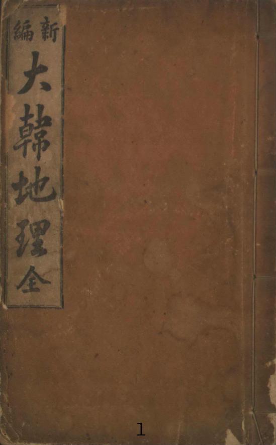
This text "Shinpyeon Daehan Jiri (新編 大韓地理)" is one of geoprapy documents published by Korean governmnet.
Do you know the meanig of 大韓地理 ?
大韓 is the short expression of 大韓帝國 as you may know.
And 地 menas "land". 理 menas "to govern".
so 地理 means "territory".
In brief, do you think that in Korean official territorial text, there is a reference to the other country's island?
Do you know why we used the same expression of Japanese word without any revision?
That's because Korean government want to proclaim a territorial right on this island against the Japanese government, cause after the Japan's victory against Russia1904 years Japan was insisting Dok-do is their island.
Still don't you understand why in 1900 year's "Daehan Empire Rule" did Korean government express "鬱陵全島 and 石島竹島", not "鬱陵島 and 石島竹島"?
you should know the menaing of 全.
Anyway thank you for showing me another proof of our right on Dok-do.
I am not a professional for the geography. and I am not just one of teachers who teach their mother language, so I am very busy.
But here I can get many informations, of course these information will be used for Korean right on Dok-do.
OPPS, SORRY FOR MISSING TO SAY HELLO AGAIN.
Anyway if you can, please answer to my question.
What do you think "Why did Korean goverment refer this 'yang-go island' in this Uldo SECTION of Korean territorial official text?"
To GANEGANESE,
I can't still forget you kindness of sending a letter to my school in DC. :)
How was that? did that work?
Or were you just noticed as a silly minded person?
I am also very curious~ ;)
Juuno asks: What do you think "Why did Korean goverment refer this 'yang-go island' in this Uldo SECTION of Korean territorial official text?"
ReplyDeleteGerry answers: I think the reason they used the Japanese name for the island was because they did not have a Korean name for the island or did not know the Korean name.
Anyway, I am glad you will be using our documents to promote your claim. The more people that know about this document the better.
Why don't you go and post it on some of your favorite Dokdo sites since I have not seen it mentioned on any of them in regard to the Ulleungdo description.
And you can even give them your explanation for why a Korean geography book used the Japanese name for Liancourt Rocks instead of "Seokdo" (石島) or "Dokdo" (獨島). I am sure you will find someone who will say, "그럴 수 있었겠지?"
Coordinates refer to the 경위(經緯) given for Ulleungdo.
Gerry,
ReplyDelete"輿地図書" which is Chosun's Public Record is also very interesting for me.
http://blogimg.goo.ne.jp/user_image/5b/97/e52490687e77b7ab7d0348bb3c64a9fe.jpg
「云于山欝陵一島(It was said that Usan and Ulleungdo is one(same) island)」
then, how about the Japan's name about Dok-do?
ReplyDeleteDid they have their own name on Dok-do?
At the first, Japan called the island as "松島" and later "竹島" and at this time they called as "yangko-do". three different names.
then, could you say Japan had their own name on DOK-DO?
nowaday Japan again uses as 竹島.
Do you know why?
Why had the both of country had a lot of confusion on the name of DOK-DO?
That's because of the island is not inhabitable.
And only after early of 20th century, they started to proclaim their territory.
And still I have a question.
actually my question was not about the name, because at that time there were really lots of confusion on the name of the island, for the both of countries.
Don't you think?
my question was about the explanation for the dok-do in this old text of 1907 years.
"WHY" did the Korean government explain about this island in their official territory document? without any other additional explanation such like 'but, this is the other country's island.'
THE REASON IS " THIS ISLAND IS ONE OF KOREAN ISLAND."
Don't you think?
===========================
And I really would like to explain of the meaning of "visiblity range".
the reason of importance of "visiblity" is this.
at the old times, i mean, before the accurate map or the other method for the location of island,
the 'visiblity' is the only way to see and to try to travel or to use some island.
If you can see one island from the other lands or islands, then Human always tend to travel or explore the island. that's the nature of Human.
And if the island is very useful for fishing or something els, then people start to use that.
that's the basic of human civilization or exploration.
Don't you agree?
Anyway, I think your answer is just one of your ideas. and that's all. I mean I don't agree with your idea.
Moreover, as I told you, the name of Dok-do is a really useless topic for argument, cause both Korea and Japan also had a lot of mistakes for that. haha
And, for your question, actually I don't have much time for this.
I have to prepare my fall semester of Law school.
However, fortunately, Korean government has just started to work for this argument, as I recommanded.
Before our police is just inoring Japan's attitude, cause we are still controlling this island proprly.
But, you can have a lot of documents or evidence or proof for our territorial right on this island.
Don't worry.
In Korea, here is plenty of people who study for this.
You can have professional ideas on this subject.
Be happy.
You will be satisfied as I wish.
:)
In addition,
ReplyDeleteFrom Ullung-do we can see DOK-DO,
But, from any of Japanese territories, they can't see this island.
THAT IS THE DIFFERENCE BETWEEN KOREA AND JAPAN.
THE "VISIBLITY RANGE".
IN THE OLD TIMES, WHO USED THIS UNINHABITABLE ISLAND?
Don't you think your this blog is just a kind of a wordplay?
An american who study Korean old douments written by Chinese letters, with help of Japanese friends,
made a blog.
sorry, but
Actually, this is just for my fun. not for study.
so i don't feel to have to mention about this in my blog.
Sorry.
and bye~
:)
very sorry, but
ReplyDeleteas you know you are not a professional for both of geography and also for chinese letter.
also not for Korean words...
Sorry, this is not a ignorance, but the reality.
AND I THINK PACIFIST AND KANEGANESE ARE ALSO NOT PROFESSIONAL FOR GEOGRAPHY AND CHINESE AND ALSO KOREAN LANGUAGE.
But, still you people have been trying to persuade Korean people and the others. And I think your people believe that you can do it.
;)
This is the most ridiculous thing I have ever seen.
Sorry, but don't think Korean people are just fool.
And at many times I saw the white people and Japanese might think they are really better than the others.
Funny, isn't it?
:)
look the reality, look the real world.
are you people enough good to teach us? not as a professional?
Do you guys still think this year is 1950's years? at the time of Korean war?
Japanese, do you still think you are enough good to teach Korea?
I think the HOSINO, THE COACH OF JAPANESE OLYMPIC BASEBALL TEAM, thought like that.
ridiculous :)
and funny. haha ^
THINK AS YOU WISH.
but, now is 21th century.
^^
Juuno,
ReplyDeleteIf there are any mistakes in my translation, please let me know and I will correct them. That would be more helpful than your silly comments about baseball.
juuno,
ReplyDeleteJapan had always a name for Liancourt Rocks, while Korea had not at all.
Before 17th centhry: Japan (-), Korea (-)
Since the 17th century: Japan (Matsushima), Korea (-)
From the late 19th century to early 1900's:
Japan (Yanko island, Ryanko island), Korea (Yang-ko)
1903~1904(?):
Japan (Yanko island, Ryanko island), Korea (Dokdo)
Since 1905:
Japan (Takeshima), Korea (Dokdo)
Understand? Thank you.
Before 17th centhry: Japan (-), Korea (usando)
ReplyDeleteSince the 17th century: Japan (Matsushima), Korea (sambong-do or usando)
From the late 19th century to early 1900's:
Japan (Yanko island, Ryanko island), Korea (suk-do)
1903~1904(?):
Japan (Yanko island, Ryanko island), Korea (Dokdo)
Since 1905:
Japan (Takeshima), Korea (Dokdo)
ok? understand?
Juuno,
ReplyDeleteIf Koreans were referring to Liancourt Rocks as "Seokdo" or "Dokdo" since 1900, why did the Korean geography book use the Japanese name of "Yang-ko" for the rocks in 1907?
Koreans changed the name "Sea of Japan" to "Sea of Joseon" and the name of Ulleungdo to "Uldo," but they did not change the Japanese name for Liancourt Rocks. Why?
to gerry,
ReplyDeleteyour comments:
"Coordinates refer to the 경위(經緯) given for Ulleungdo."
and
"Moreover, the coordinates given for Uldo (鬱島 - 울도) excluded Liancourt Rocks."
in here, the 경위(經緯) meaning 'longtitude and latitude' of ullung-do, OF COURSE excluded DOK-DO.
BECAUSE THAT 경위(經緯)IS JUST THE 경위(經緯) OF ULLUNG-DO.
BUT, why do you mention that thing?
ha.
If the 경위(經緯) of KYUSHU excluded Thusima(對馬島), THEN would that mean Thusima(對馬島) is not the territory of Japan?
your comment in this blog really makes me laugh.
..............
that's because, as i wrote above comment,
ReplyDelete"That's because Korean government want to proclaim a territorial right on this island against the Japanese government, cause after the Japan's victory against Russia1904 years Japan was insisting Dok-do is their island."
did you read my comment? or not?
ha, I think if you wanted to ask me, you should read my comments before asking something.
don't you think?
still funny. haha
Juuno,
ReplyDeleteSo by teaching Korean middle school children the Japanese name for Liancourt Rocks instead of the Korean name, the Korean government was somehow proclaiming the rocks as Korean territory?
juuno,
ReplyDeleteI know you already recognise that Usando, Sambongdo and Seokdo were not Liancourt Rocks but you still pretend to be ignorant and avoid to see the truth.
Please read the corresponding articles in this blog.
and what do you think of the "VISIBLITY RANGE"?
ReplyDeleteI read before one of Pacifist's commnet, in which he just ignored about this importance thing "VISIBLITY RANGE".
and that comment made me think that he is really worse than an amatuer.
If he had known anything about geography and history, he would have not just ignored this important fact.
anyway, I think you people should learn the way of dispute.
READ AND LISTEN TO THE OTHERS.
AND THEN ASK OR SAY SOMETHING.
DON'T MAKE THE OTHERS REPEAT AGAIN.
DON'T BE FALLEN TO YOUR OWN DOGMATISM.
please~
AND, I AM SO BUSY NOW,
as you know, I've just settled up here in DC.
COME ON~ HAHA
many people will visit here, and they will ply with you~
don't hurry.
then, may see you~ ?
ha ^^
===============
AND, THIS 新編 大韓地理 IS NOT FOR TEACHING MIDDLE SCHOOL STUDENTS.
you really have to see more widely.
don't see only the tree, but should see the whole forest.
---------------------
I mean, you should know the situation of 1907 years.
in 1905, one of japanese county proclaimed their right on dok-do.
and, in 1906 the japanese government insisted this thing officially to Korean government, just after they took our right of diplomacy in 1905.
AND the all of Korean people was out of rage, and also Korean government too.
then 1907 Korean government re-published this 新編 大韓地理 to say our right on Dok-do.(新編 MEANS,AS YOU MAY KNOW THE NEW VERSION, THANKS)
so, they had to express the name of dok-do as same as japan's TO PROTEST TO THE JAPAN'S STEALING OUR LAND.
Still don't you understand?
Still would you see ony the treeS? not the whole forest?
hahaha :)
very funny.
PLEASE, EVERY THING ARE CONNECTED WIH THE OTHER WHOLE THINGS.
HU... ARE YOU MY STUDENT?
I WILL NOT ANSWER AGAIN UNTILL YOU ANSWER TO MY QUESTION.
GOT IT?
to pacifist,
ReplyDeleteActually I don't agree with your idea.
ok?
there is a lot of old documents.
and you just pick up some of documents for your opinion.
didn't you?
anyway my answer is
"I don't agree with your idea."
ok?
then, answer to my question. about the meaning of visiblity range in the historical geography.
ok?
juuno,
ReplyDelete다시 뵙게 되니 반갑습니다.
며칠 전에 아주 재미있는 일이 있었습니다.
일본인이 편찬한 "한국지리지"에 독도가 왜 기록되어 있냐고 물어보니, 일본인 상인을 위해서 넣었다고 하더군요.
그러면서 하는 말이, "독도가 조선의 땅이라는 말이 없다"고 하더군요. 저는 너무 재미있었습니다. 하하하
한국의 지리를 기록한 책에 독도가 있으면, 당연히 독도는 한국땅인 것입니다.
당연히 독도가 한국땅이라고 하는 말은 없습니다. 그렇듯이 "독도가 한국땅이 아니다."라는 말도 없습니다. 그래서 그렇게 다시 물어보았습니다. 하하하
덧붙혀서, 그 책에 울릉도가 한국땅이라는 말이 있냐고도 물었는데, 대답은 없더군요.
여기있는 대부분의 일본인의 주장은 위에 보는 것과 같은 경우가 많습니다.
자신에게 유리하다 싶으면 조그마한 거라도 물고 늘어지면서, 자신들에게 불리한 것에 대해서는 대충 얼버무리고 넘어 갑니다.
또한, 심리적인 관점에서 없는 말도 자신에게 유리하게 만들어내고 그러는 것 같습니다. 대학때 논리학을 수강했던 것이 이럴때 도움이 되는군요.
저도 독도에 대하여 너무 모른다는 것이 아쉽지만, 우선 한국 자료를 많이 보는 것이 최우선인 것 같네요.
그럼, DC에서도 건승하시기를 바랍니다.
Juuno wrote: "AND, THIS 新編 大韓地理 IS NOT FOR TEACHING MIDDLE SCHOOL STUDENTS.
ReplyDeleteYahoo's Korean Encyclopedia wrote: HERE: "신편대한지리 (新編大韓地理) - 1907년 일본인 다부치 도모히코[田淵友彦(전연우언)]의 《한국신지리(韓國新地理)》를 초역(抄譯), 출간한 중등학교 지리교과용 도서."
"Sinpyeon Daehan Jiri (新編大韓地理) - A middle-school geography textbook published in 1907 that was an abridged translation (or "selective translation") of Tabuchi Tomohiko's (田淵友彦) "New Korean Geography."
Juuno, it is good that you will not be answering anymore of my questions because I will not be wasting anymore time on you, either.
juuno,
ReplyDeleteVisibility doesn't effect sovereignty.
The dispute about visibility of Liancourt Rocks once occured after Rhee Syngman "stole" Japanese island called Takeshima, but it was because Korean scholars insisted that Annals of Sejong mentioned Liancourt Rocks could be seen from Ulleungdo.
It is not relataed with sovereignty of the island, it was only related with interpretation of old documents.
Anyway, you should learn that Usando in old documents didn't indicate it was Liancourt Rocks because Usando was inhabitable island where plural families lived and cultivated.
If you still insist that Usando was Liancourt Rocks, you have to bring your evidence - such as some old documents referring to Usando as barren two rock islets without soil and water. Or bring precise map of Usando that show unique character of Liancourt Rocks - two barren rocks. Thank you.
(For your convenience, Japan has these evidences.)
lord,
ReplyDelete거짓말을 말하는 것은 그만두어 주세요.Ulleungdo는 한국의 섬이라고 나는 말합니다.Liancourt Rocks(얀코섬)는 이 시점에서는 ownerless island입니다.사실을 왜곡하지 말아 주세요.
당신은 이전도 나를 오해해 거짓말쟁이라고 부르고, 사과했던 바로 직후는 아닙니까.발언은 정확하게 해 주세요.
지금까지 아무도(당신도 Steve Barber도, 그리고 Juuno도) 한국이 Liancourt Rocks를 영유 할 수 있다고 하는 논거를 나타낼 수 없는 것에 유의해 주세요.
pacifist,
ReplyDelete번역한 글과 나의 글에 대한 대답의 글을 혼동하여 당신을 거짓말쟁이라고 부른 것에 대하여 다시 한번 사과드리겠습니다. 죄송했습니다.
pacifist, 당신도 내가 했던 것과 같이 글을 처음부터 다시 읽어보시기 바랍니다. 당신은 문제의 본질을 흐트러트리고 있습니다.
당신이 한국지리지에 "독도가 한국땅이다"라고 쓰여진 글이 없다고 했을 때, 이미 감정적으로 대응을 한 것입니다. 논리적으로 생각했다면 그렇게 대답을 안했을 것입니다.
시간적인 순서의 차이는 조금 다릅니다. 하지만, 문제의 본질을 봐주시기 바랍니다. 당신은 문제의 본질에 대한 답을 잘 안하는 것 같은 느낌입니다.
당신은 "독도가 한국의 땅이 아니다"라고 쓰여진 글이 있으냐의 질문과, "을릉도가 한국의 땅이다 라고 쓰여진 기록이 있느냐"의 질문에 대한 대답을 안했습니다.
기록에 대하여 질문을 했습니다. 울릉도가 한국땅이다라는 당신의 생각을 물어본 것이 아닙니다. "한국지리지"에 "울릉도가 한국땅이다"라고 쓰여진 기록이 있느냐고 질문한 것입니다.
제발 문제의 본질을 정확히 인식해주시기 바랍니다. 나의 질문은 독도가 한국땅인지 아닌지가 중요한 것이 아닙니다. 그런 표현을 한 기록이 있느냐고 질문했습니다. 당신의 의견을 물은 것이 아닙니다.
제발 제발 기록에 대하여 답해주세요.
1. Longitude and Latitude
ReplyDeleteMost of people that Dokdo bedlongs to Japanese shout that Korean territory was defined by the longitude and latitude. But, when the main island Ulleung-do belonged to Korea, the sub-island Dok-do was unnecessary to be defined by the accurate longitude and latitude. It is enough for the territorial evidence to be contained under the subtitle "鬱陵島(or "鬱島" ).
2. 양고島(ヤンコ島)
Whatever Korean fishermen called Dok-do, it is not important or critical. When many Koreans call the nail-clipper as "쓰메끼(originated from Japanese word "つめ-きり" ), we don't call the nail clipper as Japanese property.
There are some record that those das Korean fishermen called it "ヤンコ島" and wrote it as "獨島". In fact, there are strong possibility that many of them call it "독섬(Dok-seom)". So, 石島 or 獨島 can be another name.
3. terra nullius ?
Click the below text.
韓国新地理. Click and click again "07, 08, 地図, 竹島附近,
The Dokdo was inserted as a terra nullius? Or, Japanese territory?
日本民族の新發展場萬韓露領地誌, 罔部福藏 著, 1905
Geography of Manchuria, Korea and Russia Region - New Prospering Area for Japanese Race, written by Okabe Hukujyo, 1905)
表紙
竹島ハ明治三十八年二月日本新領土トナリ隱岐島司ノ管下ニ歸ス
Takeshima became a Japanese territory at February 1905 and got returned under the Oki prefecture.
(You can find the text in the upper middle part.)
If Dokdo was not original Korean territory, why did the book express the fact like this : 竹島ハ明治三十八年二月日本新領土トナリ隱岐島司ノ管下ニ歸ス
(Here, this 竹島 below means Dokdo(Liancourt Rocks), NOT “てっせみ島(댓섬,竹嶼)”.) It means that Dokdo belonged to Korea before the secret incorporation about Dokdo, though some Japanese says that a terral nullius became a Japanese territory.
4. proof as a Korean territory
大日本地名辞書(Geographical Name Dictionary of the Great Japan)
吉田東五著, 1903? 初版
(p.1083 ~ p.1084)
北方
鬱陵島 一云武陵, 一云羽陵, 在江原道蔚珍縣, 正東海中, 三峯岌嶪撑空南峯稍卑 風日淸明, 則峯頭樹木, 及山根沙渚, 歷歷可見, 風便則二日可到, 一說于山蔚島本一島 地方百里, 新羅時恃險不服, 智證王十二年, 異斯夫, 爲何瑟羅州軍王, 謂于山國人愚悍, 難以威服, 可以計服, 多以木造獅子, 分載戰艦, 抵其國誑之曰, 汝若不服, 則卽放此獸, 踏殺之, 國人恐懼來降, 高麗毅宗十三年, 王聞蔚陵地廣土肥, 可以居民, 遣溟州道監倉金柔立往視, 柔立回奏云, 島中有大山, 從山頂向東行, 至海一萬餘步, 向西行一萬三千餘步, 向南行一萬五千餘步, 向北行八千餘步, 有村落基址七所, 或有石佛鐵鍾石塔, 多生柴胡藁本石南草, 後崔忠獻獻議, 以武陵土壤膏沃, 多珍木海錯, 遣使往觀之, 有屋基破礎宛然, 不知何代人居也, 於是移東郡民, 以實之, 及使還, 多以珍木海錯進之, 後屢爲風濤所蕩覆, 舟人多物故, 因還其居民, 本朝太宗時, 聞流民逃其島者甚多, 刷出空其地, 土地沃饒, 竹大如杠, 鼠大如猫, 桃大於升, 風物稱是, 世宗二十年, 往搜逋民, 盡俘金丸等七十餘人而還, 其地遂空, 成宗二年, 有告別有三峯島者, 乃遣朴宗元往覓之, 因風濤不得泊而還, 同行一船, 泊鬱陵島, 只取大竹大鰒魚回, 啓云島中無居民矣.
(I will omit the middle part)
明治維新後, 又漁民の來往するものありて, 地志提要には隱岐國の下に附載して曰く,
土俗相傳ふ, 福浦より松島に至る海路凡六十九里, 竹島に至る, 海路凡百里, 朝鮮に 至る, 海路凡百三十六里
と, 松島とは輿地勝覽の三峯島なるべし, 明治十六年, 更に日韓兩政府の談判あり, 我往漁の舟を還して, 再往するなからしめ, 明に朝鮮の所屬と爲しぬ.
명치유신 후 또 어민의 왕래하는 것이 있어서, 地志提要에는 隱岐國의 아래에 덧붙이고 말하기를,
대대로 전해오는 바, 福浦에서 松島까지 이르는 海路는 약 69리, 竹島에 이르는 海路는 약 100리, 朝鮮에 이르는 海路는 약 136리
라고 했다. 松島란 여지승람의 삼봉도가 될 것이다. 明治16년(1883년) 다시 日韓 양 정부의 담판이 있었다. 우리의 고기잡이배를 돌렸고, 다시 가지 않게 하여 분명히 조선의 소속으로 하였다.
This book is 2nd edition but the same as the 1st.
Yoshida was the gratest geographer of Japan in those days. This is not an individual opinion and should be regarded as the common recognition at that era in Japan. He vividly considered Dokdo as an sub-island of Ulleungdo and as a Korean territory.
Gerry,
ReplyDeleteJust ask some question about 新編 大韓地理.
1.Is there any 大韓地理 published before 新編大韓地理?
I can only confirmed as follows,
大韓地誌1899-1906
朝鮮地誌 1895.
2.Are there any attached map?
3.Is there any explanation about Easternmost territory of Korea in chapter of 位置・境界, like 大韓地誌?
4.Who is the translator 金建中 and publisher 普成館, any resume about him?
mycoree,
ReplyDelete고생하셨습니다. 좋은 글에 감사드립니다.
일본인들과 gerry는 소설쓰기를 좋아하는 것 같습니다. 명백한 증거는 부정하고, 조그마한 꼬투리는 계속 물고 늘어지는 것 같습니다.
독도의 이름이 yang-ko라고 기록된 것을 문제 삼고 있으면서, 정작 독도가 한국지리지에 기록된 사실에 대해서는 "그럴수도있겠지"라고 대답하고 싶어합니다.
novelist 금메달이 따로 없는 것 같습니다.
부정할 수 없는 증거가 나왔는데, 아무도 소설을 쓰면서 반박하는 사람이 없네요. 어찌된 일인지... 무슨 소설을 쓸지 정말 궁금해집니다. ㅎㅎㅎ
ReplyDeletelord,
ReplyDelete그 당신의 질문에 대해는 제대로 대답했습니다.나의 대답을 잘 읽어 주세요.
이것이 그 때의 대답입니다.:
As I have repeatedly wrote, this book was not a book to show you territories of countries. This book was for Japanese people who were interested in business in Korean peninsula. This was definitely not a book for Koreans to argue about Korean territory. So it is nonsense to decide territory relying on this book. But I can tell you that as the title of the book may show you, the regions of Chosun and Ulleungdo were of course Korean land. Ulleungdo was related with a title of Ulleungdo under the item of 江原道.
이 계속도 반드시 읽어 주세요:
However, as to Liancourt Rocks, the author only mentioned that the uninhabited rocks are located in the middle of Ulleungdo and Oki island. He didn’t write they belonged to Ulleungdo or Korean island. It’s natural, because this book is not a book to clarify the territories. And as you can know from the fact that the author wrote the rocks as “Yanko island”, he wrote about the rocks in condition that the rocks to be ownerless island (terra nullius).
한국어로 번역한 문장보다 이 분이 잘못이 적다고 생각하기 때문에, 영어인 채 보냈습니다.「대답하지 않았다」 등과 무책임한 일을 말씀하시지 않고 , (답례)답장은 어떨까 잘 읽어 주시도록 부탁드리겠습니다.
myCoree,
ReplyDeleteMatsushima in the Meiji era was not Liancourt Rocks, it was Ulleungdo.
と, 松島とは輿地勝覽の三峯島なるべし, 明治十六年, 更に日韓兩政府の談判あり, 我往漁の舟を還して, 再往するなからしめ, 明に朝鮮の所屬と爲しぬ.
This text is mentioning the withdrawl of Japanese people from Ulleungdo in 1883. The same incident was mentioned in the Japanese text of [新編 大韓地理] too:
貝原益軒の如き本邦の属地なりと断じたる程なれ共明治十五六の交本邦人の伐木に従事するものありしを韓廷の抗議により我邦之れを韓廷に譲り所属初めて判明するに至れり。
myCoree,
ReplyDelete지명 혼란기의 참조 문헌이군요.
일본어를 이해할 수 있는 사람이라면, 문장중의 각 다양한 섬들 명칭을 변별 할 수 있습니다.
桂島 松島 竹島 磯竹島
于山島 鬱陵島 三峰島
참조 문헌의 혼란에 의해서, (吉田東伍)요시다 도고씨도
오해가 있는 것 같습니다.
현재의 New York Times 의 의견 광고의 지도는 더 심한 오류가 있다.
http://www.enjoykorea.jp/tbbs/read.php?board_id=pfree&page=7&nid=368076&start_range=368076&end_range=368438
http://bbs.enjoykorea.jp/tbbs/read.php?board_id=teconomy&nid=3625977&start_range=3625937&end_range=3625976
This comment has been removed by the author.
ReplyDeletemyCoree,
ReplyDeleteThanks a lot for the important document!
It says, "磯竹島は又竹島と云ひ、韓人之を蔚陵島(ウヌショム)と号す、この遠島の古名を于山(ウショム)と云ふにより、鶏林拾葉には之をウルマに同しと論したり、ウルマの島人は●記及ひ本朝麗藻公任家集等に見え、其島人我寛弘年中に漂到したることあり、韓土の史誌には、三国史記智証王十二年于山国を征服したる事を初めとし、高麗史にも見えたり・・・"
"Isotakeshima is also called as Takeshima, Koreans call this Unuseum (蔚陵島). As the old name of this distant island is Useum (于山), 鶏林拾葉 argued that it is the same as "Uluma" (or Uruma?). The islanders of Uluma were mentioned in ●記 or 本朝麗藻公任家集 that they drifted ashore (to Japan) in the years of 寛弘 (1004-1011). In Korean documents of history, in 三国史記, they conqured Usangugk in 智証王十二年..."
This is another evidence that Usan was not Liancourt Rocks. It was an island where people could live.
Thank you myCoree, you are working with us!
BTW, "Takeshima" in the text is Ulleungdo because it was the original name in the 17th century. It changed the name to Matsushima in the 19th century, as you have mentioned, with appearing of Argonaut island in western maps.
pacifist,
ReplyDelete桂島の記述があるのは興味深いですね
權記 または権記です。
myCoree and others,
미국, 한국 양대통령은, 이 문제를 자주(잘) 파악하고 있지 않는 것 같습니다
이쪽도 울릉도였습니다.
http://www.yonhapnews.co.kr/bulletin/2008/08/06/
0200000000AKR20080806068900001.HTML
http://www.ytn.co.kr/_comm/pop_mov.php?s_mcd=0101&s_hcd=&key=200808062204354231
(40秒経過時)
小嶋日向守様
ReplyDeleteありがとうございます。
それにしてもmyCoreeさんが、ここまで親日派とは思わなかったですね。(笑)
(myCoree, we are talking about your help. Thanks a lot! Now you are a member of our team!)
小嶋日向守,
ReplyDelete아래의 글을 읽어보시기 바랍니다.
----------------
軍艦新高行動日誌
二十五日(月)
AM. BC NE-NNE 2-4
PM. BC NNW-N 1-4
30.84-30.17
正午位置 34-54-0N 129-17-15E
午前十一時釜山港沖ニテ沖繩丸ト別本艦ハ速力カヲ增加シテ午後三時竹敷港ニ歸着シ鹿ケ小島ノ北北西三/四二鐽三/四ニ投錨ス。午後五時沖繩丸入港ス。石炭搭載第十二艦隊佐度國丸出航。十八艦隊入港ス。
松島ニ於テリアニコルド岩實見者ヨリ聽取リタル情報。リアンコル岩韓人之ヲ獨島ト書シ本邦漁夫等略シテリヤンコ島ト略稱セリ。別紙略圖ノ如ク二個岩嶼ヨリ成リ。西嶼高サ約四百呎險沮ニシテ登攀ルコト困難ナルモ東嶼較低クテ雜草ヲ生シ頂上稍稍平坦ノ地アリ。二三小舍ヲ建設スルニ足ルト云フ。
淡水東嶼東面ノ入江內ニテ少許ヲ得又全嶼ノ南方B点水面ヨリ三間餘ノ所ニ湧泉アリテ四方ニ浸出ス其量稍稍多ク年中涸渴スルコトナシ。西嶼ノ西方C点ニモ亦淸水アリ。
嶼ノ周圍ニ点在スル岩ハ槪シテ扁平ニテ大ナルハ數十疊リ敷クニ足リ常ニ水面ニ露出ス海馬玆ニ群集ス。兩嶼ノ間ハ船シ緊クニ足ルモ小舟ナレバ陸上ニ引揚リルヲ常トシ。風波强ク同島ニ緊泊ニ難キ時ハ大抵松島ニテ順風ヲ得避難スト云フ。
lord,
ReplyDeleteThe topic was already posted by Garry here:
http://dokdo-or-takeshima.blogspot.com/2007/10/1904-sep-25-first-record-of-dokdo-for.html
小嶋日向守,
ReplyDelete당신은 거의 대부분 일본의 일방적인 주장만은 보는 것 같습니다.
한국에도 자료가 있고, 논리적인 증명을 하고 있습니다.
진정으로 독도문제에 관심이 있다면, 한국의 자료도 많이 읽어보시기 바랍니다.
한국은 일본과는 명백히 다른 해석을 하고 있습니다.
일본은 한국이 독도에 대하여 몰랐다고 말하고 있고, 그 자료는 아니라고 말합니다. 하지만, 한국은 일본의 주장을 인정하지 않고 있습니다.
한국의 자료도 모두다 읽어 보시면, 이유를 알게 될 것입니다.
to gerry,
ReplyDeleteIt may be my mistake about "the shinpeon".
I might confuse that with another.
but, you still didn't answer to my question.
like this again,
your comments:
"Coordinates refer to the 경위(經緯) given for Ulleungdo."
and
"Moreover, the coordinates given for Uldo (鬱島 - 울도) excluded Liancourt Rocks."
in here, the 경위(經緯) meaning 'longtitude and latitude' of ullung-do, OF COURSE excluded DOK-DO.
BECAUSE THAT 경위(經緯)IS JUST THE 경위(經緯) OF ULLUNG-DO.
BUT, why do you mention that thing?
ha.
If the 경위(經緯) of KYUSHU excluded Thusima(對馬島), THEN would that mean Thusima(對馬島) is not the territory of Japan?
your comment in this blog really makes me laugh.
..............
to Lord,
네 반갑습니다. 솔직히 저는 여기에 시간 투자를 많이 못해요 ㅜㅜ,
그래서 실수도 하고 그러는데, 아무튼 미코리님하고 두분 너무 열심히 논쟁해주시니 감사하네요 ㅜㅜㅋ
to Pacifist,
ReplyDelete죽도가 우산도였다면, 최소한 그들이 인지하고 있던 우산도가 죽도의 다른 이름이라는 사실을 표기했을 것이다. 조선 조정 인사들이 모두 아는 '우산도'라는 공식명칭을 놔두고 생소한 이름을 따로 붙여 보고했다는 것은 상식적으로 이해할 수 없는 일이다. 울릉도에 직접 방문해 보니 우산도가 울릉도 바로 곁 죽도가 아니었기에 보고서에 우산도라는 도명(島名)이 등장하지 않았다고 볼 수밖에 없다.
울릉도 수토관이 남긴 죽도의 명칭표기만을 모아 보면 다음과 같다.
관련자료
죽도(Jukdo)의 도명
박석창의 울릉도도형(1711)
우산도(于山島)
울릉도도형(국립중앙도서관소장)
대우도(大于島)
울릉도도형(삼척시립도서관 소장)
대우도(大于島)
울릉도도형(간송미술관 소장)
아직 확인하지 못했음★
김창윤의 첩정(1786)
방패도(防牌島)
한창국의 첩정(1794)
죽도(竹島)
이태근의 첩정(1807)
x
이규원의 울릉도 검찰 계본초, 울릉도외도(1882)
죽도(竹島)
※국립중앙도서관 소장본과 삼척시립도서관 소장 울릉도도형은 지역명이 모두 일치한다. 두 지도는 거의 동시기의 지도로 생각된다. 삼척시립도서관 소장본의 포구를 지칭하는 仇味가 중앙도서관 소장본에서는 龜尾로 바뀌어 있을 뿐이다. 두 지도는 19세기 전반기의 지도로 생각된다.(이 지도들의 정확한 제작시기를 알고 계시는 분은 게시판에 연락바랍니다.)
this is from another bolg.
anyway, there was a lot of confusion about the "Usando于山島".
as you can see above,
there is lots of name on the "Jukdo"
some of Japanese insist that Jukdo is Usando according to some of documents.
But still there are another too many documents in which we called the Jukdo as different name.
Cause the name of "Usando" was written from AD 500.
Anyway I think you know the meaning of 山.
But actually the Jukdo which you insist as 于山島, is not a mountain shaped island.
But, the Dokdo is the just mountain shaped-island.
And this Jukdo is located near from Ullungdo, about 2km.
And also just one of islands of Ullungdo island sets.
as you can find in WIKIPEDIA.
--------------------------------
http://en.wikipedia.org/wiki/Jukdo_(island)
Jukdo is a small island adjacent to Ulleungdo, South Korea. It was formerly also known as Jukseodo (죽서도, 竹嶼島). It lies 2km east of Ulleungdo, and is the largest island in the group apart from Ulleungdo itself. In 2004, one family of three members were living on the island.
Administratively, Jukdo belongs to Jeodong-ri, Ulleung township, Ulleung County, Gyeongsangbuk-do.
One of the Chinese characters used to write the name Jukseodo (竹嶼島) is the same as those of Takeshima (竹島), the Japanese name for a different island, the Liancourt Rocks. Both mean "bamboo island."
---------------------------------
Anyway, I also think this is Just a wasting time.
Ha
just go to here
ReplyDeleteand look the MAP of Ullung-do and JUKDO.
AND COMPARE THE SIZE OF TWO ISLANDS
HAHA
WIKI
2.4km 떨어진 섬을 맑은 날에만 볼 수 있다고 한 것은 완전히 joke입니다.
ReplyDelete2.4km 떨어진 섬에 일본군대가 오면, 한국이 불안해한다는 것도 완전히 joke입니다. 2.4km 떨어진 섬에 일본군이 오면, 이것은 전쟁입니다.
2.4km 떨어진 섬을 한국의 경계로 알았다고 하면, 이것은 더더욱 joke입니다.
당신들의 소설은 아무도 받아주지 않습니다. 제발 상식적인 주장을 해주시기 바랍니다.
to Gerry,
ReplyDeleteand one more addition.
I add one more to make you and the others understand easily.
---------------------
Uldo
Uldo is Ulleungdo, which is in the middle of the sea about 400 ri away from Pyeonghae County’s Weolsong-po.
----------------------------
this is from this "shinpyon" on this blog.
================================
and again, your comments:
"Coordinates refer to the 경위(經緯) given for Ulleungdo."
and
"Moreover, the coordinates given for Uldo (鬱島 - 울도) excluded Liancourt Rocks."
==============================
So did you insist that dokdo is not our territory, because the coordinates of Ulido(ullungdo)
exclude dokdo?
===============================
again,
If the 경위(經緯,coordinates) of KYUSHU(九州, Nine Provinces of Japan) excluded Thusima(對馬島), THEN would that mean Thusima(對馬島) is not the territory of Japan?
also to gerry,
ReplyDeleteWhether this "shinpyeon" is for teaching middle school kids or not,
that's not such a big thing.
However in your blog, you made a big wrong logical mistake, as I wrote right before.
And in this blog, there are lots of mistakes and misunderstanding about Korean old documents written by Chinese letters.
And I argued that at previous comments.
==================================
Just remember this.
you and the other Japanese are same amateur in Chinese letters.
And even more the way of using Chinese letters in Korea.
Now do you understand? why I said this blog is useless and nothing?
hu.... hahaha ;)
lord,
ReplyDelete2.4 km 멀어진 섬이 맑은 날로 보이는 것이 아니라, 문헌에는 Ulleungdo와 Jukdo (Usando)를 하나의 그룹이라고 보고, 이 그룹이 한반도로부터 맑은 날로 보인다고 써 있습니다.
이 문장을 번역해 보심하세요:
二島在縣正東海中 三峰岌業掌空 南峯稍卑 風日清明 則峯頭樹木及山根沙渚 歴歴可見
(from 新増東国輿地勝覧, 1530)
기후가 좋은 날에는 무엇이 보인다고 써 있습니까?
이것이 Liancourt Rocks를 쓴 문장이라고 생각합니까?
juuno,
ReplyDeleteThere are lots of information in this blog. Please view yourself and think yourself whether these islands were Jukdo or Liancourt Rocks. It's obvious.
1711鬱陵島圖形:
http://dokdo-or-takeshima.blogspot.com/2007/12/1711-bak-seok-changs-map-of-ulleungdo.html
1760's 鮮域圖:
http://dokdo-or-takeshima.blogspot.com/2008/05/1760s-korean-atlas-seonyeokdo.html
1795-1800:
http://dokdo-or-takeshima.blogspot.com/2007/11/dong-yeodo-ulleungdo.html
Other maps from around 1800
http://dokdo-or-takeshima.blogspot.com/2007/12/donggyeong-san-cheon-paldo-jido.html
http://dokdo-or-takeshima.blogspot.com/2008/02/late-18th-c-joseon-paldo-jido-ulleungdo.html
http://dokdo-or-takeshima.blogspot.com/2007/10/18th19th-century-map-of-ulleungdo.html
1834 靑邱圖:
http://dokdo-or-takeshima.blogspot.com/2007/10/1834-korean-map-cheonggudo.html
pacisit,
ReplyDelete제발 논리적으로 생각해주세요.
한국에서 을릉도까지의 거리: 130km
한국에서 독도까지의 거리: 216km
을릉도에서 독도까지의 거리: 87km
당신은, 130km 떨어진 섬과 216km 떨어진 섬이 맑은 날이면 동시에 쉽게 잘 보인다는 것입니까?
당신이 억지를 부린다고 해서 한국이 인정하지 않습니다.
pacifist, 제발 자신의 한계에서 세상을 보지 말아주세요. 제발 부탁드립니다.
And here is the 海左全図 in 1822:
ReplyDeletehttp://www.geocities.jp/tanaka_kunitaka/takeshima/kaisa.jpg
And 大東輿地図 in 1861:
It didn't show Liancourt Rocks.
http://www.geocities.jp/tanaka_kunitaka/takeshima/t-daitou1861.gif
lord,
ReplyDelete그러니까 Liancourt Riocks 에서는 있을 수 $니다.논리적으로 생각해 이 문헌으로부터 Usando는 Liancourt rocks는 아니라고 결론 붙일 수 있습니다.다릅니까?
전문을 제대로 번역해 보세요.문장안에 Liancourt Rocks가 아닌 증거가 쓰여져 있을테니까.
pacifist,
ReplyDelete于山 武陵二島在縣正東海中 二島相去不遠 風日淸明 則可望見 新羅時 稱于山國 一云鬱陵島
부탁드립니다. 제발 논리학 공부를 해주세요.
한국에서 두 섬을 보게 된다면, A와 B가 동시에 모두가 맑은 날씨일 때 볼 수 있어야 합니다.
A가 맑을 날씨이고 B가 맑은 날씨가 아니면, 같이 볼 수 없는 것입니다.
그러니, 두섬이 모두가 맑은 날씨일 확률이 얼마나 되겠습니까? 억지로 해석하려고 하니 이상해지는 것입니다.
한문을 그렇게 해석하면 안되는 것입니다.
하지만, 을릉도에서 독도를 봤을 경우에는, 맑은 날씨이기만 하면 볼 수 있는 것입니다.
제발 논리학 공부를 해주세요.
lord,
ReplyDelete蔚珍縣 于山島、欝陵島 一云武陵 一云羽陵 二島在縣正東海中 三峰岌業掌空 南峯稍卑 風日清明 則峯頭樹木及山根沙渚 歴歴可見 風便則二日可到 一説于山、欝陵本一島 地方百里
이것을 전문 번역해 보세요.영어라도 한국어라도 상관하지 않습니다.기다리겠습니다.
lord,
ReplyDelete한국에서는 옛날, Ulleungdo와 그 주위의 섬을 포함해 「Usanguk」라고 부르고 있었으므로, Usnaguk가 한반도로부터 보인다고 썼습니다.
한반도로부터 맑은 날로 보이는 섬의 모습이 과연 하나의 섬 뿐이었는가, 두 개의 섬으로 보였는지, 망원경도 망원 렌즈도 없는 시대에 어떻게 보였는지요.
문헌에 그렇게 써 있으니까, 어쩔 수 없는 것입니다.옛 한국인은 그렇게 생각하고 있었습니다.비논리적이라고 비난 한다면 선조를 비난 하는 j일이 되어요.
거짓말이라고 생각된다면, 우에에 둔 한문을 번역해 보세요.기다리겠습니다.
小嶋日向守様
ReplyDeleteいつも貴重なご意見をありがとうございます。
桂島については山陰中央新報にも記事がありましたね:
http://albatross.soc.shimane-u.ac.jp/src/news/scs40.htm
隠岐列島にも大桂島という島がありますが・・・
http://www.mapion.co.jp/phonebook/M07005/32526/L0630260/
pacifist,
ReplyDelete제가 해석한 글이 아닙니다. 다른 분의 해석과 설명을 인용했습니다.
저는 번역기를 사용하게 될 것을 알기 때문에, 간단한 단어를 선택하고 있고 문장을 짧게 쓰려고 하고 있습니다.
하지만, 인용된 글은 번역이 잘 안될 수 있을 지 모릅니다.
===========
于山島 鬱陵島 一云武陵 一云羽陵 二島在縣正東海中 三峯岌嶪撑空 南峯稍卑 風日淸明 則峯頭樹木及山根沙渚 歷歷可見 風便 則二日可到 一說 于山 鬱陵 本一島 地方百里
우산도(于山島) 울릉도(鬱陵島) : 우산도는 무릉도(武陵島)를 말하고, 울릉도는 우릉도(羽陵島)를 말한다. 두 섬이 고을 정 동쪽 바다 가운데 있다. 세 봉우리가 곧게 솟아 하늘에 닿았는데 남쪽 봉우리가 약간 낮다. 바람과 날씨가 청명하면 봉우리 머리의 수목과 산 밑의 모래톱을 역력히 볼 수 있으며 순풍이면 이틀에 갈 수 있다. 일설에는 우산 울릉이 원래 한 섬으로서 땅의 둘레는 백 리 라고 한다.
위 조선의 정사인 세종실록 지리지의 기록과 동일한 동국여지승람의 기록과 동람도, 그리고 동여비고는, 조선의 조정에서 누차에 걸쳐 관리들을 울릉도에 파견 조사한 결과이므로, 여기서 말하는 일운(一云)은, 하나의 사물을 두고, 다른 이름을 표시한 것이 아니라, 각각 별개로 존재하는 사물을 지칭하는 것이며, 또한 “일설 우산 울릉 본일도(一說 于山 鬱陵 本一島)”는 하나의 섬이 두 개의 이름을 가졌다는 의미가 아니고, 전해오는 이야기에 의하면, 우산도와 울릉도라는 두 개의 섬이 본래는 하나의 섬이었다는 의미로 해석하는 것이 옳다.
============
아래의 해석하는 방법을 다시 강조합니다.
“일설 우산 울릉 본일도(一說 于山 鬱陵 本一島)”는 하나의 섬이 두 개의 이름을 가졌다는 의미가 아니고, 전해오는 이야기에 의하면, 우산도와 울릉도라는 두 개의 섬이 본래는 하나의 섬이었다는 의미로 해석하는 것이 옳다.
============
과학적으로도 울릉도와 독도는 하나의 커다란 화산섬으로, 바다 위에 조금씩만 모습을 보이고 있습니다.
AS I said,
ReplyDeleteone documents said usando and ullungdo is in a same group.
but, the other lots of documents said differently.
However
you, pacifist and the others,
always said about only the documents which said one group.
haha,
yes that's your food. just eat~
haha.
===========================
still I doubt your ability on translating the old Korean documents written by Chinese characters haha.
are you professional? on the Chinese letters?
only the map~?
haha,
how about this?
林子平
bigsize
I THINK YOU LIKE KOREAN MAP.
BUT I LOVE YOUR MAP :)
and his family name is same as mine ;)
pacifist,
ReplyDelete一說 : 일설에 의하면
한국에서는 이말을, 어떠한 주장이나 학설에 대하여도 쓰고, 소문이나, 옛날부터 전해내려오는 이야기를 인용할 때도 씁니다.
"일설에 의하면, pacifist는 한국인이라고 한다." 이런식의 표현이 가능합니다.
pacifist, 제발 편견을 버려주세요. 그리고 논리학 공부도 해주세요.
lord,
ReplyDelete당신의 제일의 결점은 문장을 직접 읽지 말고 타인의 의견을 진실로 받아들이는 것입니다.
자신으로 이 한문을 읽을 수 없습니까?타인의 해석을 통째로 삼킴 하고, 그것을 또 다른 사람에게 전합니까?
이하는 영역입니다.번역기로 한국어로 번역하는 것보다 정확하므로 영문인 채 싣습니다.
Some say Muleung (武陵), some say Ulleung (羽陵) – the two islands locate at just east of the prefecture in the sea. Three peaks support the sky, the south peak is slightly lower than others. On a windy and fine day, one can clearly see the trees on the top of the hills and the sea shore at the foot of a mountain. If wind is high, one can reach the island(s) in two days. There is a view (theory) that Usan and Ulleung are one island and its circumference is 100-ri (40km).
이 문장은 Ulleungdo와 Usando를 쓴 것입니다.이 문장으로부터 Liancourt Rocks를 쓰고 있다고 생각합니까?
일설에 Ulleungdo와 Usando가 하나의 섬이라고 하는 견해가 있다는 것은, 옛부터의 문헌에서는 Ullengdo를 Usan라고 부르고 있었던 시대가 있는 것을 가리키고 있는 것이라고 생각합니다.
또, 실제로 Ulleungdo에 건넌 사람의 이야기로부터 근처의 섬(Jukdo)은 Ullengdo의 동쪽에 있고, 반도에서는 안보인다고 하는 정보도 전해지고 있었을지도 모릅니다.
어쨌든, 이 문장에 쓰여져 있는 Usando는 Liancourt Rocks로는 없는 것은 명확합니다.반도로부터 나무들이나 모래 사장이 보이는 것은 Ulleungdo 이외에는 있을 수 없습니다.이런 생각을 논리적이라고 말합니다.
pacifist,
ReplyDelete당신은 일설에 의한 주장을 100% 확신하면서 주장을 하고 있군요.
일설에 의하면, 한국인이 일본으로 건나가 일본을 세웠다고 합니다. 당신을 그걸 믿을 수 있습니까?
나는 한자를 쓸 일이 거의 없는 사람입니다. 그래서 못읽는 한자가 많습니다. 내 한자 실력을 비난할 필요는 없습니다.
juuno,
ReplyDeleteWe can read Chinese texts because we are using Chinese charcters on every day basis, while Koreans (especially young Koreans) don't know Chinese characters.
BTW, can you read the Chinese (and Japanese) texts on the 林子平's map you attached?
The island name was written as 竹嶋 (Takeshima), which meant Ulleungdo in those days. And there is a text along the island which reads "此嶋ヨリ隠州を望 又朝鮮ヲモ見ル" ((One can) view Onshu (Oki county of Japan) from this island, and (can) view Chosun". This text is obviously taken from "Onshu Shicho Gouki":
http://dokdo-or-takeshima.blogspot.com/2007/10/1667-onshu-shicho-goki.html
http://dokdo-or-takeshima.blogspot.com/2007/10/onshu-shicho-goki-different.html
It meant that the island (Ulleungdo) was the eastern limit of Japan because one could see Chosun from there.
And you may notice one more annotation along the island: "朝鮮ノ持也" (It belongs to Chosun).
This illustrates the incident that the island (Ulleungdo) was given to Korea after the dispute in the late 17th century.
And there is a small island just beside Ullengdo - it must be Jukdo. Liancourt Rocks were not drawn. (The rocks were to be in the middle of Ullengdo and Oki island.)
林子平 himself wrote that "図は、只其四方渡海の国の港口のみ図して全形を挙げず" (I drew only harbors of foreign countries around Japan on the map and didn't draw all the figures).
lord,
ReplyDelete당신이 한자를 읽을 수 없는 것을 꾸짖거나 하지 않습니다만, 타인이 번역한 것을 그대로 믿는 것은 매우 위험하다고 하는 것은 기억해 두는 편이 좋다고 생각합니다.
자신의 나라의 고문서도 읽을 수 없는데 정당한 논의를 할 수 있을까요?한자를 조금은 공부되는 것을 추천합니다.
pacifist,
ReplyDelete당신은 정말로 논리가 부족한 사람이고, 상식도 부족한 사람입니다.
간단한 한자를 읽을 수 있는데, 문장의 구조도 알고 있는데, 모르는 단어는 한자 사전을 찾으면 되는데, 왜 논리를 펼칠 수 없을 것 같습니까?
당신은 "일설"과 100% 확실한 사건도 구분 못합니까?
나는 한자 사전만 있으면 읽을 수 있는데, 당신은 논리 공부를 많이 하셔야 겠군요. 그리고 편견도 제발 버리시기를 부탁드립니다.
lord,
ReplyDelete당신이 스스로 한문을 번역하지 않고, 타인이 번역한 것을 가져왔으므로, 위험하다고 지적했습니다.
한자의 사전을 사용해 번역할 수 있다면, 왜 그렇게 하지 않았습니까?
나는 논리적으로 쓰고 있습니다.당신이 논리적이지 않은 것처럼 보여요.
1) 당신은 한국의 낡은 책에 써 있는 「맑은 날로 보인다」라고 하는 말을 Liancourt Rocks라고 해석했습니다.
2) 그에 대하고, 나는 한국의 낡은 책에 써 있는 문장을 나타내고, Liancourt Rocks로는 없게 Ulleungdo(와 주위의 섬들)가 반도로부터 보인다고 써 있는 것을 나타냈습니다.
3)또, 이 문장안의 Usando는 Liancourt Rocks는 아닌 것을 나타내 보였습니다.Liancourt Rocks는 반도로부터 안보이는 위, 나무들도 모래 사장도 없기 때문입니다.
이런 논리입니다.알아 받을 수 있었습니까?
또, 도중에 Mr.Kojima(小嶋日向守)가 나타내 보여 준 다음의 문장도 한자 사전으로 번역해 주세요:
鬱陵于山両島 天気清明蔚三両地登高皆見
이 의미를 이해할 수 있으면, 더욱 더 Usando는 Liancourt Rocks로는 없는 것을 안다고 생각합니다.
to pacifist,
ReplyDeleteI THINK you don't know the way of using chinese letters is very different in the county and at the time.
you said
당신이 한자를 읽을 수 없는 것을 꾸짖거나 하지 않습니다만, 타인이 번역한 것을 그대로 믿는 것은 매우 위험하다고 하는 것은 기억해 두는 편이 좋다고 생각합니다.
actually i want to say samething to you.
and, look the loction of "takeshima" in 林's map.
you always said to us, the location of jukdo near ullungdo in old map.
same as that, now i tell you.
look the location.
and,
you said, japanese use chinese letters during normal times.
do you know?
in korea, also we have to know chinese letters, cause many of korean word is made from chinese letters.
like nowadays, we use many of english word in our life. taxi,hotel and so on.
JUST LET ME ASK YOU ONE THING.
WHAT IS YOUR MAJOR SUBJEC?
DID YOU GRADUATE FROM CHINESE OR GEOGRAPHY SCHOOL?
OR
Do you just use your daily chinese knoweledge to translate "the old Korean historical documents written by old chinese letters"?
AND I also know that,
In Japan you use different type of chinese letters.(ESPECIALLY MUCH DIFFERENT FROM THE OLD CHINESE LETTERS, don't you agree?) ha
don't try to cheat me. hahaha
--------------------------------
The most dangerous thing is the amateur's translation for old historical documents.
If that documents is not their own ountry's old documents, that is worse than ever before.
======================
in the middle school, a lot of kids tent to think they know many thing, and they make a trouble with their parents.
ha
=======================
STILL YOU DIDN'T ANSWER TO MY QUSTION.
DID YOU GRADUATED FROM CHINESE OR GEOGRAPHY MAJOR SCHOOL?
========================
YOU SHOULD REMEMBER THE SAME TALK.
당신이 한자를 읽을 수 없는 것을 꾸짖거나 하지 않습니다만, 타인이 번역한 것을 그대로 믿는 것은 매우 위험하다고 하는 것은 기억해 두는 편이 좋다고 생각합니다.
HAHAHAHAHAHAHAHAHAHAHAHAH
-------------
AND, the importance of "visiblility range" is best in the situation of historical geography.
because at the old times, there was no an accurate measurement or method or the detail map.
now after modern times, we don't think about the visiblity, cause we have a lot of the other method. telescope, radar and so on.
so the visibility doesn't matter nowadays to the sovereignty,as you said.
but,
============
now, we are talking about the old days, like 1700 or 1800 or 1900.
when i see you people,
you are like just a middle school children. ha
and, they easily think they know many things, cause they graduated from elementary school.
kakaka haha
really funny :)
hahaha ^
pacifist,
ReplyDelete정말로 당신은 이해력이 많이 부족한 사람이군요.
내가 당신의 글을 읽을 때, 그냥 받아들였습니까?
당신의 논리를 반박하고 있습니다.
다른 사람이 번역한 것을 가져오면서 확인도 안해봤을 것이라 생각합니까?
당신의 인식의 한계에서 제발 벗어나세요.
한국에서도 인정하지 않는 번역을 하면서 어떻게 한국을 설득하려고 합니까?
한국에서 "일설"이라는 말은, 확신이 없을 때 쓰는 말입니다. 일본에서는 "일설"이라는 말이 확신이 있을 때 사용하는 말입니까?
당신이 아무리 한자를 가져와도, 그것이 한국의 주장과 다른 것을 알고 있습니다. 한국도 인정하고, 상식에 맞는 번역을 하세요.
p.s 한국이 인정 안한다고 말했을 때, 한국이 인정하는 문장을 가져와서 나를 설득하려 제발 하지마세요. 당신은 예전에 그런적이 있습니다. 독도문제에서 한국과 일본이 다르게 번역하는 문장을 말하는 것입니다.
제발 논리 공부를 해주세요. 제가 이런 말까지 해야겠습니까?
Juuno,
ReplyDeleteCorrection:
eastern limit of Japan →
northwest limit of Japan
(sorry)
JUST ANSWER TO MY QUESTION.
ReplyDeleteWHICH UNIVERSITY DID YOU GRADUATE FROM?
If you want the other people to believe your idea, then you should prove your ablities for the geography and also the old chinese letters.
don't you agree?
ha
in this blog, you made me really disappointed.
ReplyDeletefor the geography and also for the translating of the chinese letters.
i feel sorry to you and gerry and also silly-minded kaneganese.
zuzuzuzuz haha
WHICH UNIVERSITY?
ReplyDeletePACIFIST AND GERRY AND KANEGANESE :)
WHAT WAS YOUR MAJORS IN YOUR UNIVERSITIES?
Could you tell me that thing?
OR NOT?
;)
^^
ReplyDeleteHHAHA
juuno,
ReplyDeleteUnfortunately, visibility won't be a basis of sovereignty under the international law.
Do you know 金門島 whihc is very near to China but owned by Taiwan?
How about Gibraltal?
One island of the Ogasawara archipelago was first discovered by an American ship but Japanese moved to the island from another island after the occasion, so USA admitted it belonged to Japan.
One should visit, occupy and control the place to claim the sovereignty.
If really Korea had visited, occupied and controlled Liancourt Rocks before Japan did, no one would not refute your insistency.
But there is no such evidences in Korea.
As to my specialty, I am not a specialist of geography and Chinese litarature but I graduated from one of the National Universities and was educated Chinese old language (漢文, 古文) in high school days.
The Chinese characters used in old documents (of Korea and of Japan too) are nearer to the characters we use now in Japan than the characters in modern China which had been changed during these 50 years (especially after Cultural Revolution).
Gerry,
ReplyDeletePlease correct following Chinese characters.
動徑三十七度 → 東經三十七度
四天尺 → 四千尺
四五白石 → 四五百石
赤大하니라 → 亦大하니라
山鷸類가 다하야 → 山鷸類가 多하야
效驗 → 効驗
유하야 → 有하야
장이 三十 → 長이 三十
* 桐,松,白 → 欅,桐,松,白
ReplyDeleteAh, I'd forgotten about this *!
lord,
ReplyDelete내가 논리적으로 설명했는데, 아직 납득할 수 없습니까?한번 더 내가 쓴 전의 문장을 잘 읽어 주세요.
Mr.Kojima의 소개해 준 한문은 번역했습니까?한자 사전을 사용해 번역해 주세요.
나는 당신이 「맑은 날로 보이는 것은 Liancourt Rocks다」라고 한 발언에 논리적으로 반론하고 있습니다.
지엽말절을 보지 않고 , 제일 소중한 일로 제대로 대응해 주세요.
나는 Liancourt Rocks가 아니고, 한반도로부터 보이는 거리에 있는 섬을 써 있는 문장을 나타냈습니다.
여기까지는 이해할 수 있군요?
이만큼 논리적으로 설명하고 있는데, 아직 이해할 수 없습니까?
그리고다른 문장을 읽고, 아직 한국의 옛 문장에 써 있는 「맑은 날로 보인다」라고 하는 표현이 Ulleungdo로부터 Liancourt Rocks가 보인다고 해석할 수 있습니까?
아직 그렇게 생각한다면, Mr.Kojima가 낸 문장을 번역해 읽어 주세요.한자 사전을 사용하고 자신으로 번역하고, 보내 주세요.기다리고 있습니다.
Thank you, 小嶋日向守.
ReplyDeleteFor some reason, Koreans usually write 效驗 instead of 効驗, but I think they mean the same thing.
As for 欅, I was not sure about that, but my Korean dictionary refers to it as an "oak" (떡갈나무)instead of a zelkova (느티나무).
Anyway, thank you for those corrections.
Gerry,
ReplyDelete欅 = 느티나무, 거
A Japanese dictionary reads;
けやき 【欅】a zelkova /zlkv/ (tree).
樫 = 견
かし【樫・橿】an evergreen oak (tree)
pacifist,
ReplyDelete제발 부탁드립니다. 한자 번역을 제대로 해주세요.
一說
千軍萬馬
위의 두 한자의 차이를 모르십니까?
한자에서 '1'이라는 숫자는, 가능성이 아주 적다는 의미로 해석해야 합니다.
'1000'과 '10000'은 아주 많다는 의미로 사용되는 것과 마찬가지입니다.
어떻게 "一說"을 가지고, 100% 확신하는 주장을 합니까?
당신은 한자도 모르는 사람이 아니지 않습니까?
일본에서는 "一說"이 다르게 쓰입니까?
제발 부탁드립니다. 억지주장을 그만두세요. 논리공부도 부탁드립니다.
to pacifist,
ReplyDeletei really think you have a poor understanding on Geography and history,
and also their connection between geography and history.
your example and this case are absolutely different.
and now do you say about the INTERNATIONAL LAW?
do you know about the LAW?
DID YOU GRADUATE FROM A LAW SCHOOL?
OR
AGAIN,
do you pretend to know something about LAW?
As I said, the most dangerous thing is pretending to know something even if you don't know anything.
zuzuzuzuz,
what is your major?
or
do you have any expierence of LAW OR GEOGRAPHY OR OLD CHINESE LETTERS?
ANYWAY,
JUST GO YOUR WAY.
I DON'T CARE, BYE. HA
lord,
ReplyDelete우리는 같은 한자를 이해할 수 있는 아시아인입니다.일설의 의미는 알고 있고, 나의 (뜻)이유로는 제대로 번역하고 있습니다.잘 읽어 주세요.
There is a view (theory) that Usan and Ulleung are one island and its circumference is 100-ri (40km).
우리의 논의의 본질은 여기에는 없습니다.
蔚珍縣 于山島、欝陵島 一云武陵 一云羽陵 二島在縣正東海中 三峰岌業掌空 南峯稍卑 風日清明 則峯頭樹木及山根沙渚 歴歴可見 風便則二日可到 一説于山、欝陵本一島 地方百里
이 문장으로 기술되어 있는 Usando는 한반도에서 본 기술입니까, 그렇지 않으면 Ulleungdo에서 본 Liancourt Rocks의 기술입니까?
당신이 따돌려 대답하려고 하지 않기 때문에, 결론을 말씀드립니다.
이 문장으로부터 아는 것은, 두 개의 섬은 한반도로부터 보인다고 쓰고 있는 것(이것은 인정하는군요?), 그리고 Ulleungdo에서 본 Liancourt Rocks의 기술이 아닌 것, 입니다.
다음에 Mr.Kojima가 제기해 준 문장을 봐 주세요.
鬱陵于山両島 天気清明蔚三両地登高皆見
당신이 번역할 수 없는 듯한 것으로, 해설합니다.
鬱陵于山両島: Ulleungdo 와 Usando의 양쪽 모두
天気清明:날씨가 좋다면
蔚三両地:蔚珍・三陟두 개의 장소에서
登高皆見:높은 곳에 오르면 모두 보인다
즉, 이 문장에서도 Usando는 한반도로부터 보인다고 쓰고 있습니다.
여기까지는 이해할 수 있었습니까?
논리적으로 설명하고 있기 때문에, 감정 빼고 논리적으로 생각해 주세요.
그런데, 그러면 여기서 혐의가 생깁니다.최초의 문제가 된 한국의 낡은 책에 써 있던 기술은 lord씨가 주장하도록(듯이) Ulleungdo에서 본 Liancourt Rocks를 쓴 것 인지 어떨지, 라고 하는 혐의입니다.
一云 于山 武陵 本二島 相距不遠 風日清明則可望見
(from 高麗史,1451)
于山武陵二島在県正東海中 二島相去不遠 風日清明則可望見
(from 世宗実録,1454)
이 둘의 낡은 책의 문장은 같은 것을 말하고 있습니다.
Usan와 Mulleon의 두 개의 섬이 「멀지 않아서」바람이 있어 맑은 날에는 잘 보인다: 이렇게 써 있습니다.
확실히 두 개의 섬이 한반도에서 가까운 것인지, 그렇지 않으면 서로 가까운 것인지, 어느 쪽에도 해석할 수 있는 문장입니다.이 문장만에서는 결정적 수단은 없습니다.
여기까지는 이해할 수 있군요?논리적으로 생각해 주세요.
그렇다면, 다음에 당시의 한국의 학자들이 이 문장을 어떻게 해석하고 있었는지, 라고 하는 것이 소중하게 됩니다.
거기서, 1530년의 문헌의 이야기가 되는 것입니다.(新增東國輿地勝覽)
이 문헌은 1530년에 25권에 정리한 것입니다만, 원래는 1481년의 Dongguk Yeoji Seungram東國輿地勝覽의 기술입니다.즉, 최초의 낡은 책(위에 말한 문제의 기술이 있는 책)으로부터 30년 정도 밖에 지나지 않은 무렵의 책입니다.
于山島 鬱陵島 一云武陵 一云羽陵 二島在縣正東海中 三峯岌嶪撑空 南峯稍卑 風日淸明則峯頭樹木 及山根沙渚 歷歷可見 風便則二日可到 一說于山鬱陵 本一島 地方百里
거기에 써 있는 기술로, 지금까지 말해 온 대로, Usando는 한반도로부터 보인다고 하는 의미가 써 있습니다.
즉 원래의 고려사나 Annals of King Sejong의 「두 개의 섬이 가까워서 날씨가 좋다면 보인다」라고 하는 문장은 두 개의 섬이 한반도로부터 보인다고 하는 의미이며, 두 개의 섬이 서로 가까워서 보인다고 하는 것은 아니다, 라고 한국의 당시의 학자도 생각하고 있었다고 하는 것입니다.
여기까지의 논리는 이해할 수 있습니까?
17 세기말에 Ulleungdo를 둘러싸 영유권 싸움이 일어났을 때, 조선 정부는 이 「고려사」의 기록을 보내고, Ulleungdo는 한반도로부터 보이는 것을 나타내, 일본의 에도 막부를 설득했습니다.
여러분은, 그 때와 같은 낡은 책을 내 오고, 이번은 「Liancourt Rocks가 보인다」라고 써 있다고 주장하고 있습니다.
이것에 모순을 느끼지 않습니까?
논리적으로 생각해 당신의 패배군요.
juuno,
ReplyDeleteThis blog is not for specialists of geography or international law.
The most important thing in this issue is whether you have common sense or not.
Do you?
pacifist,
ReplyDelete이제 논리를 생각해주셔서 정말로 감사드립니다.
이전의 역사책에서 한반도의 울진과 삼척의 높은 곳에서 올라가면 두섬이 모두 보인다고 기록을 했다고 해서, 다음의 역사책에서 똑 같이 기록할 필요가 있습니까?
제발 논리적으로 생각해 주세요.
그리고 결정적으로, 당신들의 입장에서 말하는 두섬을 삼척에서 본다면, 을릉도와 2.4km 떨어진 섬은 겹쳐져서 하나의 섬으로 보인다는 것입니다.
뿐만 아니라, 2.4km 떨어진 섬은 너무 작아서 을릉도의 부속섬이라는 것입니다. 을릉도가 얼마나 큰 섬인지 모르십니까?
별도로 기록하지 않아도 한국의 땅이라는 것입니다. 을릉도 크기의 섬에서 2.4km 떨어진 섬에 대하여 기록한 한국의 문서를 제발 제시해 주시기 바랍니다.
pacifist, 제발 논리적인 사고 뿐만 아니라 실제적인 사고를 해주세요.
삼척에서 을릉도와 2.4km 섬이 두개로 보입니까?
제발 인식의 한계에서 벗어나 주시기 바랍니다.
"일설"에 의하면 pacifist 당신이 일본의 우익이라고 하더군요. 제발 "일설"을 믿지 말아주세요. 저도 당신이 우익이라고 믿고 싶지 않습니다.
그리고 상식에 대해서 언급해 주셔서 감사드립니다. 상식적으로 생각해 주세요. 당신에게 부족한 것을 당신이 알고 있어서 정말 다행입니다.
pacifist,
ReplyDeletehttp://web.cnei.or.kr/jries/web/go/soc/geo/geomo/html/vocano-htm/ullung2.htm
삼척에서 울릉도와 2.4km 떨어진 섬이 안보입니다.
왜냐하면, 울릉도 동쪽에 있기 때문에, 울릉도에 가려져서 안보이기 때문입니다.
pacifist, 제발 상식과 논리, 그리고 실제를 모두 이용해서 생각해 주세요. 당신의 인식의 한계와 편견에서 벗어나 주세요. 제발 부탁드립니다.
pacifist,
ReplyDeletehttp://user.chol.com/~leewb01/ul/ullungdo.jpg
울릉도의 다른 지도입니다. 지도의 북쪽을 확인해 주세요. 일본의 우익은 북쪽을 교묘히 조작하여, 을릉도에서 2.4km 떨어진 섬이 보이는 것처럼 속이고 있습니다.
당신의 주장이 한국에 받아들여지려면, 논리적인 것 뿐만 아니라 실제적인 것까지 확인 가능해야 합니다.
제발, 논리 상식 실제를 모두 동원해주세요. 부탁드립니다.
pacifist,
ReplyDeleteMr.Kojima에게 정말로 감사한다고 전해주시기 바랍니다. 일본에도 이렇게 훌륭한 사람이 있군요.
울릉도의 동쪽에 있는 섬이 울릉로에서 제일 높은 곳에 가려져서 한반도에서 안보이니, 이제 당신들의 주장은 끝났군요.
+++++++++++++
pacifist said... 12:09 PM
다음에 Mr.Kojima가 제기해 준 문장을 봐 주세요.
鬱陵于山両島 天気清明蔚三両地登高皆見
당신이 번역할 수 없는 듯한 것으로, 해설합니다.
鬱陵于山両島: Ulleungdo 와 Usando의 양쪽 모두
天気清明:날씨가 좋다면
蔚三両地:蔚珍・三陟두 개의 장소에서
登高皆見:높은 곳에 오르면 모두 보인다
즉, 이 문장에서도 Usando는 한반도로부터 보인다고 쓰고 있습니다.
++++++++++
lord,
ReplyDelete한 번에 많은 편지를 받은 것 같아서, 하나하나 (답례)답장합니다.
2.4 km 멀어진 섬도 함께 보였는지라고 하는 주지의 질문입니다만, 이것에는 전에 이미 쓰고 있습니다.사람의 문장을 제대로 읽지 않은 증거군요.
현대의 지리를 알고 있는 사람에게는 그렇게 생각할 수 있겠지만, 15 세기나 16 세기의 시대에는 망원 렌즈도 고성능의 망원경도 없고, 많게는 육안으로 보고 있었습니다.
할 수 있으면 lord씨, 당신 자신이 강원도, Samcheok까지 가서 비싼 빌딩 위로부터 육안으로 봐 주세요.100 km이상 멀어진 섬은 어떻게 보일까요.
해상에 떠오르는 작은 점밖에 안보일 것입니다.퇴색하고 있으면, 불필요하게 보기 힘들 것입니다.Ulleungdo와 같이 지형이 뒤얽히고 있으면 2나 3살의 섬이 겹치고 있는 것처럼 보여도 이상하지는 않습니다.
거기에 섬이 두 개 있다고 생각해 보면, 그렇게 보였을지도 모릅니다.
그러면, 왜 「거기에 섬이 두 개 있다」라고 생각해 보았는지요?
그것은 낡은 책에 두 개의 섬이 써 있기 때문입니다.예를 들면 1431년에 편찬 된 태종 실록의 1412년의 항에는 Yusangk island(나가레야마국도)와 Muleung (무릉)의 두 개의 섬이 기술되어 있습니다.http://toron.pepper.jp/jp/take/15C/rusan.html
어느 쪽의 섬도 사람이 살 수 있는 섬입니다.Liancourt Rocks로는 없습니다.
당시의 조선의 사람들은 Ulleungdo에 복수의 사람이 살 수 있는 섬이 있다, 그리고 그것이(그룹으로서) Usanguk로 불리고 있고, 한반도로부터 맑은 날로 보인다, 라고 하는 인식을 가지고 있었습니다.
그리고, 그것을 토대로 해 낡은 지리의 책이 쓰여졌습니다.이해할 수 있습니까?논리적으로 생각해 주세요.
한국의 낡은 책을 전체적으로 바라보면, 이것을 잘 압니다.지엽말절에 사로 잡히지 않고 , 넓은 눈으로 바라봐 주세요.
여러분의 조상이 여하에 당시로서의 지식을 책으로 해서 정리했는지, 생각해 보세요.이것은 훌륭한 실적입니다.
2.4 km 멀어진 섬이 반도로부터 보였을 것이 없다는 등 말하는 트집은, 이러한 선인들의 노력 전에서는 잠꼬대와 같은 것입니다.(이 문장, 번역기로 잘 번역할 수 있을지, 불안합니다만)
lord,
ReplyDelete번역기의 성능이 나쁜 것인지, 당신의 두 살째의 질문의 의미를 모릅니다.소개된 사이트에서는 Ulleungdo의 지도가 보입니다만.한국의 지도이므로, Liancourt Rocks도 난외에 써 있습니다.이 지도의 무엇이 문제입니까?다른 말로 써 주세요.번역기가 제대로 번역해 주지 않기 때문에.
pacifist,
ReplyDelete울릉도에서 2.4km 떨어진 섬은 울릉도의 동쪽 한가운데에 있습니다. 울릉도의 가장 높은 봉우리에 가려져서 한반도에서 안보입니다.
지도에서 위치를 정확히 확인해주세요.
울릉도와 독도는 한반도에서 보입니다. ㅎㅎㅎ
pacifist, 이제 당신의 소설도 끝이 났군요. 당신 조상들의 잠꼬대도 이젠 끝이군요.
http://map.naver.com/
mouse의 wheel로 조정하면 축소해서 볼 수 있습니다. 또한, drag하면 위치를 이동시킬 수 있습니다.
pacifist,
ReplyDelete을릉도에서 2.4km 떨어진 섬은 동쪽에 있습니다.
큰 물체에 가려져서 작은 물제가 안보인다는 것입니다.
한반도에서 을릉도를 봤을 경우, 을릉도 뒤에 있는 물체는 안보입니다.
지도에서 위치를 확인해주세요.
지도의 북쪽을 꼭 확인해 주세요.
lord,
ReplyDelete당신은 다음과 같이 쓰고 있습니다만, 의미가 전혀 모릅니다.
「울릉도의 동쪽에 있는 섬이 울릉로로 제일 높은 곳에 추려 나눌 수 있어 한반도에서 안보리이니까, 이제(벌써) 당신들의 주장은 끝났군요.」
좋습니까 lord씨, 이 문장도 한반도의 비싼 장소로부터 맑은 날에 보면, Ulleungdo와 Usando가 보인다고 쓰고 있습니다.결국, 15 세기나 16 세기의 낡은 책에 써 있는 것으로 같은 것을 말합니다.
한국의 옛 학자는 Ulleungdo와 Usando는 하나의 그룹을 형성하고 있고, 그것이 한반도로부터 맑은 날로 보인다, 라고 생각하고 있었습니다.이것은 먼저 준 한국의 낡은 책을 전체를 통해 잘 읽으면 아는 일입니다.
Usando는 Liancourt Rocks는 아니었습니다.
당신이 최초로 주장된 「Ulleungdo로부터 Liancourt Rocks가 보인다」라고 하는 의미로 옛날 사람이 사용했으므로 h는 없었다고 말하는 것을 이해할 수 있었습니까?
최근에는 한국의 학자도 Usando는 KLiancourt Rocks는 아니었다고 인정하기 시작하고 있습니다.
http://dokdo-or-takeshima.blogspot.com/2007/11/korean-scholar-says-usando-was.html
이해해 주실 수 있었습니까?논리적으로 이야기했으니까, 지로 이해할 수 없을 것 같다면, 이해력의 부족이라고 말해도 좋다고 생각합니다.
lord,
ReplyDelete당신은 정말로 문장을 이해할 수 없는 사람이군요.훌륭한 한국의 선인들이 울어요.내가 쓴 문장을 잘 읽어 주세요.
사람이 쓴 문장을 제대로 이해할 수 없는 사람에게는 아무리 논리적으로 설명해도 의사가 통하지 않습니다.
당신에게는 한국의 선인이 남긴 유산, 훌륭한 낡은 책을 잘 읽혀지는 것을 추천합니다.지식이 없으면 논의가 되지 않습니다.
pacifist,
ReplyDelete울릉도의 높이: 984m
죽도의 높이: 106m
한반도 -> 울릉도 -> 죽도
울릉도가 높기 때문에 죽도가 안보입니다.
지도에서 죽도의 실제 위치를 확인해 주세요.
울릉도에서 정확하게 동쪽 한가운데에 있습니다.
pacifist,
ReplyDelete울릉도의 높이: 984m
죽도의 높이: 106m
http://img440.imageshack.us/img440/7884/uldw1.jpg
죽도의 위치를 확인해 보세요.
lord,
ReplyDelete당신은 내가 쓴 문장을 잘 읽고 있지 않아요?나는 물리적으로 보이는, 안보이는 것 이야기를 하고 있지 않습니다.
몇 번 이야기해도 모르는 것 같기 때문에, 조목별로 나누어 쓴 글로 합니다:
1) 한국의 낡은 책에서는 두 개의 섬을 총칭해 Usanguk로 하고 있다.
2) 15 세기 16 세기에는 망원 렌즈나 고성능의 망원경은 없고, 많게는 육안으로 관찰할 수 밖에 없었다.
3) Ulleungdo는 불규칙한 형태를 한 섬이므로, 100 km의 멀리서 보면 두 개의 섬이 겹쳐 보일 가능성을 배제할 수 없다
이러한 조건을 생각하면, 옛 책에 Ulleungdo와 Usando가 반도로부터 보인다고 쓰여져 있어도 이상하지는 않다.
반대로, 이것으로부터 말할 수 있는 것은, Usando는 Ulleungdo로부터 게다가 92 km동에 있는 섬은 아닌, 이라고 하는 것입니다.
이것으로 나의 생각을 이해할 수 있었습니까?이만큼 설명해도 이해할 수 없을 것 같다면, 더 이상의 논의는 소용없습니다.
pacifist,
ReplyDelete3) Ulleungdo는 불규칙한 형태를 한 섬이므로, 100 km의 멀리서 보면 두 개의 섬이 겹쳐 보일 가능성을 배제할 수 없다
당신의 주장은 끝났습니다. 더이상 거짓을 말하지 마세요.
우산은 독도입니다. 많은 한국 문헌이 기록하고 있습니다.
pacifist,
ReplyDeletehttp://img440.imageshack.us/img440/7884/uldw1.jpg
http://ko.wikipedia.org/wiki/%EA%B7%B8%EB%A6%BC:Ulleung_island_from_above.jpg
소설을 그만 쓰시기 바랍니다.
lord,
ReplyDelete이만큼 논리적으로 이야기해도, 아직 이해할 수 없습니까?
Usando는 독도(Liancourt Rocks)는 아니었습니다.Sambongdo도 Seokdo도 독도(Liancourt Rocks)가 아닙니다.
한국에는 독도(Liancourt Rocks)의 영유권을 주장하는 근거가 없습니다.
그것을 있다고 한다면, 증거를 내 주세요.할 수 없다면, 당신의 이야기야말로 만들어낸 이야기입니다.
이승만은 죄를 지음입니다.당신같은 사람들에게 「독도는 한국령」이라고 근거도 없는데 교육하고 믿게 해 이와 같이 괴롭힐 수 있고 있으니까.
이제 슬슬 이승만의 거짓말을 알아차려 주세요.강렬한 반일가였던 그는 감히 일본의 섬을 훔쳤습니다.
그는 충분히 울분맑음등 해를 할 수 있던 것이지요.그러나, 그 행위는 국제적으로는 위법행위이며, 한국은 당시 「은 야만스러운 나라다」라고 세계로부터 보여지고 있었습니다.
그러나 21 세기가 된 지금, 여러분이 자신 힘으로 이승만의 속박으로부터 해방되지 않으면 안됩니다.
pacifist,
ReplyDelete더이상 거짓말을 하지마세요.
lord,
ReplyDelete증거를 제출할 수 없는 편이 거짓말이지요?
거짓말이 아니라고 한다면, 영유권을 주장할 수 있는 근거를 제출해 주세요.
pacifist,
ReplyDelete울진과 삼척에서 죽도가 안보입니다.
울릉도가 높이가 높고 굉장히 큰 섬이기 때문에, 죽도가 안보입니다.
당신들의 옛문헌에 대한 주장은 거짓으로 밝혀졌습니다.
그리고, 이승만 대통령은 한국의 신(god)이 아닙니다. 이승만 대통령 이전부터 한국은 독도를 점유하고 있었습니다.
당신은, 내가 제시한 사진에 대해서 정확히 이해하시기 바랍니다.
더이상 거짓말을 하지 마세요. 제발 논리적으로 생각하세요.
lord,
ReplyDelete또 같은 것을 말한다···이해력이 부족한 것 같네요.
내가 전에 쓴 문장을 5회 정도 반복해 읽어 주세요.그래서 의미를 모른다면, 더이상 설명하지 않습니다.쓸데 없기 때문에.
pacifist,
ReplyDelete당신은 정말로 이해력이 없는 사람입니까?
984m와 106m 중에서 어느 쪽이 더 높습니까?
당신은 이것을 모릅니까?
나는 그래도 당신이 지금까지 이런 주장을 강력하게 했을 때에는, 반대 주장이 있을 것이라는 것을 몰랐을 것입니다.
논리도 없는 사람이, 이제는 수학도 못하다니 정말 불쌍하군요.
984와 106 중에서 어느 쪽이 큰 수입니까? 하하하
lord,
ReplyDelete그것은 논리라고는 말하지 않습니다.자신의 나라의 고전을 읽을 수 없는 주제에 트집은 그만두어 주세요.
당신의 오해에의 대답은 모두 당신의 나라의 낡은 책에 써 있습니다.잘 공부해 주세요.
pacifist,
ReplyDelete鬱陵于山両島 天気清明蔚三両地登高皆見
鬱陵于山両島: Ulleungdo 와 Usando의 양쪽 모두
天気清明: 날씨가 좋다면
蔚三両地: 蔚珍(울진)・三陟(삼척) 두 개의 장소에서
登高皆見: 높은 곳에 오르면 모두 보인다
===
위의 글은 당신이 번역한 문장입니다.
나는 두 개의 섬이 을릉도와 독도인 것을 증명했습니다.
죽도는 울릉도 때문에 보이지 않습니다.
+++
http://img520.imageshack.us/img520/5968/ulleungdoer0.jpg
+++
내글에 반박해 보세요.
당신은 이문제를 절대로 반박할 수 없습니다.
p.s. 당신이 무식하고 이해력도 없는 사람이라서 그림을 그렸습니다. 치매가 있다면, 빨리 고치세요.
lord,
ReplyDelete어리석어서 대답할 생각으로도 되지 않습니다만···
한반도로부터 Liancourt Rocks가 보인다면, 당신이 말하는 대로입니다만, 유감스럽지만 보이지 않습니다.
이 문장의 어디에 「독도」라고 써 있습니까?Usando로 밖에 써 있지 않습니다.
여러분 한국인은 Usando=독도와 어릴 적부터 교육되고 있는 것 같기 때문에 파블로프의 개와 같이 조건 반사로 그렇게 생각하는 것 같습니다만, 큰 실수입니다.
독도라는 말은 19034년경에 일본인 으로 고용해진 한국인 어민이 말하기 시작한 이름으로, 그 무렵은 일반적이지는 않았습니다.많은 한국인이 독도라고 하는 이름을 듣게 되는 것은, 전후가 되고 나서입니다.이승만이 부정한 라인을 긋고, 이 섬을 횡령한 뒤, 활발히 정당성을 주장하는 선전을 실시했습니다.
그것이 한국인의 내셔널리즘과 결합되고, 현재의 한국인의 주장과 달랐습니다.
그러나, 한국인 중(안)에서는 정당화 되어도 국제사회에서는 지금도 불법 행위라고 인식되고 있습니다.
한국이 부당한 나라가 아니다고 하는 것을 세계에 나타내기 위해서는, 이 이승만의 부정을 한국의 여러분이 바로잡는 것이 필요합니다.
한국의 여러분 아무쪼록 눈을 떠 주세요.한번 더 사실을 조사해 주세요.
이 blog로 발언하는 한국인의 분이나 친한파의 사람들은 아직껏 하나도 한국의 Liancourt Rocks 영유권을 나타내는 증거를 들 수 없습니다.
한국의 사람들은 이 사실을 무겁게 받아 들여야 합니다.
pacifist,
ReplyDelete당신은 정말 멍청한 사람이군요.
한반도에서 울릉도와 죽도가 모두 보인다는 말입니까?
하하하
이제 당신의 주장은 통하지 않습니다.
기본부터 틀렸습니다.
lord,
ReplyDelete기본을 모르는 당신과 얼마 이야기해도 쓸데없는 같습니다.진짜 무능인가, 혹은 진실을 인정했지만들 없는 이승만 sympathizer같습니다.시간의 낭비이기 때문에, 이제(벌써) 당신의 시시한 이야기에는 교제하지 않습니다.
당신은 진지하게 이 문제를 이야기를 주고 받을 생각이 없으면, 이 blog로부터 떠나 주세요.모두의 귀찮습니다.여기는 진지한 토론의 장소입니다.
이것이 당신에게의 마지막 통고입니다.더이상 대답은 쓰지 말아 주세요.
to anyone,
ReplyDeleteI think somebody may report my blogg as a spam to google.
really miserable people.
God will furnish you.
this is a part of email from GOOGLE TO ME.
" Hello,
Your blog at: http://juuno777.blogspot.com/ has been identified as a potential spam blog. To correct this, please request a review by filling out the form at http://www.blogger.com/unlock-blog.g?lockedBlogID=8377732325399317076
Your blog will be deleted within 20 days if it isn't reviewed, and you'll be unable to publish posts during this time. After we receive your request, we'll review your blog and unlock it within two business days. If this blog doesn't belong to you, you don't have to do anything, and any other blogs you may have won't be affected."
Anway I reacted to this mail already.
But in my blogg, there is nothing except that 林子平's old map.
you can check easily.
---------------------
to pacifist,
when I SEE YOU,
YOU ARE REALLY MISERABLE.
DO YOU THINK THE JUDGE ONLY LOOK THE LAW?
NO, THEY ALSO LOOK THE REALITIES.
OF COURSE WITH THE LAW.
THE REALITY ANF LAW ARE THE STANDARD FOR JUDGE.
ANYWAY,
IF somebody report my blog because of that Japanese old map,
he will provably be furnihed by google too.
And this is another link for 林子平's map.
I heard that 林子平 is one of great scholar of 1700's Japan history.
林子平's map2
to, Pacifist,
ReplyDeletein the cort, the judge decide one case by the fact and law.
I think you don't know anything about the Law.
ha
I will not teach you anymore.
Because I wish you have a big shame.
you miserable people, just bye. haha
juuno,
ReplyDeleteThen why are you here?
If you really know about law, why can't you spell "court" correctly?
As to 林子平, you will know details about him in the future maybe on this blog.
Just brifly analysis of Hayashi Shihei's map,because this issue is off-topic of 新編大韓地理.
ReplyDeleteIt is not Liancourt Rocks, but Ulleungdo and most prominent adjunctive island of Usando-Jukdo which discribes in Hayashi Shihei's map.
P/S Pleasea avoid off-topic comments and post it proper threads;d
pacifist,
ReplyDelete나는 당신이 했던 말이 잘못되었다는 것을 증명했습니다.
당신은 치매 증상이 있는 것 같군요.
빨리 병원에 가보시기 바랍니다.
당신은 기본이 안되어 있습니다.
+++++
pacifist said... 12:09 PM
鬱陵于山両島 天気清明蔚三両地登高皆見
鬱陵于山両島: Ulleungdo 와 Usando의 양쪽 모두
天気清明:날씨가 좋다면
蔚三両地:蔚珍・三陟두 개의 장소에서
登高皆見:높은 곳에 오르면 모두 보인다
즉, 이 문장에서도 Usando는 한반도로부터 보인다고 쓰고 있습니다.
+++++
울릉도의 높이 : 984m
죽도의 높이 : 106m
울릉도의 면적 : 72.56㎢
죽도의 면적 : 0.207869㎢ = 207,869㎡
http://img99.imageshack.us/img99/8412/ulleungdokb6.jpg
죽도의 위치: 울릉도의 동쪽 한가운데 2.4km 떨어져서 죽도가 있습니다.
따라서 죽도는 한반도 동쪽에서 절대 보이지 않습니다.
++++++
pacifist, 빨리 병원에 가서 치매 증상을 치료하세요.
Gerry,
ReplyDeleteThis guy, lord, is continuouisly making silly comments. Please delete the guy's comments, they are harmful.
pacifist,
ReplyDelete이제 당신의 끝이 보이는군요.
나는 당신들의 논리가 틀렸다는 것을 증명했습니다.
내 논리에 반박해 보세요.
당신이 한말에 대한 반박을 하세요.
예를 들어, "한반도에서 100,000m 공중으로 올라가면 죽도가 보인다"와 같이 말입니다. 하하하
pacifist,
ReplyDelete나는 당신이 진심으로 독도에 대해서 편견이 없기를 바랍니다.
당신은 한국의 자료를 무조건 부정하고 있습니다.
당신은 당신이 펼쳤던 주장까지 부정하고 있습니다.
당신은 이승만 대통령이 한국의 신이라고 생각하고 있습니다. 한국에서도 이승만 대통령을 좋아하지 않는 사람들이 많습니다.
당신이 아무리 부정한다고 하더라도, 한국 사람들은 당신의 속임수에 넘어가지 않습니다.
한국은 독도에 대한 확고한 자료를 가지고 있습니다.
그동안은 당신들의 거짓말을 그냥 덮어둔 것 뿐입니다.
하지만, 이제는 더 이상 당신들의 거짓말을 용서하지 않을 것입니다.
Lord,
ReplyDelete쓸데 없는 말을 계속하면 삭제할 겁니다.
Pacifist, Kaneganese, GTOMR,
ReplyDeleteI have found something very, very, very interesting. I will try to post it tonight after I finish work because I will need some help translating it since it is not very clear.
This may be a big discovery.
Pacifist;
ReplyDelete(sorry this comment is off-topic on this thread)
What about translate and create post about the series of korean record which discribes Usan(West) and Ulluengdo(East) can be seen from east coast of Korean Peninsula?
example1
example2
Similar concept like the "easternmost territory series"?
I have not enough time to translate those articles, but it is necesarry.
Gerry,
It is interesting what you discovered. Im not sure it is same or different I also found some, few month ago and told it Kaneganese already. talk u soon.
Gerry and GTOMR,
ReplyDeleteI'm looking forward to seeing the posting!
BTW, I will take holiday from tomorrow until early next week - I am going to Busan to enjoy Korean foods. So if my response would not be swift, don't care...
GTOMR,
I agree, I will think about it after coming back from my holiday. Thanks for the proposal.
GTOMR,
ReplyDeleteI am talking about a 1903 Korean newspaper article that seems to be quoting a Japanese newspaper article that said 1,000 people was living on 竹島 (Takeshima) and 220 people were living on 于山島 (Usando). There were also other islands mentioned, as well, so we have to figure out if the 竹島 referred to was Ulleungdo and its neighboring island of 于山島 (Usando). However, I think it was referring to Ulleungdo and its neighborin island of Usando since 于山島 was written right after 竹島.
I am on a break, so I need to go. I hope I see you online tonight.
Gerry,
ReplyDeleteOh Your new serch is different from what I found, but I still need to serch some resources if I announce it.
By the way, whay they said in the newspaper below?(sorry it is off-topic) It seems the battle of Sea of Japan with Russia valtic fleet, especially ,line 3-4、大部隊X二十八日X XXXXX島附近(on 28th big toop .........nearby XXXisland,they were defeated).I just guess is it Liancourt Rocks or not?
皇城新聞1905.06.02
日艦隊의 公報 日本聯合艦隊司令官의 公報를 槪據한 則 聯合艦隊의 大部隊가 二十八日 後에난 안고후島 附近에셔 敗殘한 俄國艦隊의 主力部隊를 包圍攻擊하야 其降服을 受한 後에 追擊은 中止하고 此艦을 措處하난 中이오...
ReplyDeleteYes, it means Dokdo.
ではまた...
My coree,
ReplyDeleteThey wrote "Dokdo獨島" or "Liancourt Rocksやんこ"?
What they wrote exactly?
안고후島 is ‘アンゴフ島’.
ReplyDeleteThe newspaper just translated 'the public notice of Japanese Fleet(日艦隊의 公報)' and 'the public notice of Japanese Union Fleet Commander(日本聯合艦隊司令官의 公報)’.
I wonder what was written in the public notice written in Japanese.
The battle of Japan Sea (or the battle of Tsushima) occured on 27th May 1905 and almost ended on the night of 27th.
ReplyDeleteOn the 28th all the Japanese fleet got together aroud Ulleungdo in search of the remnant of the Baltic fleet and found them at the south of Ulleungdo.
The date of the article indicated 28th, so the island may be indicative of Ulleungdo(?)....
In addition, please look at the map:
ReplyDeletehttp://www.russojapanesewar.com/tsushima-map-4.html
Nabogatof's surrender took place on 28th at just the south of Liancourt Rocks. So there is a possibility that the article mentioned Liancourt Rocks too.
pacifist and GTOMR,
ReplyDeleteI said : 안고후島 is ‘アンゴフ島’.
But, now I think 안고후島 is ‘アンゴ-島’. That is to say, '후' means 'long sound', according to that article.
See you next time. No time today.
GTOMRさん、
ReplyDeleteこの「안고후島」(アンゴフ島)は、確かに「リアンコルド」岩です。これは「大発見」かも知れませんね。日露戦争・日本海海戦では有名な文書ですから、どこかに、影印か「起こし」があると思いますが、
『官報』 明治38年5月30日号外
日本海海戦続報
連合艦隊司令長官東郷平八郎ノ報告 其五
聯合艦隊ノ大部ハ前ニ電報シタル如ク一昨二十八日午後「リアンコルド」岩附近ニ於テ
敗残敵艦隊ノ主力ヲ包圍攻擊シテ其降服ヲ受ケ追撃ヲ中止シ之カ處処分ニ従事中・・・
日艦隊의 公報 日本聯合艦隊司令官의 公報를 槪據한 則
聯合艦隊의 大部隊가 二十八日 後에난 안고후島 附近에셔 敗殘한 俄國艦隊의 主力部隊를 包圍攻擊하야 其降服을 受한 後에 追擊은 中止하고 此艦을 措處하난 中이오...
あきらかにこの『官報』の翻訳ですから、この「안고후島」(アンゴフ島)は「リアンコルド」岩にまちがいない。
光武9年(1905)6月2日の時点において、この皇城新聞の記事を書いた記者は、鬱陵島附近にあるこの島を「独島」とも「石島」とも認識していないことがわかります。
もっとも、この翻訳記事では、
「リアンコルド」を「アンゴフ」だけでなく、ロシアの戦艦の名前
「アドミラル、ウシャーコフ」を 「アドミラルジャコフ」
「ヅミトリー、ドンスコイ」を 「ラミドリドンスコリ」
「ビエドーウイ」を 「リュドブイシャン」
「クニヤージ、スワロフ」を 「クニャスワロフ」
敵艦隊司令長官ロゼトウエンスキーを ロジエンスキ
という具合に、音訳はかなり違っています。
カタカナが読めなかったのか、あるいは、あいだにもうひとつ別の翻訳?が挟まったのか、あるいは、ロシア語については別に参照する語彙表があったのか。
いずれにしても、一次資料として、この時点での韓国側の「独島=竹島」の「呼び方」が発見されたのは、すごいと思います。
Kaneganese さん
できれば、この史料を別項目でポストしていただいて、議論できればと思います。
This "An-go-hu 안고후 island" is surely "Liancoult Rocks" as this
Hwang seong Sin Mun(皇城新聞) 1905. 06.02. article is a translation of Admiral Togo Heihachirou 's report in 『官報』明治38年5月30日号外 日本海海戦続報 as shown above.
It shows the author of this Hwang seong Sin Mun article didn't recognized the island near Ulleongdo as "Dokto" or "Seok-Do".
We have got a new historical document that shows how Koreans called the islet name at the time of 1905 June 2nd .
This comment has been removed by the author.
ReplyDeleteYou can see Adomiral Togo(東郷平八郎)'s report
ReplyDeletein 官報号外 1905.05.30
here
http://www.geocities.jp/tanaka_kunitaka/takeshima/gazette-1905/
05 其五
and here
http://www.han.org/a/half-moon/shiryou/etc/kanpou_050529.pdf
It begins with the famous words
本日天候晴朗ナレドモ波高シ
韓国側は、「日露戦争の作戦に必要だったため、日本は独島を強奪した」と主張していますが、この説が成り立たないことを示すのが、この「東郷平八郎の報告」だと私は思っています。
ReplyDeleteロシアとの海戦の最高責任者である東郷提督にとって、もし、作戦上、竹島の領土編入が緊要の課題であったとするならば、それは固く彼の心に刻まれていたはずです。そうであれば、彼は「リアンコルド岩」ではなく、編入後の「竹島」という名前を報告に使ったのではないでしょうか。
ところが、彼は、戦勝を伝えるこの電文で、あえて「旧名」である「リアンコルド岩」で通しています。あとになって、あわてて海軍省の側で、「リアンコルド岩」は「竹島」の間違いであった、として訂正しています。(6月5日付官報=上記半月城さんの資料の後半にあります)
すなわち、東郷提督にとって、この岩が「日本領」であろうとなかろうと、作戦遂行上は、何の関係もなかった、ということなのではないでしょうか?
また、これまでにも指摘されていることですが、日本は当時、朝鮮半島のあちこちに、日露戦争に備えた軍事施設を作っています。領土編入をしてもしなくても、軍事施設の建設はしたわけです。
まして、竹島=独島に望楼が建設されたのは、この日本海海戦が終わった後のことでした。
よって、「日本は日露戦争の必要のため、独島を強奪した」という韓国側の説明は、歴史的に成立しないと思います。
しかし、いずれにしても、この1905・05・30官報号外「東郷平八郎の報告」と、その翻訳である「皇城新聞1905・06・02記事」は、セットで、当時の日韓両国の「竹島=独島」についての認識を知ることができる、一級の一次史料だと思います。
「皇城新聞」の「アンゴフ島」については、これまで触れた資料はないと思います。
いつものことながら、GTOMRさんの史料発掘能力には驚嘆します。
matsuさん、GTOMRさん
ReplyDelete少し話が見えてきました。(今日は飲み会で忙しいので)明日もう一度読み直してまとめて見たいと思います。色々情報提供、ありがとうございました。
"本日天候晴朗ナレドモ波高シ"
This is one of my faborite phrases by Akiyama Saneyuki(秋山真之). Does anybody know English translation?
GTOMR,
ReplyDeleteI've sent you an e-mail. Please check it tomorrow.
1907.幼年必讀釋義 教師用 玄采 編
ReplyDeleteこちらには、鬱陵島部分の説明もあります。
おおよそ、この大韓地理に文章が似ているようにも思えます。
鬱陵島X北緯130度四十五分乃至五十三分 東経37度34分至31分間
と緯度経度の表記が間違ってはいるのですが。
(この間違いは大韓新地誌も同様でした)
1906年ならびに1907発行の國語讀本(學部 編)なるものがあります。
ReplyDeleteこの、本の巻三 第五課 江原道 (1906:19 1907:Vol3-23)
にある江原道の付属図は、1907年の大韓新地氏の付属図にデザインが似ております。
このことを考えると、この帝國語讀本の江原道圖の鬱陵島圖と、大韓新地誌の慶尚道の圖に記載されている鬱陵島の圖の元になる圖が既に1906年にあったと考えられます。
元図が作成された年代やその時の経緯がわかれば何か面白いことがわかるかもしれません。
と、思ったら、これは大韓新地誌の投稿の部分ですでにKaneganeseさんが提示している
ReplyDelete1905年10月の分道詳密韓国新地図の江源道図 と同じで、かつそちらの方が標高なり詳しく乗っています。
この1905年10月発行の分道詳密韓国新地図の江源道図の鬱陵島の圖はどこから来たのでしょうか?
一瞬、
多少奥原の鬱陵島見取り図とデザインが違うような気もしますが、若干違っており、
かつ、あちらは、奥原の鬱陵島の見取り図が1906年5月末ですから・・・
それと似たのが例の電信の件例の電信の件なのですが、この時の地図も奥原と似ているのですが、これ、日時はいつのものかご存知の方居りますか?