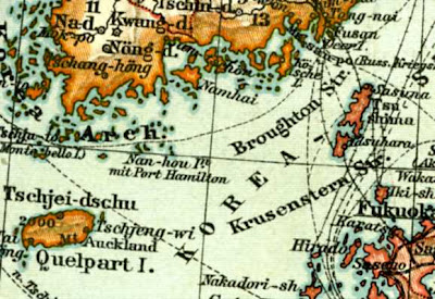
 This map was made in Germany in 1902, just two years before the Russo-Japanese war. (I found almost the same map which was published in 1897, so this map may have been the 1902 version of the 1897 map.)
Ulleungdo was depicted as Matsu-shima (Dagelet I.) and Liancourt Rocks as Liancourt In. (Hornet In.). Although the colour of Liancourt Rocks is not clear, Matu-shima (Ulleungdo, Dagelet island) was printed in red, the same colour as Japan. It may be hard to differentiate on screen but Korea is painted in brown/orange - please see the last close-up photo. Germany believed that Liancourt Rocks to be Japanese territory even two years after the 1900 Imperial Edict which mentioned Seokdo. Pro-Korean scholars claime that Seokdo was Dokdo (Laincourt Rocks) but this theory seems to be groundless.


No comments:
Post a Comment
Note: Only a member of this blog may post a comment.