 Below are maps of the Korean peninsula and Gangwon Province from the atlas "Donggyeong San Cheon: Paldo Jido" (東京山川 八道地圖). The date of the atlas and maps are unknown, but they were most likely made sometime before the 1800s. The atlas is stored in Korea's Koryo University Library. (Link to Korean Map)
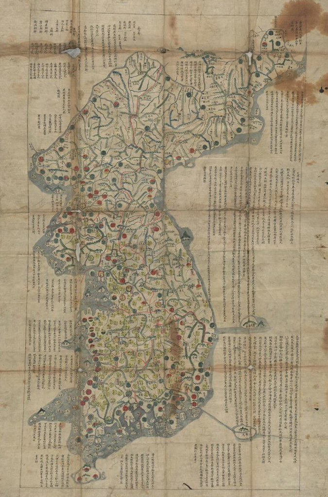
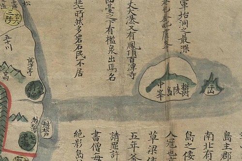
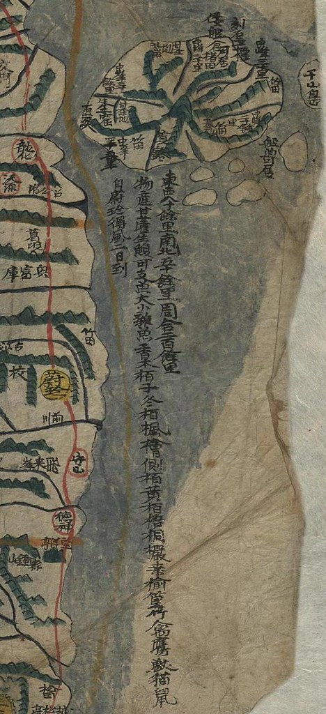
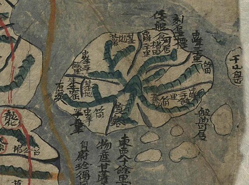
The map of the Korean peninsula shows Ulleungdo (鬱陵島) off the east coast with a small neighboring isand labeled "于山" (Usan). Korea claims that the "island of Usan" (于山島) was the old Korean name for "Dokdo" (Liancourt Rocks), but this map, like many others, shows that Usando was a neighboring island of Ulleungdo, not Dokdo (獨島). This is confirmed by the Gangwondo (江原道) map that was included in the same atlas.
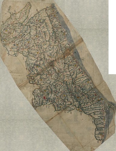
The Gangwondo map (LINK) shows a close-up of Ulleungdo with an island just off its east shore labeled "于山島" (Usando). We know that the Usando on this map was not "Dokdo" because Dokdo is ninety-two kilometers southeast of Ulleungdo and is essentially made up of two islets, not one. The maps also shows Ulleungdo with five other small islands just off its southern shore, which was a common feature of Korea's old Ulleungdo maps.
The writing below Ulleungdo gives the dimensions of the island (80 ri east to west & 50 ri north to south) and the flora and fauna found there. It also says that Ulleungdo was two days away by boat from Uljin (蔚珍), which is a place on the Korean peninsula.
I hope they will adopt this map for the new Korean banknote!
ReplyDeleteThis is another evidence to show that Usando was not Liancourt rocks.
Now we have lots of evidences...
Korea didn't know Liancourt rocks, old documents and maps show it and Korean eastern territory didn't include Liancourt rocks from 1894 to 1948. Then, how Korea can keep insisting that they have right to own Liancourt rocks?
Just ask a question, how to judge this map was published before 1800?.
ReplyDeleteThe full chosun map resemble to 海左全圖 on 1823 and Local map of 江原道,incruding detail map of Ulluengdo seems to be 朝鮮地圖1898/江原道圖 on 大韓地誌1899.
Is there any relatinon with 東京山川 and Yamakawa publisher山川出版社,from 1889?_
http://ja.wikipedia.org/wiki/%E5%B1%B1%E5%B7%9D%E5%87%BA%E7%89%88%E7%A4%BE
This comment has been removed by the author.
ReplyDeleteGTOMR,
ReplyDeleteI have no idea when it was made, but I guess "山川" simply means "mountains and rivers" which depicted precisely and labeled intensively. I don't know what "東京" means in Korean, though.
one wonder about the title cover.
ReplyDeleteUsually they wrote just a map title name only.
For e.g. 青邱圖 ,海東輿地圖,東輿圖 and so on.
(check and compare many map title pages.)
But This map name might be 「八道地圖」,and 東京山川 doesnt seems to be map name itself.
And , in the main place, they use number of Zero=0 for e.g. see ”三陟三0六”instead of "三百六”on full Chosun map.See 江陵,they wrote 五0四 instead of 五百四.When Korean started to use "0(Zero)"?(I didnt check it all the map about 0)
In addition, I felt strange that 江原道圖 with Detail Ulleungdo map, they wrote Chinese letter bit dirty.
GTOMR,
ReplyDeleteIt does look like "0"s. Good find !
There are no maps show the eastern border of Korea include Takeshima/ Dokto, 131-52E, even after tne World war. All of maps in Korea during late 19th century to after the World War descrived 130-54E which include Jukdo, several kilometers to the west of Ululundo.
ReplyDeleteCheck your documents in Korea.