Below is a link to an article reporting that North Gyeongsang Province (慶尙北道) officials plan to use "world-renowned media corporations," including National Geographic, to promote the "history, geography, and natural resources of Dokdo and Ulleungdo." They believe that a documentary on the islands will help strengthen Korea's sovereignty claim over Dokdo (Liancourt Rocks).
I do know about the other media corporations they plan to use, but I do not think their plan for promoting Korean sovereignty over Dokdo will work with National Geographic, which I suspect will want to give a more balanced historical description of the islands than Koreans may want. I think rather than promoting Korean sovereignty over Dokdo, such a documentary with National Geographic will only serve to inform the world that Korea's sovereignty claims on "Dokdo" are disputed by Japan.
Actually, I wish the "History Channel" would do a program on the history of Ulleungdo and Liancourt Rocks (Dokdo/Takeshima). I think that would be interesting.
Here is a link to the English article:
"Dokdo to enchant TV audiences worldwide"
Here is a link to what appears to be a Japanese translation of a Yonhap News article on the Korean plan:
慶尚北道、海外放送通じて独島・鬱陵島知ら
26.3.08
Takeshima Not Mentioned in Japanese Educational Guidelines
These days it seems that both Korea and Japan have stopped talking about the dispute over Liancourt Rocks (Dokdo/Takeshima), apparently in an attempt to improve the relationship between the two countries. Even scholars from both countries seem to be avoiding public discussion of the subject. And according to a Korean article HERE, the Japanese Ministry of Education has removed mention of Takeshima from its educational guidelines to Japanese teachers.
I think it is good that both the Korean and Japanese governments are trying to improve relations by not making Liancourt Rocks (Dokdo/Takeshima) an issue, but I do not understand why the Japanese government would not want Japanese students to know the facts surrounding the dispute?
Teaching about the Liancourt Rocks dispute and not making it a diplomatic issue are two separate things. Japanese educators should be allowed to do their job while Japanese diplomats do theirs.
The following is my translation of a Korean article, HERE, from Korea's "Maeil Business" newspaper:
"'Dokdo' Contents Removed from Japanese Educational Guidelines"
It has been revealed that the Japanese Ministry of Education, Culture, Sports, Science and Technology removed mention of Japanese sovereignty over Dokdo (Takeshima) and Senkaku (尖閣) Islands in a February amendment to its Educational Guidelines. This measure was adopted by Prime Minister Yasuo Fukuda, who places importance on Asian diplomancy, to avoid friction with Korea and China.
However, during a meeting of the Education Committee of the House of Representatives, which convenced on the 21st, Democratic Party Diet Representative Maki Yoshio said, "Takeshima (Dokdo) and Senkaku must be mentioned in the guidelines," and "showing concern for and compromising with neighboring countries are separate issues."
22.3.08
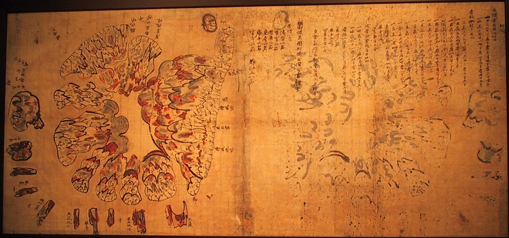
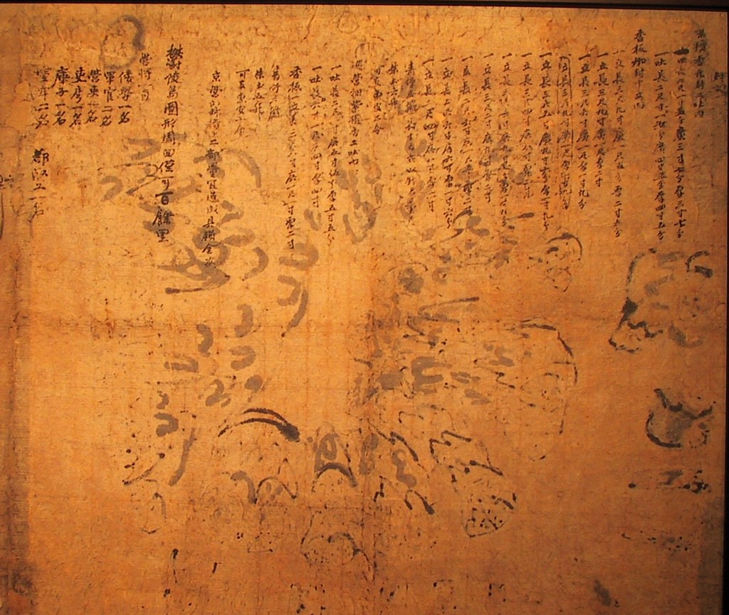
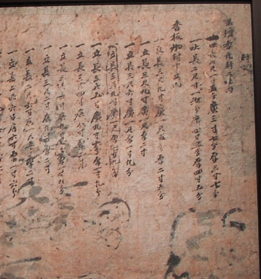
Samcheok Museum's "Ulleungdo Dohyeong"
Below is an old Korean map of Ulleungdo called "Ulleungdo Dohyeong" (鬱陵島圖形). The exact date of the map is unknown, but it is believed to have been made sometime in the latter part of the Joseon Dynasty (1392 - 1910), before 1882. The map is the property of the Samcheok Municipal Museum (三陟市立博物館).
Could we work on translating it together?


Could we work on translating it together?

20.3.08
Some Interesting Photos of Ulleungdo
Here is a link to some interesting photos of Ulleungdo. Notice how steep the cliffs are.
Link to a lot of pictures of Ulleungdo
Another link
http://blog.naver.com/gongjoo0270/48857053
Link to a lot of pictures of Ulleungdo
Another link
http://blog.naver.com/gongjoo0270/48857053
19.3.08
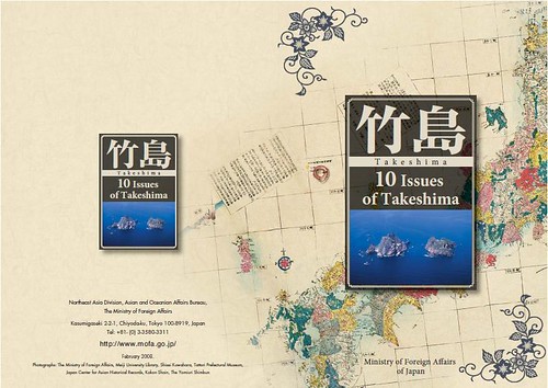
2008 - "10 Issues of Takeshima" by MOFA

The Ministry of Foreign Affairs of Japan published the new brochure for Takeshima in Feb. 2008. You can download them in Japanese, English and Korean from their site below.
Japanese Ministry of Foreign Affairs ( English [PDF] /Japanese [PDF] /Korean [PDF] )
2008 - "10 Issues of Takeshima" by MOFAPoint 1. Japan has long recognized the existence of Takeshima.
A group of island that are currently called Takeshima were once known as "Matsusihma," and the island that is now known as Utsuryo (pronounced Ulleung in Korean) used to be known as "Takeshima" or "Isotakeshima." Although there has been a period of temporary confusion concerning the names of Takeshima and Utsuryo Island due to an error in the charting of Utsuryo Island by European explorers and others, it is obvious from a variety of written of written ducuments that Japan has long recognized the existence of "Takeshima" and "Matsushima." For example, on many maps, including "Kaisei Nippon Yochi Rotei Zenzu (Revised Complete Map of Japanese Lands and Roads: first published in 1779)" by Sekisui Nagakubo, which is the most prominent published cartographic projection of Japan, the locations of Utsuryo Island and Takeshima are accurately recorded at their current position between the Korean Penninsula and the Oki Islands.
Point 2. There is no evidence that the ROK has long recognized the existence of Takeshima.
2-1
The ROK claims that, based on what is recorded in old Korean texts such as "Samguksagi(History of the Three Kingdom : 1145)", "Sejong Sillok Jiriji(Geographical Appendix to the Veritable Records of King Sejong: 1454)", "Sinjeung Dongguk Yeoji Seungnam(A Revised Edition of the Augmented Study of Korea : 1531)", "Dongguk Munheonbigo(Study of Korean Documents: 1770)", "Mangi Yoram(Handbook of State Affairs: 1808)" and "Jeungbo Munheonbigo (Augmented Study of Documents: 1908)", Koreans had long been aware of the existence of the two islands of Utsuryo and Usan Island, and that this very Usan Island is the Takeshima of today.
2-2
However, whereas in "History of the Three Kingdoms", there is a description that Utsuryo Island which belonged to Usan Country became a part of Silla in the year of 512, but thee is no mention of Usan Island. Moreover, in records concerning Usan Island in ancient Korean documents, the island is described as a place in which many
people lived, and where large bamboo groves were cultivated. Such description does not represent the realities of Takeshima and rather reminds us of Utsuryo Island.2-3
The ROK side claims that Usan Island is what the Japanese called Matsushima (present day Takeshima) based on the description in "Yeojiji (Record of Geography: 1656)" cited in "Study of Korean Documents", "Augmented Study of Documents" and "Handbook of State Affairs." However, there is a study which criticizes that the original text in "Record of Geography" indicates that Usan Island and Utsuryo Island are two names for one island and that the description in the documents such as "Study of Korean Documents" are indirect and inaccurate quotations from "Record of Geography". The study makes the point that the description in those documents were copied from "Ganggyego (Study of National Boundary)" (part of "Ganggyeji (Record of National Boundary: 1756)"), which had uncritically borrowed from the unreliable deposition by Ahn Yong-Bok (refer to point 5).2-4
In the map attached to "A Revised Edition of the Augmented Survey of the Geography of Korea," Utsuryo Island and Usan Island are described as two separate islands. If, as the ROK claims, Usan Island were the present Takeshima, then it should have been described as a much smaller island than Utsuryo Island situated east of Utsuryo Island. However, the Usan Island is portrayed on the map as being roughly of the same size as Utsuryo Island, and situated between the Korean Peninsula and Utsuryo Island (west of Utsuryo Island). This clearly shows that that island does not exist at all in reality.
Point 3. Japan used Takeshima as a stopover port en route to Utsuryo Island and as fishing ground. It thus established its sovereignty over Takeshima by the mid 17th century at the very latest.
3-1
In 1618 (Note), two merchants of Yonago in the region of Houki-no-kuni in Tottori clan--Jinkichi Ohya and Ichibei Murakawa--received permission for passage to Utsuryo Island (then "Takeshima") from the Shogunate via the feudal lord of Tottori. Subsequently, the two families took turns in traveling to Utsuryo Island once every year, and engaging in catching abalone and sea lions, and in felling trees, including bamboo. (Note) Some believe that it was in 1625.3-2
Both families built ships bearing the sails emblazing the hollyhock crest of the ruling that was caught being sent in tribute to the Shogunate and others. The families were thus engaged in a kind of Shogunate-approved monopoly on the island.3-3
During this period, Takeshima that was on the route from Oki to Utsuryo Island was a navigational port and docking point for ships. It was naturally utilized as a rich fishing ground for sea lions and abalone.3-4
Therefore, we firmly believe that Japan has established the sovereignty of Takeshima by the beginning of the Edo Period (1603-1867) in the mid 17th century at the very latest.3-5
If the Shogunate then had recognized Utsuryo Island and Takeshima as foreign territories, it should have banned passage to these islands in 1653 when it issued its directive of "sakoku", closing Japan to the outside world and prohibiting Japanese from traveling abroad. However, no such measure was actually taken.
Point 4. At the end of the 17th century Japan prohibited passage of ships to Utsuryo Island, but not to Takeshima.
4-1
With the permission of the Shogunate to make passage for Utsuryo Island, the Ohya and Murakawa families of Yonago engaged in their monopolistic business enterprise unhindered by others for approximately 70 years.4-2
In 1692 when the Murakawa family traveled to Utsuryo Island, they encountered many Korean on the island engaged in fishing. The following year, when the Ohya family made the the journey to the island, they also met with many Koreans and decided to bring two of these Koreans, Ahn Yong-Bok and Park Eo-Doon, back with them to Japan. This was at a time that the royal dynasty of Korea prohibited its people from travelling to Utsuryo Island.4-3.
The feudal clan of Tsushima(which was the point of contact with the Korean Government at that time), following directions from the Shogunate, which had become aware of the situation, repatriated Ahn and Park to Korea, and initiated negotiations with Korean requesting it to prohibit its fishermen's passage to Uturyo island. However, these negotiations failed to reach agreement, given a difference in opinions concerning the attribution of Utsuryo Island.4-4
Having received a report from the Tsushima clan concerning the breaking-off of negotiations, the Shogunate decided to prohibit passage to Utsuryo Island in January 1696, judging that it is in the best interest of Japan to maintain favorable relations with Korea, The Tsushima clan was directed to convey this decision to the Korean side. The course of these negotiations concerning the attribution of Utsuryo Island is known generally as the "Takeshima Ikken (The Affair of Takeshima)."4-5
On the other hand, passage to Takeshima was not banned. This clearly shows that Japan has regarded Takeshima as its territory since then.
Point 5. The deposition by Ahn Yong-Bok, on which ROK side bases its claim, contains many points that conflict with factual evidence.
5-1
After the Shogunate decided to prohibit passage to Utsuryo Island, Ahn Yong-Bok came once again to Japan. After that, Ahn, who was once again repatriated to Korean, was interrogated by the Korean officials as being in contravention of the ban on travel to Utsuryo Island. The deposition made by Ahn at the time is cited by the ROK side today as one of the foundations for its claim on the sovereignty over Takeshima.5-2
According to documents held by the ROK side, Ahn
Yong-Bok confessed that while in Japan he had acquired a written document from
the Edo Shogunate that indicated the Shogunate's acceptance of Utsuryo Island and Takeshima as territories of Korea. He also confessed that this document was later confiscated by the lord of Tsushima. However, according to documents held by the Japanese side, although there are records of Ahn Yong-Bok having visited Japan in 1693 and 1696, there are no records that a written document such as that claimed by the ROK side was ever given to Ahn Yong-Bok.5-3
Moreover, according to the documents held by the ROK side, Ahn Yong-Bok is reported to have stated on his 1696 visit to Japan that there were many Japanese on Utsuryo Island. However, his visit to Japan on that occasion was after the Shogunate had decided to prohibit passage to Utsuryo Island, and neither the Ohya nor Murakawa family went to the island at that time.5-4
The descriptions on Ahn Yong-Bok in the documents held by the ROK side are based on the deposition made by a person who had raveled overseas violating national prohibition, and was interrogated upon his return to Korea. The deposition contains many points that conflict with factual evidence, including but not limited to those mentioned above. Regardless of that, these descriptions have been cited by the ROK side as one of the foundations for sovereignty over Takeshima.
Point 6. Japan reaffirmed its intention to claim sovereignty over Takeshima by incorporating Takaeshima into Shimane Prefecture in 1905.
6-1
It was at the beginning of the 1900s that sea lion hunting came to be undertaken in a full fledged manner in Takeshima. However, since there quickly grew to be excessive competition in sea lion hunting, Yozaburo Nakai, a resident of the Oki Islands of Shimane Prefecture, who aimed to stabilize his sea lion hunting business submitted a request in September 1904 to three government ministers (Home Minister, Foreign Minister, Agriculture and Commerce Minister) to incorporate the territory of the Lyanko Islands and to extend a 10-year lease on its utilization.
(Note) "Lyanko Islands" was a Japanese colloquial term for Takeshima derived from "Liancourt Islands," the Western name given to Takeshima. At that time, Utsuryo Island came to be called “Matsushima” in addition to “Takeshima” and current Takeshima came to be called to “Lyanko Islands” in addition to “Matsushima” due to charting errors by European explorers.6-2
Having received the request from Nakai, the Government of Japan, hearing opinions from Shimane Prefecture, confirmed that there is no problem in bringing Takeshima under the jurisdiction of the Okinoshima branch and that "Takeshima" is the appropriate name for the island. With this confirmation, the Government, in January 1905, through a Cabinet decision, stipulated that the islands came under the jurisdiction of the Okinoshima branch of Shimane Prefectural Government, and that the island were officially named as "Takeshima." This decision was conveyed to the Governor of Shimane Prefecture by the Minister for Home Affairs. With this Cabinet Decision, Japan reaffirmed its intention to claim sovereignty over Takeshima.6-3
Based on the Cabinet Decision and the Ministerial Instruction from the Minister for Home Affairs, the Governor of Shimane Prefecture published in February 1905 that Takeshima was officially named as "Takeshima" and that it came under the jurisdiction of the Okinoshima branch. He also informed the Okinoshima branch to this effect. These measures were carried in the newspapers of the day and were broadly publicized.6-4
Based on the Cabinet Decision stipulating that Takeshima came under the jurisdiction of the Okinoshima branch of Shimane Prefectual Government, the governor registered Takeshima into the State Land Register, and established a license system for sea lion hunting. The hunting of sea lions continued from then until 1941.6-5
In Korea, it is said that records exist that according to the stipulations of Imperial Ordinance No. 41 of 1900, not only was the name Utsuryo Island to be changed to Utsu Island (pronounced Uldo in Korean), but that the monitoring of the island would be henceforth undertaken by a county magistrate. Some researchers point out that this ordinance stipulates that the region under the jurisdiction of Utsuryo County included "all of Ulleungdo (Utsuryo Island), Jukdo (Takeshima) and Seokdo (Ishijima)," (the names of the islands are written in Chinese characters (ideogram)) and that, while this "Jukdo" refers to a small island called "Chikusho" adjacent to Utsuryo Island, "Seokdo" (literally meaning “stone island”) actually corresponds to the current "Dokdo." According to the researchers, , Seokdo ( 石島) turned to Dokdo (独島) (literally meaning lone island) because they are phonetically interchangeable in a Korean dialect despite the fact that they do not share the same ideograms.6-6
If it were, however, the case that "Seokdo" corresponds to the current Takeshima ("Dokdo"), there would be doubts as to why the Imperial Ordinance of 1900 did not use "Dokdo" in the text, why the name "Usan Island," which the ROK claims to be the former name of Takeshima, was not used, and when and how the name Dokdo was first used.6-7
Whatever the case, even assuming such doubts will be cleared, there is no evidence that Korea had ever exercised effective control over Takeshima around the time of the promulgation of the Imperial Ordinance. Therefore, it is considered that Korea had never established sovereignty over Takeshima.
Point 7. In the drafting process of the Treaty of Peace with Japan, the United States rejected the request by the ROK that Takeshima be added to the relevant article of the Treaty as one of the areas Japan would renounce, claiming that Takeshima had been under the jurisdiction of
Japan.
7-1
The San Francisco Peace Treaty, signed in September 1951, stipulates that “Japan, recognizing the independence of Korea, renounces all right, title and claim to Korea, including the islands of Quelpart, Port Hamilton and Dagelet."7-2
Upon learning of the content of this part of the Treaty drafted by the United States and the United Kingdom in July 1951, the ROK had You Chan Yang, Korean Ambassador to the United States, send a letter to Dean G. Acheson, the Secretary of State of the United States. In the letter, the Ambassador wrote, "My Government requests that the word ’renounces’ in Paragraph(a), Article Number 2, should be replaced by confirms that it renounced on August 9, 1945, all right, title and claim to Korea and the islands which were part of Korea prior to its annexation by Japan, including the islands Quelpart, Port Hamilton, Dagelet, Dokdo and Parangdo."7-3
In August of the same year, the United States responded to the letter by a letter from Dean Rusk, United States Assistant Secretary of State for Far Eastern Affairs to Ambassador Yang. The content of the response was, "...the United States Government does not feel that the Treaty (San Francisco Peace Treaty) should adopt the theory that Japan's acceptance of the Potsdam Declaration on August 9, 1945 constituted a formal or final renunciation of sovereignty by Japan over the areas dealt with in the Declaration. As regards the island of Dokdo, otherwise known as Takeshima or Liancourt Rocks, this normally uninhabited rock formation was according to our information never treated as part of Korea and, since about 1905, has been under the jurisdiction of the Oki Islands Branch Office of Shimane Prefecture of Japan. The island does not appear ever before to have been claimed by Korea." Based on this correcspondence, it is evident that Takeshima was affirmed as part of the territory of Japan.7-4
The report of Ambassador Van Fleet (refer to point 10) states that "the United States concluded that they (the islands of Takeshima) remained under Japanese sovereignty and the Island was not included among the Islands that Japan released from its ownership under the Peace Treaty. "
Point 8. In 1952, Takeshima was designated as a bombing range for the U.S. Forces stationed in Japan, which shows that Takeshima was treated as part of the territory of Japan.
8-1
In July 1950, while Japan was still under Allied occupation, the supreme command for allied Powers designated Takeshima as a bombing range for U.S. Forces by an instruction note (SCAPIN-2160).8-2
In July 1952, given the expressed desire by the U.S. Forces to continue to utilize Takeshima as a training area, the Joint Committee established for the purpose of implementing the Japan-U.S. Administrative Agreement under the Japan-U.S. Security Treaty designated Takeshima as a bombing range for the U.S. Forces stationed in Japan. The Ministry of Foreign Affairs promptly published this fact through the Official Gazette.8-3
The Japan-U.S. Administrative Agreement stipulated that the Joint Committee shall serve as the means for consultation in determining the facilities and areas in Japan. Therefore, the fact that Takeshima was discussed in the Committee and the fact that the island was designated as an area for use by the U.S. Forces stationed in Japan clearly shows that Takeshima is part of the territory of Japan.
Point 9. The ROK is illegally occupying Takeshima, against which Japan has been consistently making strong protests.
9-1
In January 1952, the President of the ROK Syngman Rhee issued a Declaration concerning maritime sovereignty, with which he installed the so-called "Syngman Rhee Line." Installation of this "line" encompassing the islands of Takeshima was a unilateral act in contravention of international law.9-2
In March 1953, the Joint Committee decided to release Takeshima from the designation of a bombing range for the U.S. Forces. It prompted resumption of fishing by Japanese on and around Takeshima, where it was confirmed at the same time that there were also Koreans engaged in fishing. In July of the same year, a Japanese patrol vessel of the Maritime Safety Agency (now the Japan Coast Guard) that demanded Koreans engaged in illegal fishing to leave the vicinity of Takeshima was fired upon by the Korean authorities that were supporting and protecting the Korean fishermen.9-3
In June 1954, the Ministry of Home Affairs of the ROK announced that the ROK Coast Guard had urgently dispatched a permanent battalion on Takeshima. In August of the same year a vessel of the Maritime Safety Agency on patrol in the vicinity of Takeshima was fired on from Takeshima. Through this incident, it was confirmed that the ROK security personnel had been stationed on Takeshima.9-4
Since then,the ROK has kept and keeps, security personnel stationed on Takeshima as well as constructing lodgings, a monitoring facility, a lighthouse, and port and docking facilities.9-5
The occupation of Takeshima by the ROK is an illegal occupation undertaken on absolutely no basis of international law. No measure taken by the ROK during its illegal occupation with regard to Takeshima has any legal justification. This illegal occupation is not acceptable in any way, gien Japan's position on its sovereignty over Takeshima. Japan has been consistently making strong protests against each and every measure taken by the ROK and demanding the withdrawal of the measure.
Point 10. Although Japan proposed to the ROK that the dispute over Takeshima be referred to the International Court of Justice, the ROK rejected this proposal.
10-1
Since the installation of the "Syngman Rhee Line" by the ROK, Japan has been repeated protesting against the ROK's actions such as claims of sovereignty over Takeshima, fishing activities around Takeshima, fires against patrol vessels, and the construction of structures on the island. In order to resolve the dispute in a peaceful manner, Japan proposed, with a note verbale, to the ROK that the issue concerning the sovereignty of Takeshima be referred to the International Court of Justice in September 1954. However, the ROK rejected this proposal. In addition, on the occasion of the Foreign Ministerial talks in March 1962, Zentaro Kosaka, then Minister for Foreign Affairs of Japan, made a proposal to Choi Duk-shin, then Minister of Foreign Affairs of the ROK, to refer the issue to the Court, but this proposal was not accepted by the ROK again. This situation remains the same until now.
10-2
The International Court of Justice has jurisdiction over a dispute only when the parties to the dispute have agreed to bring the case to the Court. Accordingly, even if Japan refers the issue to the Court unilaterally, the ROK has no obligation to respond to it, and the Court will not have jurisdiction until the ROK voluntarily accepts it.10-3
According to the report of Ambassador Van Fleet who visited the ROK in 1954, which was made public in 1986, the United States concluded that Takeshima is Japanese territory, and took the position that the dispute might properly be referred to the International Court of Justice. Ambassador Fleet reports that though the United States conveyed this suggestion to the ROK, the ROK argued that “Dokto” was a part of Utsuryo Island.
12.3.08
Samcheok Museum's "Ulleungdo Dohyeong" (鬱陵島圖形)
Below is an old Korean map of the Korean island of Ulleungdo, entitled "Ulleungdo Dohyeong" (鬱陵島圖形). The map is the property of the Samcheok Municipal Museum (三陟市立博物館), but is currently on display at the Gyeonggi Cultural Foundation (京畿文化材團) Art Center in Suwon until March 31. The exact date of the map is unknown, but it is believed to have been made sometime in the latter part of the Joseon Dynasty (1392 - 1910), before 1882.
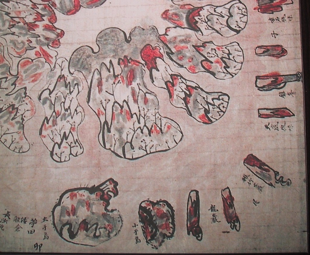
For some reason, Ulleungdo was drawn upside down on the map since the top of the map shows the southern shore and the bottom shows the northern shore. Accordingly, Ulleungdo's eastern shore appears on the left side of the map. One of the interesting things about this map is that the two largest islands off Ulleungdo's eastern shore (left side) are labeled 大于島 (Dae-Udo) and 小于島 (So-Udo), which literally mean "large Udo" and "small Udo," respectively. The "large Udo" is believed to have been Ulleungdo's present-day neighboring island of Jukdo (竹島), which is about two kilometers off Ulleungdo's eastern shore, while the "small Udo" is believed to have been Ulleungdo's Gwaneumdo (觀音島), which is about 100 meters offshore.

Korean Link
10.3.08
Is Mark Lovemo's "Dokdo" Web site history?
Has Mark Lovemo deleted his Dokdo Web site, which argued in support of Korea's claim to the island? I noticed today that the link no longer works. Did he finally open his eyes to the truth?
It seems "Dokdo" Web sites are suffering slow, painful deaths.
Here is the old link to Mark's site:
http://www.geocities.com/mlovmo/page4.html
It seems "Dokdo" Web sites are suffering slow, painful deaths.
Here is the old link to Mark's site:
http://www.geocities.com/mlovmo/page4.html
9.3.08
The 5th column “Seeking Truth Based Solely on Facts(実事求是)”
Below is a translation of The 5th column “Seeking Truth Based Solely on Facts(実事求是)” by Prof. Shimojo Masao
.
"South Korea’s erroneous interpretation of the document 'Takeshima and Another Island are Unrelated to Japan'"
.
The Takeshima Day ceremony held at the Shimane Prefectural Hall on February 22 seems to have attracted South Korean interest, as the Dokdo Headquarters in that country fanned the flames of the dispute by offering the following explanation of the origins of the Takeshima controversy: “The Japanese refer to Dokdo as Takeshima, or Bamboo Island, though the island has no bamboo whatsoever. The reason they call it the island of bamboo is that in the local dialect of Korea’s Jeolla Province, “dok” is pronounced as “tok”. Thus the pronunciation of the island’s name of Tokushima evolved into Takeshima. Japan established Takeshima Day in 2005, and they are increasingly resorting to such thieving trickery to snatch Dokdo and make it Japanese territory.”
.
On the day of the ceremony, the Yonhap News Agency of South Korea reported the discovery of a Japanese map with a color code indicating Dokdo was Korean territory. This story was repeated by the Kyunghyang Shinmun, Dong-a Ilbo, the Korean edition of World Times, and Ko-news.
.
The story arose with the announcement by Hosaka Yuji of Sejong University that two Japanese maps show Takeshima to be Korean territory. This announcement was based on only two maps, including the “Shinsen Chosen Zenzu (新撰朝鮮全図) ”, or New Map of Choseon. But the declaration from the Dokdo Headquarters and Hosaka Yuji’s view merely reveal the limits of South Korean capabilities to interpret old documents. On the contrary, the map verifies that Takeshima was not Korean territory.
.
If they could read the order of the Japanese Council of State (Cabinet) “Takeshima and Another Island are Unrelated to Japan”, they wouldn't confuse Matsushima, which was the other island, with today’s Takeshima or attribute it to the Jeolla Province dialect. The critical factors for the Takeshima issue are critiques of documents and objective historical facts.
.
South Korea thinks that reference was being made to today’s Takeshima in the Council of State order, but that’s just a superficial analysis. The Kobunroku (Official Documents) included a rough map of Isotakeshima and a document collected when Shimane prefecture asked the government about including Ulleungdo and Takeshima in the prefecture in 1876. The content of the documents were confusing, however.
When Shimane Prefecture compiled the documents, they described Isotakeshima as Ulleungdo. They also described Matsushima as the Ulleungdo to which the Oya and Murakawa families of Yonago in the Tottori domain were authorized by the Shogunate to travel. Thus, they recorded two Ulleungdos.
.
There was a reason for that confusion. In those days a “Takeshima” that did not exist was depicted in maps and charts made in the West, and the Japanese cartographers followed suit. That was due to both Hayashi Shihei’s “Sangoku Setsujozu(三国接壌図)” (1785), which contained two Ulleungdos, and Philipp von Siebold’s Map of Japan (1840), in which Takeshima (Argonaut Island) was drawn at 129 degrees 50 minutes east longitude, and Matsushima (Dagelet Island) was drawn at 130 degrees 56 minutes east longitude. The Takeshima in the latter map, which gained currency in the West, was Argonaut Island--which did not exist. Today’s Takeshima, at 131 degrees 55 minutes east longitude, began to appear in charts after 1849 when the French whaling ship Liancourt came across the island. Neither of the two maps that Mr. Hosaka “discovered” includes today’s Takeshima.
.
After that, the survey conducted by the warship Amagi in 1880 revealed that Matsushima was Ulleungdo. The islet that Pak Chang-seok(朴錫昌) designated as the “so-called Usando” in 1711 was called Takeshima, or Jukdo in Korean. In 1882, Lee Gyu-wen(李奎遠) produced a map after his survey of Ulleungdo; he also called the island Jukdo.
.
Ryanko island (Liancourt Rocks), which was unclaimed until 1904, was called Takeshima by Azuma Bunsuke, the administrator of Oki Island, because Ulleungdo was referred to as Matsushima when it was under Oki Island jurisdiction and they had to use the remaining name of Takeshima (as seen in the official document #152). The Dokdo Headquarters’ explanation that the name of Takeshima originated from a Jeolla Province dialect is not true.
.
Now, the Dokdo Protection Squad of South Korea has brought some pamphlets that show a copy of the order from the Council of State. I immediately used it in my Takeshima Day lecture as an example of their inability to read documents. The more that South Korea continues its historical offensive, the clearer it becomes that Takeshima was not Korean territory.
.
“実事求是 〜日韓のトゲ、竹島問題を考える〜 第5回 韓国側による「竹島外一島、本邦関係無之」の解釈の誤り 下條正男”
Translated by Pacifist
Edited by William Sakovich
Courtesy of Web Takeshima Research Center
Other Column of the Series:
The 22th column “ Refutation against "The Meiji Government's recognition of Takeshima=Dokdo" by Mr. Park Byeong-seop(朴炳渉)””, Part 1, Part 2, Part 3, Part 4
The 21st column " Refutation against "Analysis of Shimojo Masao's Editorials" by Mr. Park Byeong-seop(朴炳渉)”
The 20th column “Act of Folly by "Northeast Asian History Foundation"”
The 16th column ""Dokdo Month" without any historical grounds."
The 15th column " South Korea's Groundless Claim of "Inherent Part of (Korean) Territory"
The 12th column “Northeast Asian History Foundation and Dokdo Research Center's Misunderstanding”
The 10th column " A Blunder of Sokdo(石島) = Dokto(独島) Theory”
The 9th column "Criticism on Dokdo Research Center”
The 8th column “The Historical Facts" The 6th column “Onshu-shicho-goki (隠州視聴合記)" and the "Nihon Yochi Totei Zenzu (日本輿地路程全図)" by Nagakubo Sekisui(長久保赤水)"The 5th column “South Korea’s erroneous interpretation of the document 'Takeshima and Another Island are Unrelated to Japan"
The 4th column “Errors in Educational Video Produced by the Northeast Asian History Foundation (東北アジア歴史財団)."
Reference: Kobunroku(公文録)
6.3.08
Over 40 Old Korean Maps on Display in Suwon
 According to an article in the Chosun Ilbo, HERE, over forty old Korean maps of Ulleungdo and Dokdo are on display at the Gyeonggi Cultural Foundation in Suwon until the end of March. Maps from the Dokdo Museum, the Korean National Library, Seoul National University's Gyujanggak Institute for Korean Studies, and Samcheok Museum are among the maps on display and include Lee Gyu-won's 1882 "Ulleungdo Woi-do" (鬱陵島 外圖) and Bak Seok-chang's 1711 "Ulleungdo Do-hyeong" (鬱陵島 圖形). Samcheok Museum's "Ulleungdo Do-hyeong" (鬱陵島 圖形) should also be on display.
This exhibition is a rare opportunity. Don't miss it.
4.3.08
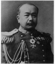
1853-1922 - 肝付兼行 (Kimotsuki Kaneyuki)
 内藤正中氏はその著書などを通して、1904年に中井養三郎が政府へ領土編入の願いを出そうとしたときに、まるで海軍の作成した水路誌の記述をもって肝付が現竹島を朝鮮領であると認識していたかのように主張していますが、果たしてそれは事実でしょうか? "検証"してみます。
海軍水路部長の肝付兼行には、日露戦争のさなかであり、ウラジヲ艦隊の動向や廻航されてくるバルチック艦隊を迎え撃つ日本海での海戦に対処してゆくことが求められていた。その海軍水路部発行の一八九四(明治二七)年、一八九九(明治三二)年版『朝鮮水路誌』には、松島(鬱陵島)、リアンコールト列岩と記している。ところが一八九二(明治二五)年以降に次々と刊行された『日本水路誌』には松島もリアンコールト列岩もともに記されておらず、海軍がリアンコールト列岩を日本領では無く、朝鮮領としていた事を意味している。
(中略)
海軍水路部で肝付兼行水路部長に会って話を聞くと、リヤンコ島の所属については確乎とした証拠がないという。リヤンコ島の位置は隠岐より八五浬、鬱陵島よりは五五浬であるが、出雲国多古鼻からは一〇八浬、、朝鮮ルツドネル岬からは一一八浬である。だから日本の方が一〇浬も近く、しかも日本人が同島で漁労をしている以上は、日本領土に編入するのがよろしいと言う説を述べるのであった。中井は「時ノ水路部長肝付将軍断定ニ頼リテ、本島ノ全ク無所属ナル事ヲ確カメタリ」と言うに至る。(「史的検証竹島・独島」内藤正中、金柄烈 2007)
肝付の経歴を調べてみると、意外な事が判明して来ます。彼は海軍水路部長という地位にありながら、実はもとから軍人として訓練された人物ではなく、測量技術者として養成された専門家であり、近代日本の測量技術の黎明期を支えた人物の一人だったのです。 海軍中尉を最後に退役した肝付は後に1907年に男爵、1911年に貴族院議員、そして1913年には第5代大阪市長に就任しました。
以上のように、肝付は測量技術の専門家、しかも大変優れた技術者でした。1904年に中井が領土を表すものではない海図肝付(大伴)兼行海軍中尉は、明治9年東京麻布海軍海象台において、タルコット法によって緯度を観測し、北緯35度39分17秒492の値を得た。これは、日本経緯度原点の最初の測量数値となる。日本経緯度原点の緯度値を測定し、日本独自の国内経度電信測定を初めて実施した人である。
肝付は旧姓を江田そして大伴といい、鹿児島県出身で幼名を船太郎といった。明治 2年から北海道開拓使に仕えて測量を行い、明治 5年に水路局に勤務しダビットソン子午儀を用いタルコット法(緯度観測の方法で、空気の層による屈折の影響を少なくするため、時間をおかずにほとんど同じ天頂距離で子午線を通過する、ペアの星を選んで観測する)によりワシントン星表に基づく19対星を 109回にわたって観測し、天文緯度を決めた(明治 9年)。 これが港区麻布台にあった海軍関象台の肝付点であり、この値を子午環中心に移し変えたのが、日本経緯度原点の緯度値である。 明治 9年に北海道と東京間の経差観測を企てたが、海底電線の故障で、東京・青森間の測定に変更し、開拓使の福士成豊(青森)と肝付(観象台)が担当して連続測定した。これは日本で最初の経度電信測定である。
水路局は、明治 4年に柳楢悦水路監督官と中佐 1名、少佐 2名以下でスタートし、当初は北海道沿岸測量を英艦シルビア号と共同して実施し、徐々に独自の水路測量が実施できる体制となった。同5年9月に第 1号海図「釜石」が完成し、本格的な水路測量が開始された。肝付は観象台事務から測量課副長を経て、明治16年には量地課長となる。水路局はその後、明治19年に水路局から海軍水路部へと独立し、職員数 105名の大きな組織となり柳が初代水路部長、肝付が測量課長となった。
この間、明治14年には「水路測令」、「水路誌編集心得」などを刊行するとともに、柳局長の命を受けて「日本全国海岸測量12ケ年計画」の立案を担当した。水路測量では、豊後水道、尾道・広島沿岸、大村湾、下関海峡などに従事し、まさに東奔西走の活躍であった。 肝付は、明治21年初代水路部長の柳に引き続き第 2代と第 4代の水路部長となり16年間その職にあり、水路事業の発展に寄与した。退官後、明治44年に貴族院議員、大正 2年には大阪市長を努めた。(地図測量の200人)
総記 形勢 朝鮮国は亜細亜の東部にあり 其地勢たる狭長なる一大半島を成し 数多の島嶼 之を圍繞す其位置は北緯三三度一五分より同四二度二五分 東経一二四度三〇分より同一三〇度三五分に至る (海軍省水路部「朝鮮水路誌」(明治二十七年) )
また、「朝鮮水路誌」は現竹島と同じく、壱岐と対馬の間の西水道やロシア沿海州沖ののワイオダ岩など、明らかなる朝鮮領土外の海峡や島までも項目として記載している事から、水路誌が領土を規定する目的で発行されたものではなく、当該地域沿岸の船舶航行の安全を確保する為に必要な情報を載せていた事は一目瞭然です。また、1882年の朝鮮王朝、1899年、1900年の大韓帝国による鬱陵島検察使の視察記録を含めた韓国側の記録に、当時の朝鮮王朝が現竹島を領土として考えていた形跡はおろか、その存在さえ正確に把握していた形跡は全くありません。1900年に入り、いずれも日本側の記録に、日本の漁業者に雇われていた為か、1900年から1903年頃まで韓国人は"石島(ソクト)"などではなく日本式の呼び名である”ヤンコ島”と呼んでいたと言う記録、そして1904年に戦艦新高の日誌に独島と呼び始めたことが伺える記録がのこるのみです。外務省通商局編纂「通商彙纂」(1902) , 同第50号(1905) などからも、当時の韓国人は日本に比べて大変遅れた漁業の形態をしており、鬱陵島の韓国住民は筏でワカメや鮑をわずかに採取する以外に、外洋にでるような漁業に従事していた者は全くいなかったことが分かります。半島からの季節漁撈者が鬱陵島で若芽などの採取を行って船に大量に満載して帰って行くことが記されていますが、彼等の内の一人でも鬱陵島を越えて92km離れた現竹島まで漁に向かっていた形跡は全くありません。当時の大韓帝国政府の学部(教育省)の発行の地理の教科書(「大韓地誌」(1901) などにも、現竹島らしい島が明記されることはありませんでした。さらに1906年の皇城新聞の記事により、大韓帝国政府が鬱陵郡の範囲を統監府に公式返答した際、現竹島を含まない範囲を解答していたことも分かりました(「石島=独島」説否定の記述見つかる (山陰中央新報(Cache)。1894-1948 の間に発行された日英韓の各書物を見ても朝鮮領土の東端を鬱陵島の前後においており、現竹島を除外しています。 実際、明治政府の発行した数枚の地図を含め、西欧の地図においても、鬱陵島まで日本の領土とみなすことはしばしばでした。それらは韓国側が現竹島をその領土としてみなしていなかった事、そしてそれは当時、日韓両国はおろかを含む世界的な認識であったことを示す、重要な事実であると言えるでしょう。
これらのことから、「日本水路誌」に現竹島の記述が無く、逆に「朝鮮水路誌」に竹島の項目があったことが、海軍、そして明治政府が現竹島を朝鮮の領土と見なしていたなどといえるものではないことが分かります。内藤氏のように、資料の一部分のみを取りだして歪曲し、まるで肝付が何らかの領土的野心や日露戦争への策
Subscribe to:
Posts (Atom)