竹島問題の歴史

31.10.12

1877 - 公文録 内務省之部「日本海内竹島外一島地籍ニ編纂方伺」(明治10年3月)

田中邦貴氏「竹島問題」サイト(カラー画像)

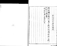
D(02左)右大臣・参議の決定文書 明治10年3月20日
「太政官」の罫紙


立案 第二十号       同廿七日来  「牟田口」印

     明治十年三月廿日
 大臣  「岩倉」具視印    本局 「土方」印、「巌谷」印)
  参議  「大隈」重信印、「寺島宗則」印、「大木」喬任印
  卿輔(印等なし)

別紙、内務省伺、日本海内竹嶋外一嶋地籍編纂之件。(Cをさす)
右ハ、元禄五年、朝鮮人入嶋以来、旧政府、該國ト往復之末、遂ニ本邦関係無之、相聞候段、申立候上ハ、
伺之趣、御聞置、左之通、御指令相成可然哉、此段相伺候也。
   御指令按
  書面(→「伺之趣」に朱字訂正)竹島外一嶋之義、本邦関係無

  之義ト、可相心得事

(02右)


(朱字)明治十年三月廿九日 朱印  誰の印? これ非常に重要
・・・・・・・・・・・・・・・・・・・・・・
B(03左~04右)
島根県→内務卿 地籍編纂の伺い 明治9年10月16日
これ以下はすべて「内務省」の罫紙

「日本海内、竹島外一島、地籍編纂方、伺」
御省、地理寮官員、地籍編纂莅檢之為、本縣巡回ノ砌、
日本海中ニ在ル竹島調査ノ儀ニ付キ、別紙「乙第二十八号」之通、照會有之候處、
本島ハ、永禄中發見之由ニテ、故鳥取藩之時、元和四年ヨリ、元禄八年マテ、凡七十八年間、同藩領内、伯耆國米子町之商、大谷九右衛門・村川市兵衛ナル者、旧幕府ノ許可ヲ経テ、毎歳渡海、島中ノ動植物ヲ積帰リ、内地ニ賣却致シ候ハ、已ニ確証有之、今ニ、古書旧状等持傳候ニ付、別紙「原由ノ大畧」、「圖面」共、相副、不取敢、致上申候。
今回、全島實檢之上、委曲ヲ具ヘ、記載可致ノ處、
固ヨリ、本縣管轄ニ確定致候ニモ無之、且、北海百余里ヲ懸隔シ、線

路モ不分明、尋常帆舞船等ノ能ク往返スヘキニ非ラサレハ、
右大谷某、村川某カ傳記ニ就キ、追テ、詳細ヲ上申可致候。
而シテ、其大方ヲ推按スルニ、管内隠岐國ノ乾位ニ當リ、山陰一帯ノ西部ニ貫附スヘキ哉ニ相見候ニ付テハ、本縣國圖ニ記載シ、地籍ニ編入スル等之儀ハ、如何取計可然哉。
何分ノ御指令相伺候也。
           縣令佐藤信寛代理  島根縣参事 境二郎
明治九年十月十六日 
     内務卿 大久保利通 殿
・・・・・・・・・・・・・・・・・・・・
A(04左)内務省地理寮→島根県地籍編製係照会 明治9年10月5日
そもそもの始まり。

乙第弐拾八号(朱字 貼紙)
御管轄内、隠岐國某方ニ當テ、従来、竹島ト相唱候孤島、有之哉ニ相聞、固ヨリ、舊鳥取藩、商船往復ノ線路モ有之趣、
右ハ、口演ヲ以テ、調査方、及御協議置候儀モ有之、
加フルニ、地籍編製、地方官心得書、第五條ノ旨モ有之候得トモ、
尚為念、及御協議候條、右五條ニ照準、而テ、舊記古圖等、御取調、本省ヘ御伺相成度、此段、及御照会候也。
  明治九年十月五日 地理寮十二等出仕 田尻賢信
              地理大属  杦山栄蔵
島根縣  地籍編製係 御中


・・・・・・・・・・・・・・・・・・・・・・・・・・・
B(島根県→内務省)の添付書類「原由ノ大畧」
(05左~08右)

磯竹島、一ニ竹島ト稱ス。隠岐國ノ乾位、一百二拾里許ニ在リ。周回凡十里許。山峻険ニシテ、平地少シ。川三条在リ。又瀑布アリ。然レドモ、深谷幽邃、樹竹稠密、其源ヲ知ル能ハス。
唯、眼ニ觸レ、其多キ者、
植物ニハ、五鬣松 紫稱檀 黄蘗 椿 樫 桐 雁皮 栂 竹 マノ竹 胡蘿蔔 蒜 款冬 蔉荷 独活 百合 牛房 茱萸 覆盆子 虎杖 アラキパ。
動物ニハ、海鹿 猫 鼠 山雀 鳩 鴨 鶸 鳧 鵜 燕 鷲 鵰 鷹 ナヂコアナ鳥 四十雀ノ類。
其他、辰砂、岩緑青アルヲ見ル。
魚貝ハ、枚挙ニ暇アラス。就中、海鹿、鮑ヲ物産ノ最トス。
鮑ヲ獲ルニ、夕ニ竹ヲ海ニ投シ、朝ニコレヲ上レハ、鮑枝葉ニ着クモノ夥シ。其味絶倫ナリト。
又、海鹿一頭、能ク數斗ノ油ヲ得ヘシ。

(06右)
次ニ一島アリ。松島ト呼フ。周回三十町許。竹島ト同一線路ニ在リ。隠岐ヲ距ル八拾里許。樹竹稀ナリ。亦魚獣ヲ産ス。
(「松島」に言及しているのは、ここだけ)

永禄中、伯耆國會見郡米子町商、大屋(後大谷ト改ム)甚吉、航シテ越後ヨリ歸リ、颶風ヲ遇フテ、此地ニ漂流ス。遂ニ、全島ヲ巡視シ、頗ル魚貝ニ富ルヲ識リ、歸國ノ日、検使安部四郎五郎(時ニ幕名ニ因リ米子城ニ居ル)ニ、彼趣ヲ申出シ、以後、渡海セント請フ。
安部氏、江戸ニ紹介シテ、許可ノ書ヲ得タリ。
實ニ、元和四年五月十六日ナリ。

従伯耆國米子、竹島、先年舩相渡之由候。然者、如其今度致渡海度之段、米子町人 、村川市兵衛・大屋甚吉申上付テ 達上聞候之處、不可有異儀之旨被仰出間 被得其意渡海之儀 可被仰付候。恐々謹言。

(06左)
 五月十六日      永井信濃守 尚政
              井上主計頭 正就
              土井大炊頭 利勝
              酒井雅楽頭 忠世
松平新太郎殿

當時 米子同町ニ、村川市兵衛ナル者アリ。大屋氏ト同シク、安部氏ノ懇親ヲ得ルカ故ニ、両家ニ命セラル。然レトモ、本島ノ發見ハ、大屋氏ニ係ル。


(07右)
此ヨリ毎歳、間断ナク渡海、漁猟セリ。
幕府、遠陬ノ地、本邦版圖内ニ入ルヲ称シ、船旗等ヲ與エ 殊ニ登営謁見セシメ、屡、葵章ノ服ヲ給ス。後 甚吉、島中ニ没ス。[墳墓、今尚 存スト云フ]。
 元禄七年甲戌ニ至リ、朝鮮人上陸スル者、若干ナリ。ソノ情、測ル可カラス。且、船中人數ノ寡少ナルヲ以テ歸リ、是ヲ訴フ。
明年 幕命ヲ得、武器ヲ載セテ到レハ其人恐レテ遁レ去ル。残ル者ニ二人 [アヒチヤン トラヱイ]アリ。即チ捕縛シテ歸ル。命アリ、江戸ニ致シ、本土ニ送還ス。
同年 彼國ヨリ、竹島ハ朝鮮ニ接近ナルヲ以テ、頻リニ其地ニ属センコトヲ請フ。幕府ニ議シテ、日本管内タルヘキノ證書上ラハ、以後 朝鮮ニ漁猟ノ権ヲ與フ可キノ命アリ。彼國、此ヲ奉ズ。此ニ因テ、同九年丙子正月、渡海ヲ禁制セラル。(ここ混乱あるか?)
(07左)
 先年 松平新太郎 因州伯州領知ノ節、
 相窺之 伯州米子ノ町人村川市兵衛
 大屋
甚吉 竹島ヘ渡海至干今雖致漁候。
 向後、竹島ヘ渡海ノ儀、制禁可申付
 旨、被仰出ノ由、可被存其趣候。恐々
 謹言

 正月二十八日    土屋相模守
              戸田山城守
              安部豊後守
              大久保加賀守
  松平伯耆守殿


(08右)
元和四年丁巳ヨリ、元禄八年乙亥ニ至テ、凡七十八年ナリ。[因ニ云フ 隠岐國、隠地郡、南方村、字福浦ノ辧才天女社ハ、當時 大谷村川両家 海波平穏祈祀ノ為メニ建立スル所ナリ。今ニ至テ 本社修繕ヲ加フルニ當レハ 必ス之ヲ両家ニ告ク] 相傳フ當時 柳澤氏の變アリ。幕府、外事ヲ省ルコト能ハス。遂ニ茲ニ至ルト云フ 。今、大谷氏傳フ所、享保年間ノ製圖ヲ縮冩シ、是ヲ附ス。
尚 両家所蔵ノ古文書等ハ、他日謄冩ノ成ルヲ俟テ、全備セントス。

C 
以下、内務省の調査結果=内務省の伺いの添付文書1号~4号
いずれも元禄時代のことのみ記す。
「松島」(=現竹島)への言及なし。

C-1(08左~10左)
一号」 「元禄九年正月、旧政府評議之旨意」
元禄竹島一件、決着の場面。江戸城の白書院。老中4人。
丙子 元禄九年 正月二十八日
天龍院公、御登城、御暇御拝領被遊候上、於御白書院、御老中御四人御列座ニテ、戸田山城守様、竹島ノ儀ニ付、御覺書一通、御渡被成。
先年以来、伯州米子ノ町人両人、竹島ヘ罷越致、漁候處、
朝鮮人モ、彼島ヘ参、致漁、日本人入交リ、無益ノ事ニ候間、
向後、米子ノ町人、渡海ノ儀、被差留トノ御儀、被仰渡候也。

同是ヨリ前、正月九日、
三澤吉左衛門方ヨリ、直右衛門、御用ニ付、罷出候様ニトノ儀ニ付、参上仕候處、豊後守様、御逢被成、御直ニ被仰聞候ハ、
竹島ノ儀、中間衆、出羽守殿、右京太夫殿ヘモ、遂、内談候。
竹島、元、シカト不相知事ニ候。伯耆ヨリ渡リ、漁イタシ来リ候由ニ付、松平伯耆守殿ヘ相尋候處、因幡・伯耆ヘ附属ト申ニテモ無之候。
米子町人両人、先年ノ通リ、船相渡度ノ由、願出候故、其時ノ領主、松平新太郎殿ヨリ、按内有之、如以前、渡海仕候様ニ、新太郎殿ヘ、以奉書、申遣候。酒井雅楽頭殿、土井大炊頭殿、井上主計頭殿、永井信濃守殿、連判ニ候故、考見候ヘハ、大形、台徳院様御代ニテモ可有之哉ト存候。先年ト有之候ヘトモ、年數ハ不相知候。
右ノ首尾ニテ、罷渡リ、漁仕来候マテニテ、朝鮮ノ島ヲ日本ヘ取候ト申ニテモ無之、日本人居住不仕候。道程ノ儀、相尋候ヘハ、伯耆ヨリハ百六十里程有之、朝鮮ヘハ四十里程有之由ニ候。然ハ、朝鮮國ノ蔚陵島ニテモ可有之候哉。
夫トモニ、日本人居住仕候カ、此方ヘ取候島ニ候ハハ、今更遣シカタキ事ニ候ヘトモ、左様ノ証據等モ無之候間、此方ヨリ構不申候様ニ被成、如何可有之哉。
又ハ、對島守殿ヨリ、蔚陵島ト書入候儀、差除返簡仕候様、被仰遣、返事無之内、對島守殿死去ニ候故、右ノ返簡、彼國ヘ差置タル由ニ候。左候ヘハ、刑部殿ヨリ、蔚陵島ノ儀、被仰越候ニ及ヒ申間敷カ、又ハ、兎角竹島ノ儀ニ付、一通リ刑部殿ヨリ書翰ニテモ、可被差越ト思召候哉。
右三様ノ御了簡、被成思召寄、委可被仰聞候。蚫取ニ参リ候迄ニテ、無益島ニ候處、此儀ムスホホレ、年来ノ通交、絶申候モ、如何ニ候。御威光、或ハ武威ヲ以テ、申勝ニイタシ候テモ、筋モナキ事申募リ候儀ハ、不入事ニ候。
竹島ノ儀、元シカト不仕事ニ候。例年、不参候。異国人、罷渡候故、重テ不罷越候様ニ、被申渡候様ニト、相模守殿ヨリ、被申渡候元バットイタシタル事ニ候。無益ノ儀ニ、事オモクレ候テモ、如何ニ存候。刑部殿ニハ、御律儀ニ候間、
始如此申置候處、今更ケ様ニハ、被申間敷トノ御遠慮モ可有之カト存候。其段ハ、少モ不苦候。我等、宜敷様ニ、了簡可仕候間、思召ノ通リ、無遠慮可被仰聞候。其方達モ、存寄リ無遠慮可被申候。同シ事ヲ、幾度モ申進候段、クドキ様に存候エトモ、異国ヘ申遣候事ニ候故、度々、存寄申遣候間、思召寄、幾度、被仰聞候様ニト存候。御事繁内ニ候故、今少シ筋道ヲモ付候上ニテ、達上聞可申ト存候。
右申渡候口上ノ趣、其方覺ノ為ニ、書付遣候トノ御事ニテ、御覺書御直ニ、御渡被成候故、受取拝見仕候ト、只今ノ御意ノ趣有、増落着申候様ニ奉存候。左候ハハ、以来、日本人ハ、彼島ヘ御渡被遊間敷トノ思召ニ候哉、ト伺申候ヘハ、如何ニモ其通ニ候。重テ、日本人、不罷渡候様ニト思召候由、御意被成候故、竹島ノ儀、返被遣候ト申手ニ葉ニテモ無御坐候哉、ト申上候ヘハ、其段モ其通リニ候島ニテモ無之候上ハ、返シ候ト申筋ニテモ無之候。此方ヨリ、構不申、以前ニ候。此方ヨリ誤リニテ候共、不被申事ニ候 。
右、被仰遣候趣トハ、少シクイ違ヒ候ヘトモ、事オモクレ可申ヨリ、少ハクヒ違候トモ、軽ク相濟申候方、宜敷候間、此段、御了簡被成候様ニトノ御事故、トクト落着申候。罷歸リ、刑部大輔ヘ可申聞ヨシ申上候テ、退坐仕ル。
・・・・・・・・・・・・・・・・・・・・・・

C-2 (11左~12右)
二号」 対馬から朝鮮譯官ヘ達書

先太守、因竹島事、遣使於貴国者、両度使事、未了。不幸、早世。由是、召還使人。不日、上船、入覲之時、問及、竹島地状方向。拠實具對、因以、其去本邦太遠、而去貴国却近。恐、両地人殽雑、必有潜通・私市等弊。隨即下令、永不許入往漁採。夫、釁隙生於細徴、禍患興於下賎、古今通病、慮寧勿預。是以、百年之好、偏欲彌篤。而、一島之微、遼付不較、豈非両邦之美事乎。茲念南宮應慇懃修書、使本州代傳盛謝、爾譯使俟回掉之日。口伸母遺。
・・・・・・・・・・・・・・・・・

C-3 (12左~13左)
第三号 該國来柬 朝鮮国礼曹参議から対馬への来翰
朝鮮国禮曹参議 李善溥→日本国對馬州刑部大輔拾遺 平義真
朝鮮国禮曹参議 李善溥 奉書
日本国對馬州 刑部大輔拾遺 平公 閣下

春日暄和、緬惟動静珎瑟、嚮慰無已。
頃因訳使、回自貴州。細伝左右、面托之言。備悉委折矣。
鬱陵島之為我地、輿図所載、文跡照然。無論彼遠此近、疆界自別、貴州既知。鬱陵島与竹島、為一島而二名。則、其名雖異、其為我地、則一也。
貴国下令、永不許入往漁採。辞意丁寧、可保久遠、無他、良幸良幸。
我国、亦、当分付官吏、以時検察、絶両地人往来、殽雑之弊矣。

昨年、漂氓人、濱海之事、率以舟楫為業、颿風焱忽易及、飄盪以至冒越重溟、轉入貴国。豈可以此有所致疑於違定約、而由他路乎。
若其呈書、誠有妄作之罪。故、已施幽極之典、以為為懲戢之地。叧勑沿海、申明禁令矣。益務誠信、以全大體、更勿生事、於邊彊庸非彼此之所大願者耶。
左右既有、面言於譯使、而然、且無一介行李、奉書契、以来者、似是、左右深念旧約不欲規外、送差之意。故、先此修牘、展布多少、送于莱館。使之轉致、統希諒炤。不宣。
戊寅 三月 日
禮曹参議 李善溥

C-4 (14左)
四号、本邦回答、及び口上書
「本邦回答」
C-4の1
日本国對馬州 刑部大輔拾遺 平義真 奉復
朝鮮國 禮曹大人 閣下

向領華椷憑審、貴国穆清嘔喩倍恒。
承諭、前年、象官超溟之旧、面陳竹島之一件、繇是左右克諒情由示以両国永通交誼、益懋誠信矣。至幸至幸。示意、即已啓逹東武了。
故、今修牘略布余蘊、附在館司舌頭。時維春寒、更希加愛、総惟鑒察。不宣。
元禄十二年 己卯 正月 日
對馬州刑部大輔拾遺  平義真
・・・・・・・・・・・・・・・・・・・・・

C-4の2 (15左~18右)口上之覚(第四号の2)
口上之覚

一、竹嶋之儀ニ付、数年来、何角与被申通候処、存之外、公儀江能被聞召分候而、宜被仰付候故。其段、訳官江、被申渡候処、御聞届候ニ而、御書簡被差渡候御書面不宜候得共、刑部大輔殿御心を被尽候而、首尾能相済、今度、返翰被差渡候。竹嶋之一疑、此度ニ而、無残所相済、朝鮮国之御望之通ニ相済、両国之大幸、此事候。
元来、竹嶋之儀、貴国より数年被捨置、其上、段々不念成儀有之故、八十余年、日本人渡り来候故、先年、因州之者、貴国之漁民を召捕罷帰、東武江申上候付、貴国之漁民、重而不罷渡様ニ、可申遣之旨、被仰出候。
依之、先、対馬守殿より、以使者申達候。其御返簡ニ、被得其意候。竹嶋江罷越候段、不届ニ
候故、則罪科ニ申付候以来之儀迄、堅申付候与之御返簡ニ候得共、紛敷御文章有之候故、其侭差置候而者、以来、又出入可有之事之端与存候故、再使者差渡候処、其後者、右之御書面与振替り、日本人犯越侵渉仕候間、不罷渡候様ニ可申付之旨、御認被差下候故、対州江茂不申越候而、使者存寄之趣申達候而、御返簡請取不申候内、不幸ニ而、先対馬守殿被相果候故、使者其侭帰国仕候。
乍然、竹嶋之儀、貴国之欝陵嶋ニ紛無之様ニ承及候通、具ニ申聞候付、幸刑部大輔殿、参府被仕候時節故、於東武、被申上候者、竹嶋之儀、朝鮮国より数年捨置、其後、御届可申時分茂、度々不念仕候故、をのつと日本之属嶋之様ニ成来候故、被仰越候段者、御尤千万ニ奉存候得共、元来、朝鮮国之地ニ紛無之、輿地図ニも慥ニ有之候。誠信を以、通交仕事ニ候間、此段、御聞分被遊、日本人渡海被差止被下候者、御誠信之至与、別而忝可奉存由、内々私迄、願被申候通、礼義正しく、誠を以、御老中迄、被申上候得者、則達上聞、被聞召分候而、向後、日本人渡海を可被差留由、被仰出候。
幸、訳官招可申由、申上置候故、訳官罷渡候節、右之趣、面談ニ而、委細可申渡之旨御差図故、先年、訳官江、口上ニ而申達候。然上者、今度者、厚く御礼も可有之与存候処、『可保久遠無他、良幸々々』与迄ニ而、御礼之心茂、無之御文章、不宜候而、御不誠信成御仕形与存候。
貴国、被欠捨懇候上、御不念多候処、手前を被顧候心者、曽而無之、剰非をも飾、殊被仰越候趣茂、前後之主意も違、一々首尾不都合ニ候。此段、真直ニ被申上候ハヽ、不首尾成のミならす、事も調不申、其上、以来迄、東武之思召も悪敷、朝鮮国之御為行々宜間敷候得共、刑部大輔殿役目之事ニ候故、東武江者、礼を尽し、誠を以、
朝鮮国より之被申分、尤与被思召候様ニ、色々御心を被尽候而、被仰上候故、首尾能相済、貴国ニ者御心遣も無之、竹嶋国籍ニ帰し申候段、偏ニ刑部大輔殿、隣交之間ニ御心を被尽候故ニ而候。
今度之儀、朝鮮国之被成掛、又者、被仰越様理ニ当り候付、相済候与思召候而者、以来迄之御了簡違ニ可罷成候、一々ニ者、不申候共、御存之事ニ候間、跡先得与御思慮被成候ハヽ、御得心可被成候。

一、御書簡之内ニ、竹嶋之儀、首尾能被仰出候段、以使者、可申遣儀ニ候処、訳官江申含遣候段、約條之外ニ、使者遣間敷与之了簡ニ而、可有之由被仰聞候。公儀より、為被仰出事ニ候故、以使者、可申越事ト思召段、御尤ニ存候。被仰聞候通、公儀より被仰出候儀者、何とても、態使者を以、参判江申達候例ニ而候得共、右之通、兼而訳官相招可申之由、被申上置候故、幸、訳官招可申之由ニ候。左候ハヽ、其節、訳官江面談ニ而、申含候得者、以使者申渡候同前ニ、聢与仕たる事与、東武ニ者被思召候而、其通、被仰付候。依之、任御差図、訳官江、口上ニ而、申含候。歳條之外ニ、使者遣間敷与之心入ニ而者、無之候用事有之節者、使者遣不申候而、不叶事ニ候、此段も、御了簡与者相違仕候間、以来之為与存、是又、申入置候。左様御心得可被成候。
右之條々、最早、首尾能事済申たる上ニ、又々申達候段、不入事之様ニ候得共、我等役目ニ付、最初より両国思召入之様子、具ニ見聞仕候処、貴国之御心入与、対州之心入与、くひ違有之候故、以来、共ニ御了簡違等候而者、幾久敷、不申通候而不叶事候処、左候而者、大切ニ被存候以後之為ニ候間、我等存候通之訳、能々東萊迄申届、朝廷方江も慥ニ転達仕候様ニ、与被申越候故、如此候。以上。
・・・・・・・・・・・・・・・・・

C(18左~19右)
内務省から右大臣岩倉具視への伺い 明治10年3月17日

内務卿大久保利通代理内務少輔前島密→右大臣岩倉具視
別紙添付書類 上掲のもの4通
嶋地第六百六十四号   印(02右と同じもの)

「日本海内、竹島外一島地籍編纂方、伺」

竹島所轄之儀ニ付、島根縣ヨリ、別紙伺出、取調候處、該島之儀ハ、元禄五年、朝鮮人入島以来、別紙書類ニ摘採スル如ク、元禄九年正月第一号、旧政府評議之旨意ニ依リ、二号、譯官ヘ達書、三号、該國来柬、四号、本邦回答、及ヒ口上書等之如ク、則、元禄十二年ニ至リ、夫々往復相濟、本邦関係無之相聞候得共、版圖ノ取捨ハ重大之事件ニ付、別紙書類、相添、為念、此段、相伺候也。

明治十年三月十七日
内務卿 大久保利通代理 内務少輔 前島密
右大臣 岩倉具視殿

・・・・・・・・・・・・・・・・
3月27日 決定通知来る?(Dの最初の行)
E 決定の通知(朱書き加筆)明治10年3月29日
(朱書)
伺之趣 竹島外一島之儀本邦関係無之儀ト可相心得事
明治十年三月二九日
・・・・・・・・・・・・・・・・
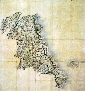
Bの添付地図(磯竹島略図)


1.10.12

1700s? - "Dong Yeo Go Sil" (東輿攷實) - Map of Uljin

The map below is a map of Uljin (蔚珍) from an atlas entitled "Dong Yeo Go Sil (東輿攷實), which is part of the Asami Collection at the University of California at Berkeley. (See HERE.) I found the atlas on the "Center for Korean Studies Materials" Web site HERE.

The interesting thing about the map is that it shows two islands east of Uljin labeled "Ulleungdo" (鬱陵島) and "Muleungdo" (武陵島), with a note saying that Muleungdo is also called "Usan" (于山). Muleungdo is drawn to the west of Ulleungdo.

The maps in this atlas are similar to those found in the "Dong Yeo Bi Go" (東輿備攷) atlas, which is believed to have been made about 1682.

Uljin (蔚珍)


Closeup of Ulleungdo (鬱陵島)


Gangwondo (江原道)


Joseon

1834 - "Cheonggu-do (靑邱圖) - Eastern Half of Ulleungdo

This is map comes from the 1834 atlas "Cheonggu-do" (靑邱圖), made by Korean geographer Kim Jong-ho (金正浩). The map shows the eastern half of Ulleungdo. Just off the east shore is a neighboring island labeled "Usan" (于山), which was the old name for Ulleungdo's neighboring island of Jukdo (竹島).

Each map page in the atlas has a ruler along the top, side, and bottom. Each segment of the ruler represents 10 ri, which was about 4 kilometers.  There are seven segments along the top of the page and ten segments along the side. Therefore Ulleungdo's neighboring island of "Usan" is shown to be about 10 ri (4 km) offshore. Today, Ulleungdo's neighboring island of Jukdo is between 2 and 4 kilometers off Ulleungdo's east shore, depending from where on the east shore you measure.

The Korean government claims that Usando (于山島 - 우산도) was the old Korean name for Liancourt Rocks (Dokdo), but this map and many others show that it was the old name for Ulleungdo's neighboring island of Jukdo, 2 kilometers off Ullleungdo's east shore.

29.9.12

Latter 1800s? - Map of Gangwon Province, Ulleungdo, and Its Neigboring Island Usando

The map to the left shows Korea's Gangwon Province and the island of Ulleungdo (鬱陵島) with its neighboring island of Usando (于山). The map is stored in the Hye-jong Museum of Korea's Gyeonghui University.

The date of the map is listed as unknown, but the map resembles other Korean maps made in the late 1800s. The shape of Ulleungdo's neighboring island of Usando, for example, is similar in shape to THIS MAP, which was made sometime between 1888 and 1895.

One of the difference between the two maps is that the 1888-1995 map shows Ulleungdo with six neighboring islands, and this map shows it with only four.

Below is the portion of the map showing Ulleungdo with its neighboring island of Usan (于山). Usando (于山島) was the old name for Ulleungdo's neighboring island of Jukdo, which is about 2 kilometers off Ulleungdo's east shore.
 
 
Notice that the shape of Ulleungdo's neighboring island of "Usan" (于山) on the above map is very similar to the shape of Ulleungdo's neighboring island of "Jukdo" (竹島) on Lee Gyu-won's 1882 survey map of Ulleungdo below. This is one reason I think the above map may have been made sometime after Lee's 1882 inspection.

23.9.12

1882 - Lee Gyu-won's Survey Map of "Outer Ulleungdo (鬱陵島外圖 - 울릉도외도)

Mr. Tanaka Kunitaka has posted a great copy of Ulleungdo Inspector Lee Gyu-won's (李奎遠) 1882 survey map of Ulleungdo entitled "Outer Ulleungdo" (鬱陵島外圖 - 울릉도외도), which shows Ulleungdo's neighboring islands,  rocky islets, and shoreline. Inspector Lee also made a separate map of "Inner Ulleungdo" (鬱陵島內圖 - 울릉도내도), which shows an interior valley labeled "Nari-dong" (羅里洞 - 나리동), also called Guk-dong (國洞 - 국동), and 14 surrounding moutain peaks that jut outward on the map, which caused some to describe the island as being pot-shaped.

Inspector Lee left on his 1882 mission expecting to find Ulleungdo with one neighboring island called "Songjukdo" (松竹島 - 송죽도), which he had heard was 1.2 to 4 km offshore. Instead, he found two neighboring islands, one named "Jukdo" (竹島 - 죽도) and the othere named "Dohang" (島項 - 도항).

Just prior to the 1882 mission both King Kojong and Inspector Lee said HERE that "Songjukdo" (松竹島 was sometimes called "Songdo" (松島 - 송도) and sometimes called "Jukdo" (竹島 - 죽도), so apparently the name "Jukdo" was being used by visitors to the island at the time. In 1870, a Japanese mission to Korea reported HERE that they had heard that Ulleungdo had a neighboring island called "Matsushima" (松島), which is the Japanese pronunciation for "Songdo." Today, Ulleungdo's neighboring island of "Jukdo" is just 2 km off Ulleungdo's east shore.

King Kojong had also asked Inspector Lee to search for a neighboring island named "Usando" (于山島 - 우산도), but Inspector Lee was unable to find an island by that name. The reason was that Usando was just another name for Ulleungdo's neighboring island of Jukdo, which Ulleungdo Inspector Bak Seok-chang labeled as "Usando" on his 1711 survey map of Ulleungdo HERE.

If you look closely at the "Outer Ulleungdo" map, you should see a faint red line that probably traced the trails taken by Lee Gyu-won as he explored the island. They show that he either entered or existed the island at four different places: "Japanese Boat Dock" (倭船艙) on the northeast, ,  "Dobang-cheong" (道方廳) on the southeast,  "Tong-gumi" (桶邱尾) on the southwest, and "Daehwangto-gumi" (大黃土邱尾) on the northwest. The "Inner Ulleungdo" map also shows a red line.

"Outer Ulleungdo" (鬱陵島外圖)


Inner Ulleungdo (鬱陵島內圖)


19.9.12

2007 Mar 19 - Dokdo Museum Director Admits Usando (于山島) on Korean Maps Ulleungdo's "Jukdo, not Dokdo"

In the March 3, 2007 article below, the online version of the Korean newspaper Daegu Ilbo reported that Dokdo Museum Director Lee Seung-jin confirmed that the island labeled "Usando" (于山島 - 우산도) on three Korean antique maps appearing in this post was Ulleungdo's neighboring island of "Jukdo" (竹島 - 죽도), which is about 2 kilometers off Ulleungdo's east shore. He added that it was not "Dokdo" (獨島 - 독도), which is about 90 kilometers to the southeast of Ulleungdo. "Dokdo" is the Korean name for Liancourt Rocks, which the Japanese refer to as "Takeshima" (竹島).

The Korean name for Ulleungdo's neighboring island of "Jukdo" (竹島) and the Japanese name for Liancourt Rocks, "Takeshima" (竹島) both use the same Chinese characters, which has caused some to confuse the Korean island of Jukdo with the Japanese island of Takeshima.

However, in spite of admitting that the Usando (于山島) on the Korean maps was Ulleungdo's neighboring island of Jukdo, the Dokdo Museum Director claimed "the Japanese were trying to cover up their forced claims" by showing closeups of the island on maps instead of the full map, which would not have shown any detail in the newspaper article. He also still claimed that Usando was one of the old Korean names for Liancourt Rocks (Dokdo), though he provided no evidence to support the claim.

The map above is Ulleungdo Inspector Bak Seok-chang's 1711 inspection map of Ulleungdo (鬱陵島圖形). The two maps below, respectively, are Kim Jong-ho's 1834 map of Ulleungdo from his atlas "Cheonggudo" (靑邱圖) and a cut-out from the Gangwon Province (江原道) map from the 1789-1795 Korean atlas  "Yeojido (輿地圖). These three maps are the maps that the head of Korea's Dokdo Museum on Ulleungdo said showed Ulleungdo's neighboring island of Jukdo (2km offshore) labeled as "Usando" (于山島 - 우산도). He added it was not "Dokdo" (獨島 - 독도), which is the Korean name for Liancourt Rocks, about 90 kilometers southeast of Ulleungdo.

The reason I am reposting this article is that the link I posted to the Korean newspaper article online is, for some reason, no longer working. Fortunately, I had saved a screenshot of it.
Dokdo Museum Head: "It's just Jukdo"
Japanese Media “Discovery of Old Map Refutes Dokdo Territorial Claims”
Japan’s Kyoto News Agency and Tottori Prefecture’s “San-in Chuo Simpo” have recently reported, “Old Korean maps have been discovered that refute Korea’s territorial claims on Dokdo.” The “San-in Chuo Simpo” reported on its Web site on the 22nd of last month that American Gerry Bevers (51), who works as an English professor at a college in Seoul and studies the Dokdo problem, had contributed old maps that refuted Korea’s territorial claims on Dokdo. 
The contributed data were pictures of three old maps of Ulleungdo that are stored in Seoul National University’s “Gyujanggak” museum. When contributing the old maps, Mr. Bevers said, “Dokdo was not written on any Korean documents or maps before the Japan government incorporated Takeshima in 1905.” He added, “The Korean side claims that the old name for Dokdo on old maps and in old documents was ‘Usanguk.’” 
Takashi Tsukamoto, advisor at Japan’s National Diet Library, claimed, “This is a new discovery that only someone living in Korea can research.” He added, “Especially, the map with the writing “haejang bamboo fields” is enough proof to show that ‘Usan’ was not Dokdo.” 
Concerning this, the Northeast Asian History Foundation submitted a statement that refuted the claims item by item. 
The Northeast Asian History Foundation said, “The contents of the maps indicated are all known by both domestic and Japanese scholars, but by saying that the date of the map is unknown and by showing only part of the maps, the Japanese side is scheming to make it seem as if the maps were newly discovered. 
Dokdo Museum Director Lee Seung-jin said, “After confirming the three old maps, it is obvious to anyone that they showed Jukdo, not Dokdo; and even in our country’s academic circles, it is judged to be Jukdo. By not showing the complete map and by showing only an enlarged section, they are trying to cover up their forced claims.” 
In our country, Dokdo has been called “Usando” (于山島, 1432) – “Sambongdo” (三峰島, 1476) – “Jasando” (子山島, 1696) – “Seokdo” (石島, Korean Imperial Edict 41), and Dokdo (獨島, 1904). 
Ulleung = Reporter Lee Jae-hun ljh@idaegu.com


18.9.12

1950 Mar 30 - "Korea's Recent Claim To The Island of Tsushima," OIR Report No. 4900

The following March 30, 1950 report entitled "Korea's Recent Claim to the Island of Tsushima" was prepared by the Division of Research for Far East in the Office of Intelligence Research (OIR) of the United States Department of State. The report essentially says that Korean post-war (WWII) claims of sovereignty over the Japanese island of Tsushima were groundless and seemed to have been based on an appeal to nationalism and anti-Japanese feeling in Korea.

The report mentions Korean President Rhee Syngman's claiming that Tsushima was originally Korean territory and that "In the heart of every Korean is a longing for the return of those islands." That emotional appeal sounds very similar to the emotional appeals many Koreans make today in regard to Liancourt Rocks (Dokdo), which Koreans also claimed after the war without providing any evidence to back up their claim.

After the war, Korea seems to have tried to take advantage of Japan's defeat by making emotional claims to Japanese territory, including Liancourt Rocks, hoping that the the United States and its allies would simply give Korea the Japanese territory it wanted without checking the facts of the claims. Well, it appears Korea misjudged the United States.

ABSTRACT  
On several occasions since the establishment of the Republic of Korea, the Koreans have indicated that they might present a claim to the Japanese island of Tsushima, apparently on the basis of the historical relationship between Korea and Tsushima. However, a note of caution in their latest statements may indicate that they have increasting doubts as to their chances of succsess and that they no longer intend to press the claim. Korea apparently held a dominant position on the island before 500 A.D., but its claim to control in subsequent periods is not supported by the facts available. On the contrary, there is little doubt that during the last 350 years Japan has exercised complete and effective control over Tsushima.  
KOREA'S RECENT CLAIM TO THE ISLAND OF TSUSHIMA

Recent Korean Statements Regarding Tsushima
 The island of Tsushima (1) has been recognized for many years by the commnity of nations as an integral part of the Japanese homeland. It was included in the territory placed under the Allied Military Occupation in 1945 instead of being detached from the Japanese Empire as conquered territory subject to future settlement at the peace conference. After the establishment of the Republic of Korea in 1948, however, Koreans began to demand Tsushima be taken from Jaapan and returned to them.
The Korean demands to date do not consitute a formal claim to sovereignty; they are, rather, declarations of future intentions and desires. The first statement on the issue was made by President RHEE Syngman on August 17, 1948, when he said, "In the heart of every Korean is a longing for the return of those islands," and indicated taht this would be the only demand for territory made by his government against Japan. The Japanese Prime Minister immediately denied the validity of any Korean claim, and heated words were exchanged by the Korean and Japanese press. The Korean demand was stated again in a petition sent to the Supreme Commander for the Allied Powers in late 1948 by the Old Men's Patriotic Association of Seoul, a minor right-wing political organization.
________________ 
  1. "The island of Tsushima" consists of (1) a single large island, about 70 miles long and 10 to 15 miles wide, that is divided into two major segments by small canals and (2) several minor islands. It is situated at the southern entrance to the Sea of Japan, approximately 27 nautical miles from the coast of Korea and 45 from Kyushu.

(Page) 2
President Rhee reiterated his demand on January 7, 1949 with the statement, "Tsushima was not robbed by Japan in the past forty year, but nevertheless the island originally belongs to our country and its return should be demanded. (1) The question was taken up by the National Assembly on March 22, when Assemblyman YI Kunwon introduced a resolution calling for the return of Tsushima to Korea. The motion was shelved after a brief examination by a subcommittee. When Rhee was questioned in a press conference on December 30, 1949 as to the advisability of sending "a research group" to the island, "in order to certify historically that Tshusimaa [cic] island belongs to the Republic of Korea," he replied that this was a problem for the Japanese peace conference and that premature discussion of it might prejudice Korean relations with other countries. (2)

While many Koreans may be convinced of the validity of the claim, it is obvious that the government's demands and popular support for them have not been based on a rational, legal analysis of the issue. The demands appear to be both a reflection of and calculated appeal to the nationalism and the anti-Japanese feelings that prevail throughout the Republic. They may also represent an attempt by the government to extract some small concessions from the Allied Powers. Public reaction to these demands has been generally favorable, but there has been some open ridicule of them and there has been little natural interest in or support of them except from such small segment of the population as the
_____________________ 
  1. RBIS, Daily Report (For Eastern Section, 5, January 12 1949, p. 444 - 7, UNCLASSIFIED.
  2. A-463, Seoul, December 31, 1949, RESTRICTED.

(Page) 3 
nationalist historicans. The lack of extensive public interest and a more dispassionate analysis by the government of its chances for success probably account for the prolonged silence following the first show of interest. The President's cautious statement of December 30, 1949, to the effect that pressing the claim could produce a conflict of interests with other nations, appear to indicate that the government has made a rational reaappraisal of its entire position in the matter. The American Embassy in Seoul is of the opinion that the government now realizes the inability of proving its case and will no longer press the claim. (1)
TSUSHIMA'S PAST RELATIONS WITH KOREA AND JAPAN (2)
The Korean demands for Tsushima have been based on the assumption that  Korea exercised genuine control over the island at some time in the past. Thus far, however, no attempts have been made to define the period of control and no reasons have been advanced for the loss of the island.
There are several important qualifications to be taken into consideration in any discussion of the evidence on the questioni of Korea's relations with Tsushima. First, the information available is far from complete, except for the most recent periods. (3) Second, it is difficult to define these relationships precisely in Western political
______________________
  1. D-93, Seoul, January 25, 1950, RESTRICTED.
  2. See appended historical bibliography.
  3. Almost no original source material is available. The sources that are available are vaue, confusing, and limited in scope; there are notable discrepancies in the reporting of alleged facts. Much more American and Japanese source material is available than Korean, and as a consequence the Korean position may be underestimated. 
(Page) 4
terminology because of the difference between Western and Oriental theories of interstate and inter-area relations. For example, under Korean Confucian and Japanese concepts of control several nations migh possess approximately similar political rights within the same area; such concepts obviously cannot be described by use of such Western terms as "dependence," "independence," "sovereignty," or "suserainty." However, despite these confusing factors, it is possible to make a reasonally accurate comparison of the relative degrees of Korean and Japanese control on the island. 
Korean realtions with Tsushima have varied significantly in the past and can best be discussed in terms of four historical periods. The earliest of these periods is the era of the Korean kingdom of Silla's predominence on the island, which ended c. 500 A.D. The period extends to 1592, when Japan launched the first of a series of major invasions against Korea from Tsushima. The extends to 1855, the date of teh Meiji Restoration in Japan. The fourth and final period includes the years from 1868 to the present.

Most sources agree that in the first period the Korean kingdom of Silla (1) governed the island for a long but indefinite period of time. There is also some evidence that Silla's control was terminated by the Japanese seizure of the island in approximately 500 A.D. 
 There is no such unanimity of opinion as to the relationship between the island and the Korean peninsula during the years from c. 500 to 1592. Some of he texts allege that
______________________
  1. An ancient state whose lands now consitute the southeast territory of the Republic.

(Page) 5

Korean influence was still paramount; references are made to the investiture of the rulers of Tsushima with titles and seals by the King of Korea, and it is claimed that the King of Korea paid subsidies to the island lord, who, in return, paid tribute and homage to Korea. However, the great number of invasions of the island by Korea during this period casts some doubt on Korea's ability to maintain control there for any appreciable length of time, even at the cost of war. Similar allegations of paramountcy are made on behalf of Japan in other works. However, the role claimed for Japan required greater activity on its part and a greater degree of control over island affairs, and this evidence accords better with the known facts of Tsushima history. The very fact that the Japanese invasion of Korea in 1592 was launced in part from the island presupposes effective Japanese control. 
For the period from 1592 to 1668 there is very little specific evidence that Korea exercised any control on the island. Even the texts that affirm belief in the existence of Korean rights of overlordship offer little information to prove that these rights were ever exercised in open and direct interention in island affairs. On the other hand, there is considerable evidence that Japanese control was complete and open and that it was peaceful, i.e., that both Korea and Tsushima acquiesced in, and willingly acknowledged, this state of affairs and no other nation challenged it. Japan appears to have been the de facto ruling power at this time.

There is no question of Tsushima's status as a dependency of Japan after 1668.
 
(Page) 6

The Japanese reorganization of the government of Tsushima following the Meiji Restoration antagonized the Koreans, but they could only express disapproval of it. No other nation has sought to challengde Japan's control since 1668. 
Therefore, from the information available, Korea's claim does not appear to be well-founded. Although Korea apparentlyy held a dominant position on the island before 500 A.D., its claim to control in subsequent periods is not supported by the facts available. On the contrary, there is little doubt that during at least 350 years Japan has exercised complete and effective control of Tsushima.