Below is a translation of The 11th column “Seeking Truth Based Solely on Facts(実事求是)” by Prof. Shimojo Masao
" South Korea's Misunderstanding of 'A Map of Three Adjoining Countries (Sangoku Setsujozu 三国接壌図)' by Hayashi Shihei(林子平)”"Chosun Ilbo" dated May 2 introduced the thesis by Hosaka Yuji of the Yonsei University, and reported "Edo Shogunate of Japan used the map which "depicted Dokdo as Korean territory" during the territorial dispute between America." According to the report, Mr. Hosaka claimed that when Edo Shogunate disputed over the sovereignty of Ogasawara Islands(小笠原諸島), which include Bonin Islands(無人島 : 小笠原群島), Shogunate used French version of “Sangoku Setsujozu” as a basis for its' sovereignty. And he continued that this makes Hayashi's map, which "depicted Takeshima as Choson's territory" an official map, thus it is considered that Bakuhu then already recognized Takeshima as Choson's territory in 19C.
However, there is no historical grounds in Mr. Hosaka's claim. In November 1861, Edo Shogunate notified to each minister of both U.S. and Britain in Japan that that foreign magistrate (外国奉行) Mizuno Chikugonokami Tadanori (水野筑後守忠徳) and superintendent (目付) Hattori Munekazu ( 服部帰一) would head to investigate Ogasawara island. But in his reply letter, Harris, a U.S. minister to Japan, stated Ogasawara island as Japanese territory and only requested Shogunate of the rights of the American who reside on the island. Apparently, there were no such things as "territorial dispute between America". Because Ogasawara island(小笠原島) was widely recognized as Japanese territory among foreign countries, as is seen in the Mizuno's letter "The letter of the planned expedition to the islands of Izu Country on behalf of Shogunate"("伊豆国附島々其外へ御用のため差遣され候につき見込の趣申上候書付")" in October, which was submitted to Bakuhu. It said that "As for Ogasawara island(s), Dutch and other countries' books state that it is Japanese island. Foreigners certainly recognize this. (小笠原島の儀、御国属島の儀と蘭書等にも相見へ、外国人ども弁知罷り在り候)"
It is also confirmed by Commodore Perry's "The Japan Expedition, 1852-1854 The Personal Journal of Commodore Matthew C. Perry." or "Narrative of the Expendition of an Squadron to the China Seas and Japan (1856)". In the book, Commodore Perry quoted translated version of Hayashi's “Sangoku Tsuran Zusetsu (三国通覧図説) ” and clearly stated that "It is quite clear that the Japanese were the first discoverers of these islands." Hosaka's claim that "Edo Bakuhu(Shogunate) used French version of “Sangoku Setsujozu” as a basis for sovereignty over Ogasawara Islands" is apparently nothing but just a fictitious story, or fantasy.
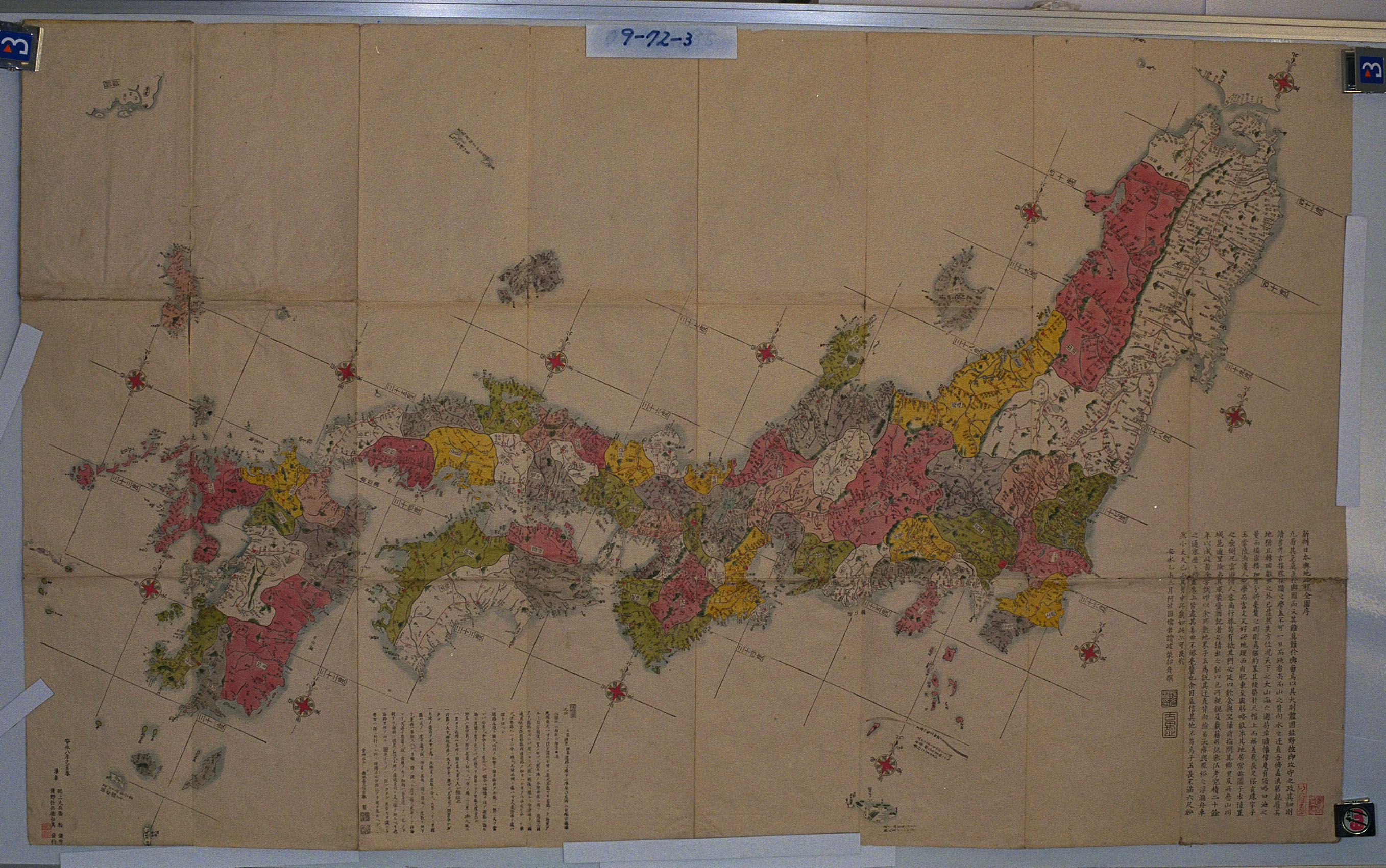
Likewise, his claim “ 'Sangoku Setsujozu' depicted Takeshima as Choson's territory" is groundless from the view of historical facts, since there is no Takeshima/Liancourt Rocks depicted on the map. Hosaka interpreted Ulleundo and Takeshima were recognized as Choson territory, since there is a notation "Choson's land (朝鮮ノ持也)" near "Takeshima(today's Ulleungdo)" depicted in Hayashi's map. However, "Takeshima(Ulleungdo)" on the map has another notation, in fact. "From this island Onshu(Oki) can be viewed/Choson can be viewed too. (此嶋ヨリ隠州ヲ望/朝鮮ヲモ見ル)." This sentence was derived from "Whole Map of Japan (日本輿地路程全図)" by Nagakubo Sekisui(長久保赤水), which Hayashi mainly used when he made the map.
Moreover, the sentence itself is actually the quotation from Saito Hosen's "Onshu Shicho Goki (隠州視聴合記)". The reason Hayashi annotated "Choson's land" afresh is because "Whole Map of Japan (日本輿地路程全図)" described Ulleungdo as Japanese territory and the a subject of the context of annotation was Ulleungdo alone. Moreover, if you compare “Sangoku Setsujozu” with "Whole Map of Japan (日本輿地路程全図)" by Nagakubo Sekisui(長久保赤水), Hayashi's map actually lacks today's Takeshima. That is because not all of islands and places in "Whole Map of Japan (日本輿地路程全図)" were copied into “Sangoku Setsujozu” as Hayashi clearly stated as follows. " I didn't enumerate all shapes of subjects(全形を挙げず)". Despite those facts, Hosaka still intentionally misreads a tiny island upper right of Ulleundo as today's Takeshima at his own discretion without criticizing documents logically, nor on the basis of historical documented facts.
Actually, Ulleungdo in Hayashi's map has its roots in 朴錫昌's 「欝陵島図形」(1711) and it is appropriate to consider it as Jukdo, not today's Takeshima/Liancourt Rocks/Dokdo. Despite those facts, Hosaka claims that Hayashi's map depicted "Takeshima" as Choson's territory and criticises the final report by Shimane's Takeshima Research Group, but those Hosaka's claim are apparently misdirected.
Mr. 金和経, a director of Dokdo Institute of 領南 University, commented, on this Hosaka's thesis, that "“Sangoku Setsujozu” was used as a official document in the bilateral territorial dispute" and it "has important meaning as a historical document." However, this comment is a reckless remark(妄言) which follows blindly claims by Hosaka who neglected criticizing historical documents properly.

p 198 "Extract from Klaproth's translation of San Kokp Tsoir Ran To Sits(三国通覧図説)."
“実事求是 〜日韓のトゲ、竹島問題を考える〜 第11回 「林子平の「三国接壌図」に対する韓国側の誤解」 下條正男”
Courtesy of Web Takeshima Research Center.
Other Column of the Series:
The 22th column “ Refutation against "The Meiji Government's recognition of Takeshima=Dokdo" by Mr. Park Byeong-seop(朴炳渉)””, Part 1, Part 2, Part 3, Part 4
The 21st column " Refutation against "Analysis of Shimojo Masao's Editorials" by Mr. Park Byeong-seop(朴炳渉)”
The 20th column “Act of Folly by "Northeast Asian History Foundation"”
The 16th column ""Dokdo Month" without any historical grounds."
The 15th column " South Korea's Groundless Claim of "Inherent Part of (Korean) Territory"
The 12th column “Northeast Asian History Foundation and Dokdo Research Center's Misunderstanding”
The 10th column " A Blunder of Sokdo(石島) = Dokto(独島) Theory”
The 9th column "Criticism on Dokdo Research Center”
The 8th column “The Historical Facts" The 6th column “Onshu-shicho-goki (隠州視聴合記)" and the "Nihon Yochi Totei Zenzu (日本輿地路程全図)" by Nagakubo Sekisui(長久保赤水)"The 5th column “South Korea’s erroneous interpretation of the document 'Takeshima and Another Island are Unrelated to Japan"
The 4th column “Errors in Educational Video Produced by the Northeast Asian History Foundation (東北アジア歴史財団)."
Kaneganese,
ReplyDeleteThanks for the post!
In my opinion, a Japanese like Prof.Hosaka is an obstacle to true friendship between Korea and Japan. It seems that he is always agitating Korean people to attack Japan.
BTW, I think 水野筑後守 should be Mizuno Chikugonokami, not chikugonomori.
金玉均 was made to stay in Ogasawara Islands for a while (1886-1888) when Korean government demanded him to be sent back to Korea for treason, before he was allowed again to come back to Tokyo by Japanese government. A few years later, he was assacinated in Shanghai in 1894. 閔妃 made his remains asunder, and the body is thrown away to the river, and the neck was sent and exposed in 京畿道, one of hands and feet in 慶尚道 and other hand and feet in 咸鏡道, in public respectively.
ReplyDeleteThank you, pacifist
ReplyDelete"BTW, I think 水野筑後守 should be Mizuno Chikugonokami, not chikugonomori."
I'll correct it right away. If you find more mistake, pleas let me know.
I think those hidden stories are really facinating and Prof. Shimojo is doing good job.
What a pile of garbage.
ReplyDeleteIs Projo trying to tell us that Hayashi Shihei drew Jukdo Islet on a map of East Asia.
How stupid does this guy think we are?
The Japanese government didn't even know Jukdo Islet existed until their navy surveyed Ulleungdo at least a century later.
Professor Shimojo must be pulling our leg on this one!!
Hey dokdo-takeshima.com!
ReplyDeleteI'm still waiting for a pre-1905 Korean map from you.
As for Prof. Hosaka, I saw him speaking in a Korean TV program,
I didn't know that he is a Japanese.
Hey Raquel.
ReplyDeleteEveryone was wondering which program you were registered at and maybe I could contact your school and help with your research.
Please tell us more about yourself!!
Hey dokdo-takeshima.com,
ReplyDeleteYou can help me here.
Please show me a pre-1905 Korean map which shows that Korea indeed controlled the Islets.
Thank you.
No, really Raquel, I insist if you are going to e-mail at my home e-mail address that you should tell us more about yourself.
ReplyDeleteYou said you were registered at a college in Cincinnati wasn't it Raquel?
Please tell us all which campus you attend, which program, your instructor. We all dying to hear!!
Talk you soon Raquel. Don't be so shy!! I mean, you aren't a phony are you??
Hey dokdo-takeshima.com,
ReplyDeleteYou are funny. You want to contact my school before you will be able to show me a map of the pre-1905 Korea made by Korea?
You are just evading my request. Is it so difficult to come up with a map as such?
Hi, raquel
ReplyDeleteThank you for your comment. We've studied numerous Korean maps, but there is no single of them which shows Takeshima/Dokdo was Korean territory. Moreover, we've noticed that so far, there is no western map which depict the island Korean territory either before 1905, as pacifist has been trying to show us recently.
As for Hayashi Shihei, I think I'm going to study more about him in the future, but this is a brief history of him. It is really stupid for Korean to claim the sovereignty based on Hayashi's map. Though I really like a person like him, but I had to say that he was nothing but just a ariminal for Edo Bakuhu and had no authority of official map making.
ReplyDeleteHayashi Shihei (林子平 : 1738-1793) was a former Samurai, who was expelled from Sendai clan(仙台藩) and travelled on foot all over Japan. He was one of the "Three Eccentrics (Sankijin) of the Kansei era(寛政の三奇人)". He did not work under the feudal lord (daimyo), but, by wondering various places, deepened the thought of the ieal political system of Japan. He published the Sangoku setsujozu ("A Map of Three Adjoining Countries"), a map attached to the Sangoku tsuran zusetsu ("An Illustrated General Survey of Three Countries (三国通覧図説)") in 1785. However, the discontinuation was ordered to Hayashi 's books in 1792 (寛政4年), six years after it was published. In the decision sentence by the shogunate for the prohibition of the publish or sale of Hayashi's "Sangoku tsuran zusetsu", the reason was clearly written that "地理相違之絵図相添書写又は板行に致し(He had drawn the geographically inaccurate illustrative maps on the paper attached or the carved on the board)". Not only Hayashi, but also publisher Suharaya Ichibee(須原屋市兵衛) and even four officers who examined his map became objects for the punishment. Finally, he was forced to come back to stay with his brother and sentenced to imprisonment until he died. He called himself as "A man who lacks 6 things (六無斎)" No parents, wife, kids, printing plates nor money, but no wish to die eighter. (「親も無し 妻無し子無し版木無し 金も無けれど死にたくも無し」)...
Raquel,
ReplyDeleteKorea claims that "Dokdo" (Liancourt Rocks) has been Korean territory for almost 1,400 years, but she does not have even one map to support her claim. Also, there are no Korean documents that show Koreans even visited Liancourt Rocks before the Japanese took them there in the early 1900s. So that is the reason Steve is avoiding your question.
I do not know how much you know about Steve Barber (Dokdo-Takeshima), but he used to post under multiply IDs until he was discovered. If I were you, I would not take him very seriously, and I woud definitely not give him any personal information.
Kaneganese,
ReplyDeleteGood job. We need to write about Hayashi Shihei as long as people like Steve always show the map insisting "Japan admitted Dokdo to be Korean territory", don't we?
But Steve, there was not an island called Dokdo in those days - the name of Dokdo was created in the early 20th century. Until then, there was no name for the island in Korea, which may mean they didn't know about the island.
kaneganese and Gerry,
ReplyDeleteThank you for your comments and advice.
I see that the Koreans have nothing concrete to say about their claim on the Rocks except shouting "Tokto Neun Woori Ttang!".
I have a feeling that "Gwaneumdo" is a mere translation of the Japanese name "Kanonjima" or "Kanonto" originally used by the Japanese and that the Koreans conveniently adapted the name to hide "Seokdo" behind it.
This is my wild thought, but hard to think otherwise because I see no
logical reason for the Confucius Korea to adapt a Buddhist term "Gwaneum" for a rock name.
And, I already imagine that the Koreans will say that most of the Ulleungdo residents of that time were Buddhist. :-)
No Raquel (san) all I'm requesting is that before you contact me personally on my e-mail account, you should be an honest person. Is this too much? If you really are an American student who is attending a school in Cincinnati? Please let us know which campus you attend, your major, and program. I really don't know what the big secret is.
ReplyDeleteBTW, Raquel you really should be careful on the usage of your articles. It's surprising how even today's American university students have trouble with their English articles, right Raquel (san)??.....wink, wink.
Kaneganese, if you read Professor Shimojo's theory he states:
"Actually, Ulleungdo in Hayashi's map has its roots in 朴錫昌's 「欝陵島図形」(1711) and it is appropriate to consider it as Jukdo, not today's Takeshima/Liancourt Rocks/Dokdo."
Seriously, how does Professor Shimojo draw the connection between a Chosun map done from a Korean survey in 1711 to a Japanese map drawn in 1785?
Hey dokdo-takeshima.com,
ReplyDeleteWhy don't you just say here that you don't have a map to support the Korean claim instead of indulging my personal things?
With your peculiar behaviour, you are hurting Korea's credibility as well.
Raquel, it nothing to do with your indulgence. Believe me. I really have zero interest in Japanese lobbyists. Keep posting "Raquel Fernandez" (San).
ReplyDeleteAs for Korean cognizence of Dokdo before 1905. Maps aren't really necessary. The Japanese Black Dragon Fishing Guide proves Koreans were well aware of Liancourt Rocks in the year 1900.
KoreanCognizanceConfirmed
So really the source of the data is moot. We can 100% verify Koreans were cognizant of the islets at the time of Ordinance 41 in 1900. Japanese can no longer say the Koreans were unaware of Liancourt Rocks in 1900.
What time is it Cincinnati "Raquel" (san)?? It appears you have been up all night!! You must be exhausted! Ha ha ha.......
Steve,
ReplyDeleteThe document you introduced says "Both of Koreans and Japanese call this island as Yanko". And "Yanko" or "Ryanko" is a Japanese name for Liancourt Rocks.
The document didn't say Dokdo.
How do you insist that Koreans knew the island before Japanese did while Koreans who were hired by Japanese called the island as Japanese called?
It has been said that Japanese fishermen from Oki islands began sealion hunting in the 1880's or 1890's before Nakai began the hunting as a big buisiness.
You should show the evidence that Koreans knew the island, used it or owned it before Japanese did. I have been asking you to bring the evidence but you always run away.
Hey dokdo-takeshima.com,
ReplyDeleteHave you heard of a semester break? I'm in Korea now and doing my research on the dispute. Besides, I only said I'm from Cincinnati in my e-mail. Did I say I'm an American? For your information, not a Japanese either.
Anyway, I see that you again came up with a Japanese document.
According to my Korean friend from Japan, the islets were called "Yanko", which is the Japanese name for the Liancourt Rocks. If the Koreans were calling it in the Japanese way, you again proved that you're really good at shooting in your own foot. :-)
Paficist, the Koreans were aware of the islands well before the Japanese Imperial Navy annexed Liancourt Rocks. That's good enough to dispute Japan's claim the island was completely ownerless.
ReplyDeleteSo what if the Koreans were using the name Yanko before 1905, they were also using the name Dokdo as the Niitaka's logbooks record. Why shouldn't the Koreans have called the islands Seokdo in 1900 for the first time? Show me a Japanese record that uses the name Takeshima before 1905.
There is no reason for us to draw the territorial limit between Japan and Korea between Ulluengdo and Dokdo in the year 2008. It didn't really matter much in 1905 because Japan had already controlled much of Korea by this time anyway. In fact Pacifist, there really was no boundary between Korean and Japan at all by February 23 1905 when Japan took the islands.
So to think Japan should extend her territorial limit around 170kms Westward to within visual proximity of Chosun land since the 6th Century is ridiculous Pacifist. You are absolutely off of your rocker if you think this will ever happen.
See this statue Pacifist? This statue is from Korea's Unified Shilla Dynasty found on Korea's Ulleungdo Island. This statue was made by Koreans living within visual proximity of Dokdo hundreds of years before Japanese pirates robbed and harassed the Koreans living on Ulleungdo. It was made at least 500 years before the first dizzy Japanese sailor washed on the beach of Ulleungdo in a storm by accident.
UlleungdoShilla1
Korea's ancient people were gazing at Dokdo before the Japanese had even adopted Buddhism.
UlleungdoShilla2
UlleungdoShilla3
Historically Japan had zero business being in the Ulleungdo-Dokdo region.
That is why the Shogunate confirmed Takeshima (Ulleungdo) and Matsushima (Dokdo) were not part of Japan in 1695.
DottoriDocuments
That is why this was again confirmed in 1836 after the Takeshima trespass incident.
TakeshimaIncident
Pacifist, respect the just and fair decisions of the Japanese Shogunate. Not the greedy expansionist land grabbers of the colonial Imperialist Japanese government.
Raquel, Korean or Japanese the document shows Korean cognizance of the island. Read the above documents and see the Japanese did not consider the islands as theirs until the expansionist Meiji Era began to colonize northeast asia.
Hey dokdo-takeshima.com,
ReplyDeleteYou better come up with a Silla map with Dokdo in it before 2012 which, according to Korea, marks the 1,500 years of Dokdo under the
Korean control. :-)
Raquel. (or whoever)
ReplyDeleteJapan better come up with a reason why we should redraw the boundary of Japan and Korea back to the colonial era. You see this is why Japan is doomed to fail in their lobbying attempt for Takeshima.
Historical issues aside. No matter how they Japanese blubber about the past, the Japanese cannot find a single reason why we should draw the today's Japan-Korea border between Ulleungdo and Dokdo.
Geographically it doesn't make sense when we consider Ulleungdo's proximity. So Japan loses on this point.
Under international law of today. Ulleungdo is habitable and capable of generating a 200 mile EEZ. This is a law that Japan follows religiously with regard to all islands in the sea. So an equidistant line between Ulleungdo and Japan's Oki Islands is a fair, modern legal principle that still puts Dokdo under Korean jurisdiction.
Politically, economically and from a standpoint of demographics in the Dokdo region the circumstances aren't even remotely similar between 1905 and 2008 so again Japan cannot provide any logic within today's modern concept of territorial law.
dokdo-takeshima.com,
ReplyDeleteAfter almost 1,400 years, doesn't it occur to you that it is extremely unusual, in the history of the world, that there had not been before 1905 even a single map by Korea with Dokdo in it? :-)
Raquel,(whoever) isn't it unusual with all of the Japanese maps of Dokdo that they either show the islets as Korean or as not part of Japan?
ReplyDeleteI've given you historical references that prove first Japanese considered the islets Korean in 1836 and second they explicitly excluded the islets from Japanese territory in 1695.
On top of that here are at least 60 plus maps that show Japan consistently excluded the islands form their territory this despite the fact they showed tiny remote islands such as the Pescadores and the Ryukyus........but no Dokdo
NoJapaneseDokdo1
NoJapaneseDokdo2
NoJapaneseDokdo3
NoJapaneseDokdo4
Even these maps books included Takeshima and Matsushima on the overall map but neither island was considered part of Japan.
NoJapaneseDokdo1
NoJapaneseDokdo1
These Japanese maps showed the islands as Korean.
KoreanDokdo1
KoreanDokdo2
Don't forget Korea's Anyongbok clearly stated that 竹島 (Takeshima-Ulleungdo) and 松島 (Matsushima-Dokdo) were part of Korea's Gangwando 江原道 Province in 1696. The Japanese raised no objection to these assertions in their following correspondence to Korea.
Please read.
AnyongbokDoc
I hope this helps your erm..."research" :-(
Steve,
ReplyDelete"Paficist, the Koreans were aware of the islands well before the Japanese Imperial Navy annexed Liancourt Rocks".
- So I have been asking you to bring the evidence of your insistency, but you couldn't bring it. Show the evidence.
"Show me a Japanese record that uses the name Takeshima before 1905".
- Are you joking? Japan named it Takeshima in 1905, so there is no record of such.
The island was called as Matsushima in the Edo period and then Yanko or Ryanko or Horunetto island or Riyankorudo island, and after that it was renamed as Takeshima in 1905. But Korea didn't have a name for it until 20th century.
I won't answer to all of your stupid insistency but I'm surprised that you still show those maps and even the statue....do you really think the statue to be an evidence to show that Koreans knew Liancourt Rocks? Good laugh.
And I'm surprised again to know that you still can't read the longitude in maps - Takeshima and Matsushima in Mori Kinseki's map are Argonaut and Dagelet islands Steve, you should learn geography - this is serious advice for you, Steve.
dokdo-takeshima.com,
ReplyDeleteYou tend to show the old Japanese maps to back the imaginary Korean claim on the Rocks, but anything before 1905 doesn't really count under the international law.
What does count is the Japanese government claim of the Rocks as a "terra nullius" in 1905.
And, so far, Korea has not been able to prove to the world that the Rocks was not a terra nullius before 1905.
Terra nullius!!
ReplyDeleteDon't make me laugh. This colonial relic wasn't even legally codified until the 1970s. It was the same legal rubbish the Europeans used to colonize the Americas, Africa, Souteast Asia and Australia. Terra nullius means squat in 2008.
Terra nullius is old school. These days the Western world is citing terms like uti possidetis. In layman's terms, other parts of the world national boundaries are being redrawn back to the boundaries before the former colonial powers seized these lands from those deemed "unenlightened" The difference is, the nese have failed to accept the wrongdoings of their colonial past and still desperately cling to the hope they can grab these lands again.
Fat chance....
Japan is still not an open developed country with regard to educating their children about Japan's colonial, expansionist past while the West has accepted this, given back some land and compensated these people. Is the West perfect? No but they are ahead of Japan by leaps and bounds in this regard.
Colonial law is dead and Japan's colonial annexation of Takeshima died with it. Do you get it?
Pacifist, what's the matter with the "stupid statue" Does it bother you to see the Koreans were living on Dokdo's most proximal land, (within visual distance of Dokdo) a full millenium before grubby Japanese pirates, trespassers and squatters drove them off of Ulleungdo? You see the Japanese were newcomers to the region and Koreans have ancient records there.
It's not just a statue Pacifist. Archeologists have found dozens of cites on Ulleungdo from ancient Koreans burial tombs. These are located in Cheonbu, Jeodong, Sadong, Namyang, Hyeonpo and Taeha Ri.
You can see the ancient Koreans were living next to Dokdo long before the Japanese invaded the region. Korea's claim the region blows Japan's away, hands down. Here they have found ancient Shilla tombs in many locations of Ullengdo.
UlleungShillaTomb1
UlleungShillaTomb1
Even the remnants of Shilla Dynasty crowns were found on Ulleungdo. Korean's lived on Ulleungdo for at least 1000 years before Japanese showed up in the region and yet Japanese insist Koreans didn't even know Dokdo existed. What a pile of rubbish!!
UlleungShillaCrown1
UlleungShillaCrown2
Here is an ancient necklace found on Korea's Ulleungdo, Dokdo's most proximal island.
UlleungShillaNecklace
There are many other archeological evidences of Koreans in the region long before the Japanese arrived. For example here is some ancient pottery.
UlleungShillaPottery1
UlleungShillaPottery2
Ancient Shilla Gilded bronze from Ulleungdo
UlleungBronzeAge
Japan wants to extend her boundary 170kms!! To within a few dozen kilometers of an island of Korea's since ancient times? Get lost Japan. You already claim 400,000 sqare kilometers around Marcus Island. You already declare a huge EEZ around the Okinotoroshimas, two rocks the size of a bedroom.
Shame on you greedy Japan.......
Hey dokdo-takeshima.com,
ReplyDeleteTalking of the Japanese presences throughout the history of the Korean peninsula, are you aware of the archaeological finding that the Japanese-style keyhole-shaped tombs from 5th century were found in the Yeongsangan area in Jeolla?
You claim that the old tombs found on Ulleungdo are definitely Korean, but who knows? They might belong to someone else. I dare not say they belong to Japanese at this point, though. :-)
Steve,
ReplyDeleteDon't be childish.
The statue may mean that there were some people in Ulleungdo many years ago and the people may have been Koreans (but still there would be a possibility that they were non-Koreans people). That's all.
It is not an evidence to show Koreans knew Liancourt Rocks - Liancourt Rocks are 92 km away - one day voyage from Ulleungdo, which was dangerous voyage in the ancient times.
The current is going from west to east so that their safe return won't be certain even if they could sail to the east. Actually, the envoy from Korea in the Edo period came to Japan through Tsushima, then sail through Kyushu and Setonaikai (Inland Sea of Seto) along the coast to avoid dangers. They didn't challenge ocean navigations.
And one more thing, Steve, concerning terra nullius. Japan could confirm that the rocks didn't belong to any countries (terra nullius) so that the world recognised the incorporation in 1905 was legal under the international law.
But the occupation by Korea in the 1950's was not. Liancourt Rocks were not terra nullius in the 1950's - so USA advised Korea to give it up.
Pacifist, Chosun records clearly state the (Usanguk) Ulleungdo became part of Unified Shilla and began paying tributes in the year 512. This is historical fact.
ReplyDeleteUlleungdoShilla
Raquel (whoever) as I've shown numerous Chosun records record Ulleungdo's incorporation into Korea hundreds of years before Japan showed up. I posted the artifacts for visual reference rather than just posting documents all of the time.
The remains found on Ulleungdo were more than just ramdom articles. There are fragments of bronze Shilla crowns from the Unified Shilla Era. So these were Koreans anyone who says otherwise is full of B.S.
Pacifist, the Japanese military annexation of Liancourt Rocks was not legal in many ways.
First, it was not open and public. Putting a two-inch tiny ad in a local newspaper is not public enough to be considered an announcement in the forum of international politics. This was exactly was Japan did in when they claimed Marcus Island. This inadequate announcement resulted in the Marcus Island dispute between the U.S. and Japan in the early 1900s. Komura Jutaro knew very well putting this tiny ad wouldn't attract the attention of any other interested sovereigns. He was the same minister who oversaw the Liancourt Rocks annexation yet he did nothing to change this procedure. In short, not open and public.
MarcusIslandFiasco
Next, Japan's annexation of Liancourt Rock was not a natural peaceful process as ICJ Judge Max Huber said territorial land claims should be. Japan's Navy annexed Liancourt Rocks for the explicit purpose of installing naval watch towers in her bid to colonize Korea during the Japanese Russian War of 1904 1905.
Japan'sMilitaryOnDokdo
Yamaza Enjiro clearly stated "..it is absolutely necessary and advisable to construct watchtowers and install wireless or submarine cable and keep watch on the hostile warships..." So we know Japan's annexation of Liancourt Rocks was neither natural of peaceful.
Third we know Japan's annexation Liancourt Rocks was seriously flawed from a geographical standpoint. Japan's Director of the Hydrographics Dept simply took a baseline measurement from both Japan and Korea and concluded because Liancourt Rocks was marginally closer to Japan there was no reason they island couldn't be Japanese. Absolutely no consideration was given to Chosun's Ulleungdo Island. This is not how we define international boundaries in the modern world. Under today's modern law of EEZ both countries are entitled to ocean waters. In 1905 Japan had unimpeded access to Ulleungdo and Chosun fishing waters. Today Korea is free and independent.
PoliticsOfExpansionism
Using the historical backdrop of 1905 as a basis for defining Japan and Korea's martime limits in 2008 is a ridiculous premise Pacifist. Give it a rest.
Korea was a free country in 1950 Pacifist. Under international law Japan could not exercise even a minimum amount of sovereignty over Liancourt Rocks. Korea was not signatory to, and thus not subject to the Japan Peace Treaty in any way shape or form. She claimed Liancourt Rocks and drew the Peace Line to keep away the Japanese who had been invading Chosun's waters for over 500 years. President Rhee's Peace Line is no different than the boundaries proposed by the British, New Zealand or SCAP.
JapanPeaceTreaty
Just because Korea didn't bow to United States secret memorandums that favoured Japan's claim to Takeshima doesn't make the Koreans a rogue state.
Steve,
ReplyDelete"Pacifist, Chosun records clearly state the (Usanguk) Ulleungdo became part of Unified Shilla and began paying tributes in the year 512".
I don't refute about the presence of Koreans in the ancient times. Don't misunderstand me, I am saying that there is no evidence they knew Liancourt Rocks in those days.
And after that period, there was an empty island policy for many years - actually they practically abandoned the island in fear of being attacked by pirates called Wako.
During the period Ulleungdo was not controlled by Korea.
So Japanese fishermen reached the island and engaged in fishery until the dispute began.
From the viewpoint today, as long as Korea had once abandoned to control the island, it was not easy to say it belonged to Korea. But anyway, the shogunate gave up the island in order to keep good relationship with Korea.
So it was not a problem. I don't say it didn't belong to Korea.
But think it again, Ulleungdo had been out of control of Korea for many years - the Sea of Japan was literally controlled by Japanese ships including fishing boats, pirate ships, merchnats' ships etc. So there should have been few chance for Koreans to sail for east - there should be few chance for them to find Liancourt Rocks. So if you really believe that they knew it, you should bring the evidence.
"Pacifist, the Japanese military annexation of Liancourt Rocks was not legal in many ways".
- I repeat again, Japan did not annex it but incorporated it. And it was done peacefully, not with military power.
Yamaza Enjiro was an elite officer in MOFA but he was not from navy or army. He had an opinion that Japan should fight against Russia but it was not for military reason, it was to protect Japan. He was a patriot.
If Yamaza said that Japan needed watchtower at Liancourt Rocks, why do you think it was a "military" incorporation?
Japan already installed watchtowers in many places including Korean islands (including Ulleungdo) so it was not necessary to incorporate islands into Japan in order to install watchtowers.
Additionally, Yamaza died at 39 years old in China when he was working hard to settle down the opposition of Yuan Shikai's government and south party of Sun Yat-sen (孫文), so rumour said that he was assasinated by Yuan Shikai (he died of angina actually though). Yamaza was an expert of China, he once helped Sun Yat-sen when he had to go out of Japan. So his policy was not always with army or navy, the policy of MOFA was independent.
BTW, Yamaza's working place before China was London. He was to ride the Titanic - he reserved a seat of the ship to come back to Japan via USA. But because of some reason he changed his ship to another one so he was safe, but this was another story.
There were many young followers to Yamaza in MOFA, he was a mentor to Hirota Kouki who became a prime minister later years. Hirota desperately fought against military power (especially against army) but he couldn't stop the army - so he was excuted after the Tokyo trial without any explanation (he refused to employ a lawyer). He was the only one civil servant who was excuted.
Steve,
ReplyDelete"First, it was not open and public".
Not open even if newspapers reported it? Then Steve, how do you think the 1900 Edict #41?
You still believe that Seokdo is Liancourt Rocks, don't you? If so, they should have confirmed that the island was not discovered by any other country, not controlled by any other country and then they should declared it - but Korean Edict was not advertised widely it was a inner edict, not to outer world. It was completely closed, not open like Japan's newspaper articles. Why don't you accuse this? If you believe that Seokdo was Liancourt Rocks, you should.
Pacifist, Yamaza Enjiro was errand boy for the Gen-yo-sha or the Black Ocean Society this means he was the colonialists version of a Yakuza. Yamaza Enjiro was working for right wing expansionists opening up China for Japanese interests. He was basically a gangster and a spy.
ReplyDeleteMy point is with Ulleungdo, Korea has the far stronger title to region as a whole Pacifist and anyone in their right mind would concede ancient Koreans would have been cognizant of Dokdo after living there for 1000 years. However cloudy the past, knowing Korea has the hands down superior title to the most proximal land to Dokdo, so it's a natural thing for Korea to possess the island.
Remember there are no Japanese historical records (documents) of Dokdo, separate of Ulleungdo, not one. Even the Japanese themselves considered Dokdo as appended to Ulleungdo and the islands as a pair. Japanese only passed by Dokdo en route to Ulleungdo. The fate of Dokdo lies in Ulleungdo so it makes no reason to separate the two now.
Korea told Japan in 1417 to stay the hell off of Ulleungdo but the Japanese wouldn't stay away. The Shogunate told Japan again in 1696 to stay away but the Japanese did not stay away. The Shogunate told the Japanese to stay away again in 1837 but again the Japanese did not stay away. The Japanese government forcibly evacuated the Japanese from Ulleungdo again in 1883 but again the Japanese would not stay away. The Koreans told the Japanese to leave the island again in 1899 but Hayashi Gonsuke did nothing.
In 1902 without the consent of the Korean government the Japanese installed their own police on Ulleungdo and told the Koreans they couldn't stop illegal Japanese logging on the island so they should sell the concessions to Japan. In 1904 Ulleungdo became occupied.....for 40 years.
Pacifist, you got it all ass backwards. It's not up to Korea to prove her title to Dokdo. Just look at a map. Japan has to prove a superior legitimate historical claim. Unfortunately for you Pacifist there are enough historical maps and documents out there to show that Japan does not have a valid historical claim and that they did in fact consider the islands as Korean. Too bad for you.
As for the 1905 annexation you say it was not a military move but peaceful lol. That's funny Pacifist. Read this link and tell me how "peaceful" Japan was in 1904-1905. Learn your own history Pacifist, you should be ashamed to say you are Japanese.
HappyTakeshimaDay?
MilitaryLandGrab1
MilitaryLandGrab2
MilitaryLandGrab3
JapanWar1
JapanWar2
As for Japan's incorporation not being open and public. Again to legitimize Japan's wrongdoing you point your finger at Korea. Sorry Pacifist, you're not going to muster a legal case by saying "they did it too!!" That's weak as water.
Today was commemorative day for Ogasawara Islands. It was the the 40th anniversary of its reversion to Japanese rule after WWII. For anyone who are interested in the process of Japanese recovery of Ogasawara islands in 1862, this book is a good read. (I borrowed it from my local library today.)
ReplyDeleteIf you read it, you would understand this recovery process was done rather amicably and neither U.S. and British actually laid serious claim on Japanese action. There was no dispute between any countries. And it was actually foreign side who used translated version of Hayashi's map, which was popular in Europe then in order to get many information of Japan. Commodore Perry loaded 750 or more books purchased in Paris and London on the ship and peruzed them. There is absolutely no trace that Edo Bakuhu side presented Hayashi's map as some kind of evidence. I think Prof, Hosaka knowingly distorted the fact, or he simply cannot understand Japanese.
By the way, while I was reading the book, I found Hattori's name is not Kiichi, but Munekazu, and among officials on 咸臨丸 and went to Ogasawara islands, there was Tanabe Taichi(田邉太一).
幕末の小笠原―欧米の捕鯨船で栄えた緑の島 (中公新書) 田中 弘之
Steve,
ReplyDeleteAt first, Yamaza was not Yakuza although pronunciation is a bit close (joking).
Genyosha was a local party of Fukuoka district - north part of Kyushu. Genyo means 玄界灘, the sea of north Kyushu.
In the beginning, it was a political party of samurais whose swords were confiscated by the new government, they began to demand civil rights movement and parliamentarism. In the course of the progress, surely there were extreme deeds but in the end it was admitted as a local political party. So it was different from a party of Yakuza.
It was a kind of hometown party, where younger members were introduced to older members, and their bond was going to be strong year by year.
The district of north Kyushu was close to the continent and Korea, so they naturally paid attention to China and Korea. These countries were related with their direct safety. Yamaza always taught to young people including Hirota Kouki, "China and Korea are the most important countries to Japan" and Hirota always said that Korea should be independent as his mentor Yamaza taught him.
So Yamaza was an expert of China but he was not an errand boy, he actually wrote the manuscripts of Japan-UK alliance, a proclamation of war against Russia etc. He was recognised by the government and people of MOFA as a future minister of Foreign Affairs or a future prime minister but he died before that when he was the Japanese Minister to China.
Yamaza was an elite diplomat who graduated from the law school of Tokyo Imperial University, not Yakuza. Steve, don't mislead the readers.
- - - - - - - - - - - - - - -
By the way, you wrote;
"....ancient Koreans would have been cognizant of Dokdo after living there for 1000 years".
Steve, this is only your imagination.
Who taught you that they lived there for 1000 years? Only refugees from the peninsula, who evaded tax and military service, may have lived there for a short period.
Steve, don't talk with your imagination. If some of the people in Ullengdo really knew Liancourt Rocks, why didn't they name it? Why didn't they draw a map?
All you have to do is show us the evidence. Steve, don't run away!
dokdo-takeshima.com,
ReplyDeleteYour wishful thinking doesn't count at all under the international law.
In the "Maeil Shinbo" article on June 22, 1913, it is written that one Kim Won-Jun of Seomyeon, Uldo-gun stopped looking for "Usando".
Think by yourself what this means.
This article alone shows that Korea did not have any idea on Usando after 1,400 years. Do you want us to believe that "Koreans would have been cognizant of Dokdo after living there for 1000 years."?
You must be kidding. :-)
___________________________________
"Anyone in their right mind would concede ancient Koreans would have been cognizant of Dokdo after living there for 1000 years. However cloudy the past, knowing Korea has the hands down superior title to the most proximal land to Dokdo, so it's a natural thing for Korea to possess the island."
Kaneganese, I agree, the Ogasawaras was an amicable incorporation. Why? Because Japan gave notification to the British and the Americans numerous times before even though they were even only remotely involved in the islands. This is the way is was supposed to be.
ReplyDeleteHowever, this was the beginning of Japanese agression in Northeast Asia. What the Japanese did on Takeshima was a totally different matter. Apples and oranges.
Yes Pacifist, Yamaza Enjiro did negotiate some treaties. As I've said he was seriously involved with the Genyosha. This is a historical fact.
Here is a definition of what the Gen-yo-sa did in Northeast Asia. The Gen'yōsha not only provided funds and weapons to the secret societies, but also arranged for refuge in Japan for leaders exposed by the Qing government. The Gen’yosha established a large network of brothels across China (and later throughout Southeast Asia) to provide meeting locations, and also to gather information. In addition to being a profitable side-business, the brothels provided opportunities to gather useful information for the later blackmail or subversion of patrons. However, although blackmail and bribery were often resorted to, more often information was obtained by employing prostitutes highly skilled in extracting information for their clients. The Gen'yōsha even established a training school for such agents in Sapporo in Hokkaidō.
Yamaza wrote manuscipts for the UK Japan alliance? Oh I remember that alliance now it reads.
"...Japan possessing paramount political, military and economic interests in Korea, Great Britain recognizes the right of Japan to take such measures of guidance, control and protection in Korea as she may deem proper and necessary to safeguard and advance those interests, provided always that such measures are not contrary to the principle of equal opportunities for the commerce and industry of all nations....."Note C:"In case Japan finds it necessary to establish [a] protectorate over Corea in order to check [the] aggressive action of any third Power, and to prevent complications in connection with [the] foreign relations of Corea, Great Britain engages to support the action of Japan..."
In other words Yamaza Enjiro was just another one of your colonial expansionists working to colonize Korea as early as 1902. As I've stated already Pacifist, Yamaza stated the Japanese needed to annex Liancourt Rocks to keep watch on Russian Warships. Not a peaceful incorporation at all.
Pacifist, don't get me wrong. I think the Japanese Meiji leaders such as Ito, Komura, Hayashi etc were brilliant men. I have some photocopies of their memorandums I keep to show my students how articulate they were and well educated. But what they did was wrong then and we won't be revisiting that era in any way shape or form again, especially with regard to territorial boundaries.
Raquel, (whoever) Ive already posted that Koreans were aware of Dokdo well before 1905. Two different editions of the Black Dragon Fishing Manual prove this from 1901 and 1903. Also the September 1904 logbooks of the warship Niitaka also show this was the case.
So just because some dizzy islander found an old document and thought he'd look for Usando means squat. Koreans had already known about Dokdo.
As I've said every Japanese document regarding Dokdo is through Ulleungdo. The islands were always considered inseparable.
Raquel? We are still waiting to hear which school you are attending, your program and instructors name. Surely you've had enough time to dream something up by now!!
Please do tell!!
BTW Pacifist, you were right Yamaza Enjiro also helped negotiate the Portsmouth Treaty with Russia.
ReplyDeleteThe part that relates to Korea reads as follows:
Article II "The Imperial Russian Government, acknowledging that Japan possesses in Korea paramount political, military and economical interests engages neither to obstruct nor interfere with measures for guidance, protection and control which the Imperial Government of Japan may find necessary to take in Korea....."
So you see, Yamaza Enjiro was a central part of Japan's military agenda for annexing Liancourt Rocks just as Nakai Yozaburo's diary stated. He was a central figure in the annexation process of Korea under Komura Jutaro's cabinet.
When you study the politics of the Dokdo Takeshima dispute Pacifist you see the same names coming up. Even Hayshi Gonsuke for example. He was the man responsible for coercing the Koreans into signing the Japan Korea Protocol and the subsequent treaties such as the Japan Korea Protectorate Treaty.
What a surprise Hayashi was also the man who pushed for Japanese land owership in Korea by scheming to circumvent treaty restrictions. What a surprise Hayashi refused to stop Japanese logging on Ulleungdo but insisted Korea simply cancel Russia's legitimate rights and sell the concession to Russia. It's also no surprise Hayashi Gonsuke refused to have the Japanese squatters removed from Ulleungdo even though some of these Japanese people were by his own admission ignorant and violent people.
These greasy dirtbags trespassers on Ulleungdo became the whole basis for Japan's rotten claim to Takeshima. Aren't you ashamed of yourself for lobbying for it Pacifist? Guess not.
Steve,
ReplyDeleteWhat part of the document you intoduced are saying about colonization of Korea? It only mentioned to protect Korea and to protect Korea was one of the reasons of both Sino-Japanese war and Russo-Japanese war. These were wars for justice. Yamaza only thought that the war against Russia was inevitable to protect Japan and Korea from the Russian imperialism.
He sent Hirota who was still a University student to a Russian factory in Korea to gather information. Yamaza had these kinds of secret information concerning Russia and decided that the war was inevitable.
Steve, I repeated this a hundred times but to install watchtowers and to incorporate an ownerless island are another thing. Watchtowers could be easily installed even in the Korean territories, so there was no need to incorporate ownereless islands for that reason.
And the incorporation was decided by the Cabinet meeting independently from army or navy. And the decision was transmitted to the local government of Shimane. Again, it was not related to army or navy. There was no navy fleets or army soldiers when they incorporated Takeshima. The local government just declared and sent prefecture representatives for inspection with private ships.
So "military incorporation" is merely a false accusation. Pro-Korean right wingers say every thing Japan did was "military" but it was wrong.
dokdo-takeshima.com,
ReplyDeleteWith your healthy imagination, You should say that Koreans were aware of Dokdo well thru working for Japanese on the Rocks before 1905.
There are no records that Koreans went to the Liancourt Rocks on their own before 1905.
By the way, Perry cited not only Hayashi's map, but also Engelbert Kaempfer's "The History of Japan, But still, there is absolutely no trace of Edo Bakuhu officials mentioned about Hayashi's map in the process of recovery. London 1727". As it was cited in Perry's journal, the book also clearly said that it was Japanese who first discovered Ogasawara islands. News of the Japanese discovery of the Bonin Islands was first reported in the West by Engelbert Kaempfer in his work History of Japan.
ReplyDelete"9 June 1827. Chichijima. HMS Blossom, commanded by Captain Beechey, lands at the main harbour of Chichijima, which he names Port Lloyd. The British conduct a survey of the islands, and Captain Beechey takes formal possession of them for Great Britain, leaving a copper plaque announcing his claim nailed to a tree. Chichijima he names Peel Island, Ototojima Stapleton Island and Anijima Buckland Island. Hahajima and its surrounding islands are named the Bailey Islands."
Before 1862, Edo Bakuhu already received 5 copies of Perry's book from U.S. government and made it translated. They knew British once claimed the sovereignty of the island while Japanese was abscent when they recovered the island. However, still, there is absolutely no trace of Edo Bakuhu officials mentioned about Hayashi's map in the process of recovery. Anyway, though Captain Beechey claimed it's sovereignty to its own government, British didn't take it seriously and rejected his claim because his claim in 1827 was't done by governmental decision.
In this latest judicial precedent, the court judged that the installation of military communications equipmentfacilities to be effective as an evidence of effective control.
ReplyDeleteThen this dokdo-takeshima.com's site prove that Japan occupied legally. Thank you, dokdo-takeshima.com
Pacifist, you are hilarious. The Japan Russia War was a war for justice!!
ReplyDeleteI saved that one on my file. I think you've summarized you attitude about Japanese activity in Korea during the colonial era quite fine. Obviously if you are so messed up to the point you believe Japan fought for truth, justice and fairness in the Russo-Japanese War you are totally beyond repair. Tora tora tora to you!!
Pacifist, your dear Yakuza friend Yamaza cooked your goose. He clearly stated the island had to be incorporated for military purposes. Also the documents provided below show the Japanese systematically surveyed and planned for constructing military facilities on Liancourt Rocks well before the Japanese incorporated the rocks. That was the whole idea of my months of searching on Japan's JACAR website. It paid off well.
I think the Tsushima's survey and subsequent construction report on January 5th sinks their battleship if you'll pardon the pun. Pacifist just accept the truth about Japan's military reasons for annexing the island. Your denial makes you look so cheesy.
JapansNavyOnTakeshima
Pacifist as you also said "the announcement was transmitted to local government" Well a local government is not the correct administrative organ for making territorial claims at the international level. A local prefecture has no legal authority to make such national governmental functions.
Opp, are you still rambling on about how Japan's annexation was legal? How typical is it of you to take one line out of reams of legal data and use it as "proof" of Japanese sovereignty over Takeshima. This is your selective approach.
Opp, nobody is arguing that military watchtowers can be an expression of effective control. What Koreans rightfully assert is that it is not a basis for incorporation. I think I've told you this about 10,000 times. Effective control is conditional. Some of these conditions are that the incorporation be done in a natural and peaceful manner. (ICJ Max Huber) Do a search on the document you provided and see how they continually cite "...the peaceful exercise of effective control.."
So I'm sorry to disappoint you, but the link you so nicely provided the readers here shows that Japan's incorporation of Takeshima was neither natural nor peaceful. The Japanese annexed the island during Japan's bid to colonize Korea during the largest war of the day. When Japan annexed Dokdo Port Arthur had just fallen, the Battle of Shenyang raged and Russia's Baltic Fleet was rounding Madagascar to engage Japan's Imperial Navy in the waters surrounding Ulleungdo, Tsushima and Liancourt Rocks. This was not "natural or peaceful" at all Opp.
Can you see how the Japanese Imperial Navy mapped the waters surrounding Korean and Japan in preparation for the Baltic Fleet in January 1904?
JapaneseWarPlan1
Can you not see how the Japanese Navy mapped Liancourt Rocks for watchtower construction just months before they annexed the island?
JapaneseWarPlan2
Japan's claim to Takeshima is a dead colonial relic from the Japan's expansionist era. When Japan starts to treat Korea like an equal instead of a colony Asia can move on. Until then relations between Japan and Korea will never heal.
On the basis of modern maritime international law and the geographical attributes of Korea, Japan and the East Sea, the current 12 mile limit now in place around Dokdo is more than fair. Quit whining Japan and leave Korea alone!!
Raquel I think it's time you told us which school you go to, and which program you are attending. What's the matter are you a fake? I knew it all along. Until you answer these questions you are a non-person to me.
>Opp, nobody is arguing that >military watchtowers can be an >expression of effective control. >What Koreans rightfully assert is >that it is not a basis for >incorporation.
ReplyDeleteSorry, Korea protested against Japanese-English alliance in October, 1905. The watch tower was constructed in August, 1905. This shows that Korea could protest at that time. However, Korea did not protest. Korea even did not notice the sovereignty display by Japan. Thank you.
dokdo-takeshima.com,
ReplyDeleteAll you say is correct only if you can prove that the Liancourt Rocks was not a terra nullius before 1905.
Otherwise, all you say is just bla bla bla bla.
Don't you have any concrete proof to back the "imaginary" Korean claim instead of indulging my private things? :-)
Dokdo-takeshima.com said that
ReplyDelete"On the basis of modern maritime international law and the geographical attributes of Korea, Japan and the East Sea, the current 12 mile limit now in place around Dokdo is more than fair. Quit whining Japan and leave Korea alone!!"
Oh, Thank you. You accept that Japan express her disappointment and protest against Korean one-side occupation. This is very important in international law. When other country express protest, the occupation is invalidity. Also in the latest judicial precedent, it is the same.
"In the view of the Court, it was on 14 February 1980, the time of Singapore’s protest in response to Malaysia’s publication of the 1979 map, that the dispute as to sovereignty over Pedra Branca/Pulau Batu Puteh crystallized."
In this trial, all the activities after 1980 were counted as invalid. Thank you!!
Steve,
ReplyDelete"I saved that one on my file. I think you've summarized you attitude about Japanese activity in Korea during the colonial era quite fine".
I didn't argue about the "colonial era" which was after 1910. I only mentioned both of Sino-Japanese (1894) and Russo-Japanese (1904-05) wars were right. These were not for invasion, not related to "colonial era". Don't mix up every thing like Korean food bi-binpab, Steve.
Japanese victory over Russia was welcomed all over the world. In Finland, there is a beer named "Genereal Togo" - they toasted with this beer and cheered the victory over Russia. Even the Korean hero, a terrorist for Japan, Ahn Joogun jumped for joy. People of Taiwan marched with lanterns to celebrate the victory. Many asian countries, including Turkey and India, were encouraged by the victory.
Pacifist are you rambling about "Togo Beer" are you drunk? The Japanese Russia War was fought over rights to colonize the Korean peninsula. It was not a righteous war by any means. The fact you try to romanticize over this brutal conflict shows you are a fanatical right wing Japanese. This is really sad.
ReplyDeleteThe foreign world celebrated when Japan won the Japan~Russian War. It was true the West wanted Japan to colonize Korea. Japan gained access to the "club" of colonial powers. But who would argue in the 2008 these activities are still basis for Japan's territorial land claims in the year 2008? Only a right wing Japanese nut-bar lobbyist like yourself it seems.
I'm sorry Pacifist and Opp. It's clear Japan's annexation of Takeshima was not "natural and peaceful" and thus not legal. Too bad for you.
Raquel, I mean Pacifist.........nah. I don't respond to fictitious characters.
Opp, Korea lost the ability to protest state to state as of August 1904 when their foreign affairs official was replaced by an American mouthpiece called Durham White Stevens.
ReplyDeleteForeignAffairsDoc
Don't you know the history of your own country Opp? How can any Japanese be so fanatical about a historical issue and still be so ignorant about their own history?
I don't deny Japan protests about Takeshima, I just don't care about their claim (like the rest of the world) They can protest until they are blue in the face, they aren't getting Dokdo.
Raquel, please don't forget to tell us your school, program and teachers!! Nobody likes a fake you know...
ReplyDeletedokdo-takeshima.com,
ReplyDeleteI'm sorry to say this, but Korea was colonized because she was weak.
Period.
It's about time that you would start to blame yourself for the colonization. I can tell you this because I'm not Japanese.
As we already know, Korea does not
have any concrete proof for her "IMAGINARY" claim to the Rocks.
If Japan was a normal country with constitutions to allow her to start a war, this dispute would have been over long time ago with the Koreans crying "aigo! aigo!"
like beaten dogs all over Korea.
If you wish to avoid an war with Japan, go to ICJ, and you have the key to open the door of ICJ.
Steve,
ReplyDelete"The Japanese Russia War was fought over rights to colonize the Korean peninsula".
No, your recognition of the war is wrong. Russo-Japanese war (1904-1905) was not related to colonization (after 1910).
It maybe related with protectoration of Korea, which was necessary to maintain Korea as a country because Korea at that time was suffering from big money shortage which Japan paid from public funds (which means tax paid by Japanese people). If Japan didn't help her, a country named Korea may have been vanished from the world map after incorporated into Russia.
To colonize (more precisely to annex) Korea or not had been argued in the Cabinet since then. It was not always to be colonized at this point, the famous statesman who was srtongly against the annexation was Ito Hirobumi.
And Steve, it has been said that your favorite Yamaza was also against the annexation, and Hirota, the follower of Yamaza, also insisted that Korea should be independent.
dokdo-takeshima.com said
ReplyDelete"Korea lost the ability to protest state to state as of August 1904"
Sorry, Park who was a foreign minister of Korea protested against Japanese-English alliance in October, 1905.
Moreover Korea did not get the title of Takeshima in international law. Then it is quite unrelated to annexation. Thank you.
Opp, don't be so arrogant. Can't you read the text of the original document I gave you?
ReplyDeleteHere's the link again.
JapanTreaty1
The Koreans had the right to protest, but all exchanges state had to go through an American representative first. In other words Korea could no longer independently conduct foreign affairs. Korea was not free at this point in many other regards.
First by Feburary of 1904 (a year before the Japanese annexed Dokdo) Japan had the right to appropriate Korean land for military purposes. Thus Korea was militarily occupied.
JapanTreaty2
We can see only three months after Japan landed on Korean soil they had secured the control of Korean communication such as postal, telephone and telegraph systems. By March of 1904 Hayashi Gonsuke had already issued a memorandum outlining a blueprint for how to manage all of Korea's affairs later on.
JapanTreaty3
By July the Japanese had adopted their system of pushiment upon the Korean people which included lashing;
JapanTreaty4
JapanTreaty5
We can see Opp and Pacifist all playing their "colonization is not related" game as if the whole process started when the ink dried on the Japanese Annexation Treaty. Thank god those of us outside the land of the rising sun know the truth. To colonize a country takes years not overnight. Japan had to get the nod from the other foreign powers first. That is why she signed so many treaties stipulating her interests in Korea were guaranteed first.
We all know that Korea was not a free country at the time Japan annexed Liancourt Rocks the documents above prove that. Opp and Pacifist can B.S. us all they want but their views are just unsubstantiated propaganda when you cite the authentic records above.
Now as far as colonization goes we know the Koreans had been protesting Japan's civilian invasion of Ulleungdo for decades before the annexation of Dokdo. So what was the Japanese response? Hayashi Gonsuke who was Japan's foreign advisor simply refused to do anything! He said these people were Korea's problem and that even though they were ignorant and violent trespassers (some possibly even killers) the Japanese had no obligation to remove them. How arrogant !!
One of those dirty trespassers was Nakai Yozaburo. He was fishing and illegally squatting on Korea's Ulleungdo and the Japanese government used his illegal business base on Ulleungdo as a bogus cover to annex the island saying he was occupying Liancourt Rocks. In 1904 Nakai's business was on Korea's Ulleungdo as recorded in the logbooks of the Warship Niitaka.
Hayshi Gonsuke (Japan's Foreign Minister) who was the man responsible for coercing and intimidating the Koreans into signing the Japan Korea Protocol and the Japan Korea Protectorate Treaty was the same expansionist who refused to have the Japanese removed from Korea's Ulleungdo.
Hayashi Gonsuke was also a lobbyist who strongly supported Komura's plan to help Japanese purchase land and settle outside of treaty designated areas.
Raquel (aka Pacifist) I still didn't get the name of your school, program and teacher. We're still waiting you big phony......
Steve Barber (Dokdo-Takeshima),
ReplyDeleteStop being ridiculous. Korea had the right to protest to Japan. In fact, Japan asked Korea to clarify what islands belonged to Ulleungdo after Korean newspapers reported that "Dokdo" was Korean territory, even though the Koreans did not know where Dokdo was.
In her response, the Korean government did not list Dokdo as a neighboring island of Ulleungdo, even though the Korean government knew about Dokdo by that time. Moreover, the Korean government gave the dimensions of Ulleungdo as forty ri (16 kilometers) east to west and sixty ri (24 kilometers) north to south, which eliminates any possibility that Liancourt Rocks was part of Ulleungdo since Liancourt Rocks is 92 kilometers southeast of Ulleungdo
Here is a translation of the July 13, 1905 article and a link to the original:
Facts on Arrangement of Uldo County
The Resident-General sent an official letter to the Interior Ministry asking it to clarify what islands belonged to Ulleungdo, which is under the administration of Samcheok County in Gangwon Province, and the year and month the county office was established. The response was that the post of Ulleungdo Administrator was established on May 20, 1898, and then on October 25, 1900, the government decided to post a county magistrate with the county office being at Daehadong (台霞洞). It said the islands under the authority of the said county were Jukdo (竹島) and Seokdo (石島), and that it was sixty ri from east to west and forty ri from north to south for a total of 200 ri.
Link to Original Article
So you see, Steve, Korea had a chance to protest, but did not.
Steve,
ReplyDeleteOh my my...how far goes your imagination of trains, Steve.
But every single evidence shows that Korea didn't know well about Liancourt Rocks.
All the developed western countries knew the truth as their maps in the 1890's showed.
Korea's east most limit was Ulleungdo, as various geography books indicated.
All the mistake of Korea began with Rhee Syngmann's wild thought that to take anything from Japan including Tsushima and even imaginary island called Parando would be their adventage.
Korean people should notice now that the "Dokdo is ours" propaganda was not right.
Gerry, the same old tired article you've posted proves nothing.
ReplyDeleteThe protest you linked to was not to Japan, it was an internal (Korean) document. We don't know if Hayashi Gonsuke ever forwarded this onward to Japan at all. BTW do think Hayashi would have entertained Korean claims anyway? Hayshi was the same thug who forced the Koreans to sign the Japan-Korea Protocol and Japan Korea Protectorate Treaty.
Gerry, Korea had the right to protest. However all of these protests had to be forwarded to a foreign representative (Durham White Stevens) who decided whether or not these complaints were to be valid enough to leave Korea. Seriously how can you be so thick as to still dispute this when I posted historically documented proof of this above?
Gerry, why don't you read more and beat your gums less? Read the link.
ForeignAffairsDoc
A classic example was when Koreans tried to plead the 1905 Japan Korea Protectorate Treaty be scrapped in late 1905. When Koreans tried to bypass Japan's foreign relations to protest the coercion of Hayashi et al the Americans simply shut them out. If those Koreans who protested had views that diverged from Japanese policy their complaints were simply dismissed. Only the mouthpiece Japan had installed was "qualified" to conduct any state to state affairs on behalf of Korea. Durham White Stevens (RIP) was chosen by the Japanese to conduct these affairs because he was a long-time supporter of Japan. However many other Japanese were appointed to the Korean government to "advise" as well.
As to Dokdo this document is flawed on two points. First, the 200ri reference is cited from old maps of Ulleungdo that showed the dimensions of Ulleungdo Island. It has nothing to do with the size of Uldo County. Second it makes no mention of the identity of Seokdo which Koreans assert is today's Dokdo.
Steve Barber (Dokdo-Takeshima),
ReplyDeleteThe document I linked to HERE was a July 13, 1905 Korean newspaper article reporting on the Korean Interior Ministry's response to the Japanese Residence General's request for confirmation of the islands belonging to Uldo County (Ulleungdo).
The title of the article was "Facts on Arrangement of Uldo County," which tells us they were talking about the county, not just the main island of Ulleungdo. Also, the county demensions were given immediately after listing the neighboring islands of Ulleungdo, so we know that the demensions were meant to include Ulleungdo's neighboring islands.
The fact that the Korean Interior Ministry's response did not mention "Dokdo," even though the Korean government knew of Dokdo by that time, and the fact that the dimensions of the county clearly excluded Liancourt Rocks (Dokdo) is damning evidence that Korea did not consider Liancourt Rocks a part of Uldo county in 1905.
The Korean lies about Liancourt Rocks only began after World War II, when Korean president Rhee Syngman greedily tried to take advantage of the situation to get as much Japanese territory as possible. However, the US government discovered that the Korean government claims on Liancourt Rocks were lies and refused to recognize them.
See HERE
Correction: It was a July 13, 1906 Korean newspaper article.
ReplyDeleteGerry, you are wrong and the sad truth is you know it.
ReplyDeleteThe measurements given on the report you say are the dimensions of Uldo Country are identical to the size of Ulleungdo that is drawn on many historical maps of Ulleungdo from before. You can see “東西六十餘里 南北四十餘里 周二百餘里” This was standard on many historical maps of Ulleungdo Gerry. Please look here.
UlleungdoDimensonMap
The quote about the neighbouring islands are simply taken from Ordinance 41. As mentioned Koreans assert Seokdo is today's Dokdo. So you see the report you talk about is simply the combination of two historical records.
It's not surprising Chosun's Interior Ministry didn't have exact geographical knowledge of Ulleungdo. The island was quite remote and travel to the island was difficult. (even today it's not much fun) so they relied on second hand inspection reports from the island.
Steve Barber (Dokdo-Takeshima),
ReplyDeleteIn his "Uldogi" (鬱島記), U Yong-jeong (禹用鼎) gave the circumference of Ulleungdo as being between 140 and 150 ri. As you know, U Yong-jeong describes his 1900 inspection of Ulleungdo, which was the inspection that led to Ulleungdo's being made into a county. Therefore, why was Ulleungdo's circumference given as 140 to 150 ri just before it was made into a county, but was given as 200 ri after becoming a county?
Link to the "Uldogi"
The circumference of 200 ri in older documents and maps could have been including Ulleungdo's neighboring islands, as well. The map you linked to does not show Ulleungdo's Usando (Jukdo), but other maps do show Usando with the same 200 ri description, including Bak Seok-chang's (朴錫昌) 1711 survey map of Ulleungdo. The map you linked to obviously omitted Usando in error since the mapmaker's other maps included the neighboring island.
At any rate, the newspaper article was talking about Uldo County, not the main island of Ulleungdo, when the 200 ri circumference was mentioned. Here is a transalation of the article, again:
Facts on Arrangement of Uldo County
The Resident-General sent an official letter to the Interior Ministry asking it to clarify what islands belonged to Ulleungdo, which is under the administration of Samcheok County in Gangwon Province, and the year and month the county office was established. The response was that the post of Ulleungdo Administrator was established on May 20, 1898, and then on October 25, 1900, the government decided to post a county magistrate with the county office being at Daehadong (台霞洞). It said the islands under the authority of the said county were Jukdo (竹島) and Seokdo (石島), and that it was sixty ri from east to west and forty ri from north to south for a total of 200 ri.
Link to the 1906 article
Also, we cannot forget the fact that the article did not mention anything about "Dokdo" (獨島), even though Dokdo had been the subject of debate in Korea just a couple of months earlier. For me, the fact that Dokdo was not mentioned as one of Ulleungdo's neighboring islands is even more important than the 200 ri circumference reference.
Sorry, but there was one more thing that I wanted to mention about the July 13, 1906 article.
ReplyDeleteWhat I wanted to talk about was the final sentence in the 1906 article, which was as follows:
該郡所管島는 竹島石島오、東西가 六十里오 南北이 四十里니, 合 二百餘里라고 하였다이다.
It said the islands under the authority of the said county were Jukdo (竹島) and Seokdo (石島), and that it was sixty ri from east to west and forty ri from north to south for a total of 200 ri.
Notice in the original Korean used the Chinese character 合 (합), which means "combined" or "added together." My question is, "What was being combined in this sentence?" Was it "adding together" the sixty and forty ri measurements? Or was it adding together the main island of Ulleungdo and its neighboring islands?
The sixty and forty measurements do not add up to 200. Of course, some might argue that the numbers should be doubled to take into account that the island has four sides, which, if calculated that way, would add up to 200. However, maybe that may just be a coincidence since many past measurements did not always add up to the circumference. For example, the measurements given on the 1711 map, where were as follows:
Circumference: About 200 ri
East-to-West: About 80 ri
North-to-South: About 50 ri
Notice that the north-south and east-west distances on the 1711 map add up to 130 ri. If you were to double those distances to account for the island having four sides, then it would be 260 ri. Neither of the formulas can explain the 200 ri circumference, which was probably just measured by sailing around the island.
Therefore, the explanation that makes the most sense for the "combined" (合) reference in the 1906 article is that it was referring to "combining" Ulleungdo and its neighboring islands. In other words, it was essentially saying that Ulleungdo and its neighboring islands of Jukdo (竹島) and Seokdo (石島) had a "combined" circumference of 200 ri.
Gerry,
ReplyDeleteI have a feeling that "Jukdo Seokdo" is one island. In Korean, if they were two islands, it should be written as "Jukdo wa (and) Seokdo".
That is, Gwaneumdo was not considerred as an island but connected to the Ulleung main island.
Gerry,
ReplyDeleteIf the circumference is 200-ri and pi(π)=3.14, the radius would be 200 ÷(3.14x2), that would be 31.847-ri.
Reference:(Circumference:C, Radius:r )
C = 2πr, or r = C ÷2π
If the rsdius is about 32-ri, the diameter would be 64-ri. Isn't this close to "東西六十餘里"?
So I think the circumference 200-ri may indicate literally the same recognition of circumference we know today. If so, the area of Ulleung is limited to whole Ulleungdo and a very narrow area along the coast - which may include some rocks around the island but not Liancourt Rocks definitely which is 92 km away.
Raquel,
ReplyDeleteI believe that the "Seokdo" (石島) in the 1900 imperial edict was a catchall phrase used to including all the rocky islets around Ulleungdo, including Gwaneumdo (觀音島). Legal documents use catchall phrases all the time to ensure nothing is left out.
Therefore, the 1900 imperial edict making Ulleungdo a county was essentially saying that Uldo County (鬱島郡) was made up of "the main island of Ulleungdo, Jukdo, and the rocky islets."
Hi Gerry,
ReplyDeleteI know you believe so, but Gwaneumdo was also called "Dohang" and it was not considerred an island in several maps.
In any case, there is no "and" in the Korean document. So, the translation should be:
The island(s) under the authority of the said county were(was) Jukdo(竹島) Seokdo(石島), and that it was sixty ri from east to west and forty ri from north to south for a total of 200 ri.
raquel,
ReplyDeleteIt's relly good for you to have your original theory and it sounds very interesting. I hope more Korean students learned a lot from recent(on going?) BSE demonstrations,start to use their own brain and have doubt even slightly what they are told to believe by government, media, teacher or any authority.
By the way, 1906 皇城新聞 article also writes "竹島石島". But it is written in Korean unlike 1900 Imperial Edict. But it is not commanized unlike 1899 article, so it can be read in both way.
鬱島郡의 配置顛末
統監府에서 內部에 公函하되 江原道 三陟郡 管下에 所在 鬱陵島에 所属島嶼와 郡廳設始 年月을 示明하라는 故로 答函하되、光武二年五月二十日에 鬱陵島監으로 設始 하였다가 光武四年十月二十五日에 政府會議를 經由하야 郡守를 配置하니 郡廳은 台霞洞에 在하고 該郡所管島는 竹島石島오、東西가 六十里오 南北이 四十里니, 合 二百餘里라고 하였다이다.
As for 観音島, it is true that Korean had normally recognized 観音島 as a cape, not island as is seen in many maps. But there are 4 official inspector's map available so far and 3 out of 4 clearly depicted 観音島 as a independent island(小于島、小干島 and 島項). And Japanese official Akamatsu, who went to Ulleundo with 禹用鼎 also depicted it as an island. In my opinion, it is more logical to consider that Korean official in 1900 defined it as an neighbouring island, not an cape or something like that. Though "島項(1882)" and "島牧(1900)" doesn't sounds like an island name. I think for Korean officials, official documents were more important than civilian's documents even it was made by famous scholar when they make important decisions like Imperial Edict.
Here is my friens's site which is full of resources. You can check three official maps which depicted 観音島 as island (see I-a).
But Imperial Edict no.41 in 1900 was written in 漢文. Thus, it shouldn't has anything to do with pronounciation of the "石島". In that sence, Gerry's catchall theory is very convincing, unless "石島" was a proper noun. Besides, he did showed us an example that showd many tiny islats labelled as "石島" on the map. But I believe even if it is true, 観音島 should be included in the catchall phrase.
And there is an theory that 石島 means 附属小六島 except for 于山島竹島 in 1899 皇城新聞 article and other maps. This one prominent island plus 5 tiny islets on southen shore in many maps and documents apparently have it's roots in 1711 official inspector's map by Bak Seokchang.
Finally, Korean pronounciation theory as a last resort fpr them, which has no concrete evidences, but plenty of counterevidence.
Thus, if you collect more logical evidences to support your theory, I think I'm happy to add yours to my list. Enjoy your research!
correction
ReplyDelete"Besides, he did showed us an example that showd many tiny islats labelled as "石島" on the map. But I believe even if it is true, 観音島 should be included in the catchall phrase."
Gerry did mentioned above that catchall phrase include 観音島. Sorry.
Gerry, you're filling in the blanks with your own interpretations.
ReplyDeleteWe know exactly where the dimension came from on this document. They came from old maps of Ulleungdo. We know where the included islands came from, that would be Chosun's Ordinace 41.
To say the Interior Ministry understood the geographics of Ulleungdo is wrong. Chosun maps even of the late 19th Century were still citing centuries-old incorrect predecessors. Only the author of Ordinance 41 on Ulleungdo truly understood what Seokdo was and the "catchall phrase" doesn't hold water at all has Hanmaumy states.
Raquel (whoever) Seokdo is not Gwaneumdo. There would be no need to make a declaration to include an island that is literally a stone's throw from the main island.
Gwaneumdo is often omitted from many maps and was often referred to as a "point" not an island at all.
To illustrate why here is a picture of Gwaneumdo and Jukdo from Seokpo on Ulleungdo
GwanemJukdoPicture
Furthermore we can see how close Gwaneumdo is from Ulleungdo. Gwaneum Straits is not even navigable from what I saw when I went there. Here is picture of Gwaneumdo from Ulleungdo's shore.
GwaneumStraits
Gerry, Jukdo is 2.2kms away from Ulleungdo. Why would the government feel a need to incorporate a bunch of rocks next to shore? Do you really think the Korean's were worried the Japanese were going to lay claim to Elephant Rock or Cheto-dae bawi? That's pretty silly. Considering they declared Jukdo Islet as Chosun territory any normal person would assume a bunch of useless stones just meters from shore are a gimmie. On top of that none of these "rocks" were eve referred to as islands other than Gwaneumdo was had long since been named numerous times.
As Hanmaumy stated it's not plausible the rocks around Ulleungdo would be described in the manner you insist. The usage you refer to is for a group of rocks in a cluster not randomly around Ulleungdo.
Only Dokdo, Yankodo lacked a clear name at this time by both Japanese and Koreans.
BTW, when translating some of the Korean records at this time the whole reason why Chosun made Ordinance 41 is documented. By 1900 Ulleungdo was being overrun. In fact in 1901 when the new administrator of Ulleungdo Island was to be appointed he was scared shitless even to go there after hearing how out of control the situation was on Ulleungdo Island .
Hi Kaneganese,
ReplyDeleteAs "Usando Jukdo" are written without "and" in the Hwangseong Shinmun article on Sept. 23, 1899, they mean one island. This was 1899.
Now in 1900, in the Imperial Edict No. 41, "Jukdo Seokdo" appears, again without "and".
I would imagine that, if they meant two separate islands, the Edict would write "entire Ulleungdo, Jukdo AND Seokdo" and not "entire Ulleungdo AND Jukdo Seokdo".
So, my theory is that the islanders in those days called Today's Jukdo in two names: Daeseom (Bamboo Island) and Dolseom or Dokseom with a dialect (Rock Island).
And, it is interesting to know that there were islanders who were still looking for "Usando" after Dokdo had been already known in the island as written in the Maeil Shinbo article on June 22, 1913. :-)
ReplyDeleteraquel,
ReplyDeleteThere are no evidence that Koren residents on Uleungdo called "石" as Dok or Dol. They definately pronounced it as Seok. You can see it in Japanese maps in 1900's. Besides, 全羅南道 dialects theory is not at all convincing since it is now revealed that those Korean residential immigrants are mainly from 江原道 and 慶尚道 (宋炳基's claim), not 全羅道(愼鏞廈's claim.I think he lied.), and that is because Korean started to change recently their claim that it was seasonal fishermen from 全羅南道 travelling to Ulleungdo, who called Liancourt Rocks "Dok seom" or "Dol seom" before 1900.
So I think it is less likely that islanders or Ulleundo residents then called 石島(even if it was Jukdo) as Dolseom or Dokseom with a dialect (Rock Island). Did you check similar expressions in other Imperial Edicts? You should.
raquel said...
"And, it is interesting to know that there were islanders who were still looking for "Usando" after Dokdo had been already known in the island as written in the Maeil Shinbo article on June 22, 1913. :-)"
I agree, I think Usando was actually Jukdo, but it was too close, too inapprochable and not huge as they imagined or told, so Usando sometimes recognized as mysterious island by islanders. Later, when Korean got to know about today's Takeshima in 1900's, they wrongfully thought this mysterious island is Usando. 張漢相's 1694 document and 安龍福's inconsistant testimony made the situation more confused.
kaneganese,
ReplyDeleteI was thinking of how "Seokdo" came to appear in the Edict.
In order to explain this, I imagined that the islanders were calling it "Dolseom" or "Dokseom"
in a colloquial way but the government clerks "translated" it to the more offcial name meaning the same.
This is my pure imagination without any field works.
By the way, Korea is now going to come out with a new Korean word "Doldo", which they will claim had become "Dokdo" with Gyeongsangdo dialect. :-)
One more thing, my Gyeongsangdo friend says that there is no such thing as "dok" instead of "dol"
ReplyDeletein Gyeongsangdo, but she is not 100% sure saying Gyeongsangdo is a huge area.
If it was one island, the article in the Hwangseong Shinmun can be translated as follows:
ReplyDeleteThe island under the jurisdiction of the said county is Jukdo-Seokdo, and it is sixty ri from east to west and forty ri from north to south for a total of 200 ri.
I think "jurisdiction" is more exact in this case.
raquel,
ReplyDeleteIs Dol(石) a 慶尚道 dialect? Are you sure? I thought Dok and Dol are both 全羅南道 dialect, or at least that is Korean scholar are claiming. I'm confused. It is important for me, so if you know it sure, please let me know.
I think it is very possible that 禹用鼎 did made inquiry to residents on Ulleungdo when he made proposal or draft of Imperial Edict no.41 as you say. But it is highly unlikely 禹用鼎 asked seasonal fishermen about the pronounciation of the island. Korean looked down fishermen and they considered them as disgusting.
No Korean Fishermen on Ulleungdo in 1901 "Even though the Japanese were gathering abalone and squid from right under their noses, the settlers did not take notice, and if their children tried to imitate the Japanese by trying to fish, they got their calves beaten until they bled in order to stop them from imitating disgusting sailors. "
Besides, there are evidences that Korean pronounciation for "石" was Seok ("石圃洞" is called "Sok-po-Don", and "石門洞" is called "Sok-Mun-Don"), not Dok nor Dol. See 鬱陵島図 by the Office of the Governors-General of Korea (朝鮮総督府), or 「韓国水産誌」鬱陵島全図 . There are some books which documented the pronouciation of the place names, but they also recorded "石" as Seok, not Dok. Moreover, 1901 Japanese document recorded Korean called today's Takeshima as "Yanko" which is a Japanese pronounciation for Liancourt, not Dokdo, Doldo, Usando nor even Seokdo.
Anyway, there is absolutely no evidence that Korean residential islanders nor 全羅南道 coastal fishermen who were seasonally visiting Ulleungdo to collect seaweeds knew today's Takeshima and called it "Dok seom" or "Dol seom" before 1900. Koren fishermen were not travelling directly from 全羅南道 to Ulleungdo for some hundreds kilometers, but travelling from coast to coast along peninsula because there ships were not strong enough for outer sea. On the contrary, there is an counterevidence of this theory. Korean old man named 洪在現 testified to the researchers that he immigrated from 慶尚道 around 1883 and went to Dokdo soon after immigration(It is the only trace that Korean called the island Dokdo before 1904, the first documented in a Japanese worship Niitaka's logbook). Though his testimony is very doubtful, if it is true, it was residential islanders from 慶尚道, not seasonal fishermen from 全羅南道, who called "Dokdo". I think it is the typical case that if you lie once, you need to keep making more lies in order to cover the first lie, or they contradict themselves.
Anyway, I'm not trying to say that your idea is wrong, I rather think it's important to have imagination or some kind of inspiration when you study this issue, but I just need to more evidences to support your theory. Enjoy your study and if you find more interesting information, please share with us !! (If you have chance to go to 高麗大学's library, please check and get a copy of 禹用鼎's "鬱島記", which is only available partially.)
kaneganaese,
ReplyDelete"dol" is a word that means "rock" in standard Korean language.
I think Prof. Shin Yong-ha is the person who first came up with the "idea" that "dok" is the Jeolla-do dialect meaning rock.
In my opinion, he is very much politically biased and shouldn't be trusted as a scholar.
Then, another claim started to appear saying that "dok" is from
the Gyeongsangdo dialect meaning the same.
So, it only shows that Korea is having hard times to make up a logical explanation for the word "Dokdo".
Not to mention, for the Korean claim on the Liancourt Rocks, the Korean name for the Liancourt Rocks can NOT be "lone island" which is the literal meaning of the Korean name "Dokdo".
Thanks for the explanation, raquel
ReplyDeleteraquel,
I'm not sure if Prof. 愼鏞廈(Shin Yong-ha) was the first who started or came up with dialect idea or not, but he claimed the theory saying majority of the Ulleungdo residents were from 全羅南道 based on 1882 inspection record, which was debunked not to be true by 宋炳基. Those mojority islanders were not residents but just a seasonal fishermen from mainland. It's really sad Korean extreme nationalism makes Korean decent scholar like him tell lie. It's suicide.
kaneganese,
ReplyDeleteBy the way, the Uldo county head, Shim Heung-taek was obviously meaning "Lone Island" with the word "Dokdo" in the following document:
http://www.museum.go.kr/kor/images/exh/special/11img.jpg
Here:
ReplyDeletewww.museum.go.kr/kor/images/exh/special/11img.jpg
kaneganese,
ReplyDeleteYou must understand that, in Korea,
telling a truth can be a social suicide.
raquel,
ReplyDeleteThank you for a clear image of "議政府参政大臣 李齋純 指令第三号". Yes, this is a clear evidence that Choson government including Shim, the local head of Ulleungdo, didn't even know much about and where today's Takeshima is and had no information on geography. They apparerently think "Dokdo" is inhabitable land which locate 100 ris(40km) from Ulleungdo. Moreover, it is more evidence that Korean government must have realized that this "Dokdo" is actually Japanese island and not Korean Usando, or Korean official must have had surveyed the island and reported and central goverenment should have claimed against Japanese government which they actually didn't do at all.
By the way, which part of this document makes you think "Shim Heung-taek was obviously meaning "Lone Island" with the word "Dokdo" in the following document"? "外洋百余里"? I think literally, it means 40km, but in this case, it simply means "far". The report by Shim to 江原道観察使署理 春川郡守 李明来 mentioned about this distance and it simply means Shim didn't even know where it was. He only knew it was far. In that sence, it is natural that Korean called today's Takeshima "Dokdo" which means "lone island".
It is understandable that telling truth about Japanese annexation always mean social suicide in Korea. But there are some brave Korean, mostly new-right, who started to claim those distortion is not true. Here is counterargument against Prof. 愼鏞廈(Shin Yong-ha) by 李榮薰(이영훈). The group published new textbook and it wrote about Korean government's attacking Japanese fishermen near Takeshima. They are not pro-Japanese, but at least it is good to see there is some activity to amend the historical distortion lean to the left and nationalism radically.
臆斷(억단)과 獨善(독선)의 식민지수탈론
Honestly, unlike other write and commentator here, I'm not a big fan of Korea and Zainichi Korean right now (I was simply not interested in before started studying this issue.) and it is not a real concern of Korea's future for me. I only hope we have normal bilateral diplomatic relation, not close one. But we have many abductees still detained in North Korea and in order to get them back, we need Korean government drop their radical nationalism and left-leaning and act against Kim Jon-il. Takeshima issue is a big political card for Japan against both Korea. It is now apparent that Korean had been illegally occupied Japanese land,lied about their history and fiercely accusing Japanese illogically.
kaneganese,
ReplyDeleteFrom the word "hyeong-pyeong" mentioned in Chinese characters in the Korean document, I see that they knew nothing of the Liancourt Rocks.
Shim Heung-taek obviously did not even know which direction the Island was located in not to mention his vague knowlegde of the distance to it. :-)
With these circumstantial evidences, I concluded that he called the island "Lone Island" with the Korean word "Dokdo".
And, of course, if it was really "Seokdo" in the Imperial Edict No. 41, Shim Heung-taek would surely know its location and its "hyeong-pyeong". :-)
ReplyDeleteThe question now is where the "Seokdo" is.
As I already said, my theory is that today's Jukdo is the "Seokdo", that is, "Jukdo Seokdo" in the Edict No. 41 is one island, Jukdo.
One more thing.
ReplyDeleteWe should keep it in our minds that the Korean governments had been lying with special emphasis that Dokdo does not mean "lone island" in their propagandas for the Liancourt Rocks.
In 1948, Koreans claimed that the Korean name for Dokdo (獨島) was "Docksum," which they said meant "a small pot-shaped island." (See HERE). The pure Korean word for an earthenware pot is "Dok" (독).
ReplyDeleteTherefore, Koreans did not initially claim that the "Dok" in "Dokdo" was the Jeolla province pronunciation for "Seok" (石), which means "rock." It was only later that they came up with that crazy theory to try to claim that they had made Dokdo a part of Uldo county with the 1900 imperial edict, which listed Ulleungdo's neighboring islands as Jukdo (竹島) and Seokdo (石島). Of course, that is total bullshit.
Moreover, we know that the "small-pot island" explanation for the name in 1948 is also bullshit because Dokdo does not look anything like a pot. In fact, their 1948 explanation for the name "Dokdo" is evidence that Koreans did not even know what Dokdo looked like when they first claimed the island in 1948.
By the way, in the same 1948 letter that I linked to HERE, Koreans also claimed that a series of islands called "Parang Island" was Korean territory. They said that Koreans used to use the islands as a "markpoint" on their travels from Mokpo to Hangu, China. They also said that there were reports that Japan planned to occupy the islands after surrender.
ReplyDeleteThe problem with the Parang Island claim is that there was no such island, and the US navy was sent on a wild-goose chase trying to find it. Again, this is more evidence that Koreans were just making up stories to try to get as much territory as they could after "liberation."
Gerry,
ReplyDeleteKorea later did find a Parangdo in the name of "Ieodo" in East China Sea.
I'm not sure if it's the "Parang Island" that Korea meant in 1948, though.
I think that Korea can be a trustworthy country and can overcome Japan only if she stops making up stories. :-)
ReplyDeleteBy the way any1 doesn't know this 2 korean peninsula map in the doccument below?
ReplyDeletehttp://ir.nul.nagoya-u.ac.jp/dspace/bitstream/2237/10609/1/%E5%90%88%E6%88%90%E3%81%95%E3%82%8C%E3%81%9F%E5%9C%B0%E5%9B%B3.pdf
1742.朝鮮八道総図 58絵図22-1 と22-2
http://ymonjo.ysn21.jp/show/sh_ref_data.asp?refno=58%8AG%90}22-1
http://ymonjo.ysn21.jp/show/sh_ref_data.asp?refno=58%8AG%90}22-2
萩藩当職山内広通と浜崎代官清水親全の命により描いた彩色図
? 朝鮮国之図 58絵図23
http://ymonjo.ysn21.jp/show/sh_ref_data.asp?refno=58%8AG%90}23
「長井半左衛門組九郎右衛門より差出候写也」とある彩色図
Today I confirmed that there are the Korean peninsula map drawn by Japanese commandar when Chosun expedition 16century
ReplyDelete千山島(West of Ulluengdo with smaller side)and 鬱陵島Ulleungdo (I confirmed by telephone to the library)
朝鮮古圖 Library @Kagoshima prefecture
文禄・慶長の役における島津軍の動きを記した古地図。本図端裏書の「高麗川上将監」から川上久国が朝鮮にて作図したものといわれているが,事実は久国の父久辰が作図したものと考えられる。
図中朱線は文禄の役,青線は慶長の島津軍の進路を示している。
The old map showing 島津 troop route on Chosun. This map was drawn By 川上久辰, father of 川上久国 who is in the position of 高麗川上将監.
Judging from the word ”高麗川上将監”,It is so called Kawakami-Hisakuni produced it in Korea during expedition.
I guess this map is not well-known on Takeshima Study?
Thank you, GTOMR.
ReplyDeleteThat is a very interesting map because if it really was made in the late 16th century, then that would mean that it is the oldest known map to show Usando (于山島) as an island smaller than Ulleungdo, even though it still shows Usando to the west of Ulleungdo.
If the map was made in the 16th century, I suspect that it was captured from the Koreans during the Japanese invasion of the 1590s or was a copy of a captured map. Do you happen to know how they dated the map?
Anyway, it would be great to get a larger copy of the map.
On 三国通覧圖説 by 林子平, there are the description as follows;
ReplyDelete「此数國ノ圖は水子敢て杜撰するにあらず、朝鮮の圖は朝鮮大象疋の伝る所のもの、崎陽人楢林氏秘蔵の珍圖あり是を以って とす。」
who is 楢林 and which map is his "interesting" map?
This guy is claiming that the Hiyashi map has Takeshima in it too.
ReplyDeletehttp://www.dokdomuseum.go.kr/exh/sub_ex_01.html?cat=1&page=2
He is named 최장근 and he is a professor of Japanese language at Taegu university. I don't know how anyone in good faith could claim that island is Takeshima.
Hi Matt,
ReplyDeleteI don't read Hangul, but isn't he 金文吉? I heard that he isn't respected by Korean either, because he is kind of a person who always tries to get attention. As GTOMR said above, Hayashi wrote a note that he referred to Joseon map, so it is Usando, today's Jukdo, not today's Takeshima. We have yet identified which Korean map Hayashi (not H"i"yashi) referred to, though.
It is basic knowledge that Takeshima竹嶋 in Edo era is "Ulluengdo", not Liacnourt Rocks (Today's Takeshima.
ReplyDelete)
Hayashi's map "Takeshima竹嶋" is ofcourse Ulluengdo. It has unnamed single island northeast of Ullengdo with nawwow-wide shape would be Jukdo-Boussole Rock. (Liacnourt Rocks is two barren rocks southeast of Ulleungdo, not single narrow wide shape island)
It is said that Hayashi Shihei make Sangoku-Tuuran Zusetsu , referenced from Korean map which Korean translator in Nagasaki owned.
Anyway check those shapes;
1 Hayashi shihei map
Zoom
2 Korean map Haedong Yojido海東與地図
zoom
Kanganese,
ReplyDeleteOops, you are right. Somehow I was looking at another page and somehow I linked it to what is displayed on the dokdo museum site. I have no idea who wrote that.
By the way, Choi Chang-Geun is this guy in this video.
http://www.youtube.com/watch?v=DHCDnE_NUvE
He is the one that asks Prof. Shimojo if he was there to see that Korean fishermen DIDN'T throw a Japanese warrior off Takeshima. LOL.
Choi Chang-Geun
ReplyDeletehttp://www.dbpia.co.kr/view/ar_view.asp?arid=1226665
>欝陵島から天気が良い日に見える島は独島しかないことは事実のである。
そもそも、見える見えないの議論は朝鮮半島東岸(召公臺や望洋亭)から視た鬱陵島のことであり、鬱陵島基点の話でないことは明白です。
話は変わりますが、今、Videoが手元にありませんが、曇りの日に石圃展望台(300m?)にいったら、低標高部が雲がかかってしまい、竹嶼すら見えませんでした。
My bad, too. Prof.金文吉 is a professor of Japanese at Busan foreign language college, not Taegu university.
ReplyDeleteGTOMR,
It's very interesting that you couldn't even see Jukdo from 石圃 with mist.
Until the end of 17 Century, Joseon people was not even sure if Usando was another name of Ulleungdo or the island between Ulleungdo and peninsula. That is probably because they thought Usando locates on the line from peninsula to Ulleungdo and both islands got merged into the one island when you see from peninsula and couldn't be distinguished from each other. (二島が半島から見ると同一直線状にあるため、重なって一島に見える。英語で的確に表現できません。) It fits all the description in Korean old maps and documents. Korean including Prof. Choi claims that it is't possible to see Jukdo from peninsula, but if we decipher what Joseon people thought at that time, it fits the description. Until the end of 17 Century, they were not perfectly sure where Usando was, but later, 張漢相, the official inspector identified it to Jukdo. 張 also witnessed today's Takeshima, but he didin't mentioned that the island was Korean territory, nor it was Usando. Joseon central government ignored the existence of this island and didn't even recorded in any official documents until 1906. After 18th Century, Joseon dynasty started to describe Jukdo as Usando, the most prominent islands of all the neighbouring islands of Ulleungdo.
Prof. Shimozo said “Ulleungdo in Hayashi's map has its roots in 朴錫昌's 「欝陵島図形」(1711) and it is appropriate to consider it as Jukdo, not today's Takeshima/Liancourt Rocks/Dokdo.
ReplyDeleteHe must be extremely desperate to deny the small island next to Ulleongdo in “三国接壌地図”is Dokdo. How can he compare a large scale map「三国接壌地図」 with 「欝陵島図形」 (The Map of Ulleongdo) ? He didn’t even give an explanation why Ulleungdo in Hayashi's map had its roots in 朴錫昌's 「欝陵島図形」(1711). It seems he was just busy with misleading the ignorant Japanese.
He pointed out Hayashi mainly used “Whole Map of Japan (日本輿地路程全図)" by Nagakubo Sekisui(長久保赤水) when he made the map. What is the island next to Ulleongdo in Nagakubo’s map? It’s Dokdo. There’s no Jukdo in Nagakubo’s map. Did Jukdo have any significance to the Japanese then? Absolutely not.
The unnamed small island next to Ulleongdo in 「三国接壌地図」 is apparently Matsushima(today’s Dokdo)and Hayashi wrote “"朝鮮ノ持之"( possession of Korea) next to Ulleongdo and Dokdo.
The real fact about 「三国接壌地図」 is here.