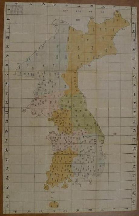
Liancourt Rocks (Dokdo / Takeshima) does not appear on the Dae Dongyeo Jido (大東輿地圖), or on any Korean map from the Joseon Dynasty, but the index map shown below makes it even clearer that Liancourt Rocks (Dokdo / Takeshima) were not considered a part of Korean territory.
It seems strange that the University of Wisconsin map is the only remaining copy of the "Dae Dongyeo Jido" (大東輿地圖) that has an index map. I wonder if it has anything to do with the fact that it was brought out of Korea in the late 1800s?

LINK to Korean Article on the map
Columbia Univ. Professor: "Kim Jeong-ho had absolutely no concept of Dokdo"
Mr Bever’s I see you’ve been posting more and more Chosun maps of Ulleungdo and Gangwando. Many of these charts are only one page of large volumes of maps of Korea and sometimes her neighbouring countries.
ReplyDeleteSo, for an objective view of the territorial perceptions of Koreans and Japanese you should also post the Chosun maps of Japan whenever possible, but I notice you neglect to do so.
For example the following map is a Chosun chart of Japan. You will notice, like all accurate Japanese maps the Oki Islands (here marked as Oki District (隱岐州) was the Westernmost limit of Japan.
Oki-Japan’s-Limit
There are many more Korean maps of Japan like this and they are crucial to determining the territorial limits of Japan and Korea, yet why haven’t any of these maps been posted here? Surely you have seen them as they are located in the same wesites and on the same page where you source your maps of Korea and Ulleungdo.
Again, take a balanced approach in your “research” Mr Bevers.
Steve,
ReplyDeleteDo you think that is an accurate map of Japan? The shape of Japan is not only deformed, but there are also hundreds of Japanese islands that do not appear on the map.
The map shows that Koreans had limited knowledge of Japanese geography. The maps contribute little or nothing to the Dokdo-Takeshima debate and are only used by people, like you, who are grasping for straws.
What those maps do prove is that Koreans considered Daemado (對馬島) to believed to be Japanese territory, contrary to what Korean nationalists claim.
There is nothing balanced about your Web site, so you have a lot of nerve to claim that this site is unbalanced. In fact, I think you may be doing it tongue-in-cheek.
Mr Bevers, that map is accurate enough to determine the limit of Japan which was of course Oki Island. (隱岐州) The Koreans certainly had enough knowledge about Japan by the time they arrived onto Chosun’s Ulleungdo region.
ReplyDeleteI’m not “grasping at straws” at all. There are hundreds of Japanese historical maps that show the limits of Japan were Oki Islands. Now, it seems I’ve found many Chosun maps of Japan that tell us the same thing. What I’m doing here is pooling data from both sides of the story that leads us to the same conclusion. Historically speaking, Japan’s territory ended at the Western limit of Oki Island.
From the maps I’m posting we also know the Chosun records related to Dokdo did not include the islands as part of Japan but rather part of Chosun (Korea)
It’s funny how you use crude Chosun maps of Ulleungdo to make assumptions that support your biased opinions, however when Chosun maps of Japan work against you, they are disregarded as “too inaccurate”. Pretty lame Mr Bevers.
Again to both Koreans and Japanese historically Oki Islands were the limit of Japan.
Japan’s-Limit-Oki
According to Prof. Kim Moon-gil, "雁道島" is today's Takeshima/Dokdo...
ReplyDelete일본 고대(奈良時代) 때, 독도를 신라 땅 안도(雁道)섬으로 불러
This comment has been removed by the author.
ReplyDeletetest
ReplyDeleteYabutarouさんの鄭尚驥「東国地図」関連の資料について、
ReplyDelete「大田島」(実は「大全図」のこと)とか「パルドブンド」(=八道分図)とか、わけのわからない言葉が並んでいるのが、私にはとても気持ちが悪いので、韓国語を翻訳しておきます。
ヤフーの掲示板
http://messages.yahoo.co.jp/bbs?.mm=GN&action=m&board=1835396&tid=cddeg&sid=1835396&mid=17587
引用されている地図のサイト
http://kr.blog.yahoo.com/krblog/4255.html?p=1&pm=l&tc=42&tt=1255088462
鄭尚驥の「東国地図」(13番目の紺色の地図)
조선 후기 지도사에서 한 획을 그은 것으로 평가되는 정상기(鄭尙驥, 1678 ~ 1752)의 동국지도이다. 정상기가 제작한 동국지도는 대전도와 팔도분도가 있는데 현존하는 것은 대부분 팔도분도이고 대전도는 매우 드물다. 이 지도는 제척(梯尺)의 형태인 백리척을 사용하여 그린 대전도로서, 당시로서는 대축척지도인 약 1 : 42만 지도이다. 한반도 북부지방의 왜곡된 윤곽이 정상기의 지도에서 비로소 제 모습을 갖추게 되었다. 이 지도는 대전도를 후대에 전사한 것으로 초기의 지도에 비해 정교함이 다소 떨어지지만 원형은 그대로 유지하고 있다.
朝鮮後期の地図史に一線を画したと評価されるチョン・サンギ(鄭尚驥1678 ~ 1752)の「東国地図」である。鄭尚驥が製作した「東国地図」には、大全図と八道分図があるが、現存するのは大部分が八道分図で大全図は非常に珍しい。この地図は、梯尺の形態の百里尺を使って描いた大全図であり、当時としては大縮尺地図の約42万分の1の地図だ。韓半島の北部地方の歪曲された輪郭が、鄭尚驥の地図ではじめて正しい姿を整えることになった。この地図は大全図を後代に転写したもので、初期の地図に比べて精巧さが多少落ちるが、原形はそのまま維持している。
次の 14 赤い地図
ReplyDeleteこの地図は、1757年(英祖33)に、英祖の命で鄭尚驥の「東国大全図」を模写して弘文館と備辺司に保管するようにした模写地図と推定されている。山、川、島などの自然地名と、郡県名、倉庫、鎮堡、察訪、山城などの人文地名、および中国と日本など全2,580余りの注記を含んでいる。山脈の表現は白頭山を基点に南に伸びた白頭大幹を大きく強調し、そこから伸びる主要山脈を強調することによって、国土を人体として認識する伝統的な地理観がそのまま反映されている。兵営、水営、邑城、鎮堡、察訪、烽燧などを記号化し、山城、峠道、関門などを絵で表現する一歩進んだ方式を見せており、これは19世紀に金正浩(キム・ジョンホ)によってさらに一層発展した。 一方、地図には、陸路、海路、峠道を現わして、軍事的、経済的、行政的な必要をすべて満たしていること示している。
*1757年(英祖33)は、申景濬『疆界誌』(『疆界考』)の書かれた1756年(英祖32)の翌年ですね。
ちょっともどって 11番目
18世紀末に製作されたと推定される朝鮮地図。朝鮮後期の地図の発達に大きく一線を画した鄭尚驥の「東国地図」の修正本系列に属する全図である。各道の郡県を円で現わし、背景の色を区別することによって八道の境界を分けた。 監営、兵営、水営は四角形で、鎮堡、駅は小さい円で表わした。 右側の註記(地理情報)には、ソウルから各地に達する距離を収録した。 他の全図とは違って道路網を描いておらず、未完の作品という感じを与える。 しかし18 ~ 19世紀につながる朝鮮全図の発達過程をよく見せる重要な地図である。
12番目 緑色の地図
正祖代に製作された地図帖の「輿地図」に収録された全国地図。全体的な輪郭は鄭尚驥の「東国地図」に従っている。この地図は何よりも派手な色彩が引き立って見えるが、山の連なりを緑色で、河川を青色、そして八道の郡県の色彩を違えて区分した。 また海岸の島々がとても詳しく描かれているが、この時期の島嶼地方に対する関心が増大していた社会的な雰囲気が反映されている。今の独島が鬱陵島の東側の東海に于山島という名称で表示されており、対馬島も描いている。地図の余白には国土の坐向、東西と南北の長さ、四方の端からソウルまでの距離、そして各道の郡県数が記載されている。
*このサイト自体が個人のブログのようで、記述内容にどれだけ信頼性があるのかは、わかりません。どこかから引用していると思います。
I really don't know what happened, but now I could post a comment.
ReplyDeleteKaneganese, Gerry,
Sorry to bother you.
No worries, matsu-san
ReplyDelete”現存するのは大部分が八道分図で大全図は非常に珍しい。””この地図は大全図を後代に転写したもので、初期の地図に比べて精巧さが多少落ちるが、原形はそのまま維持している。”
翻訳、有難うございます。でも、結局鄭尚驥自身の手によるものなのかどうか、どちらとも取れます。