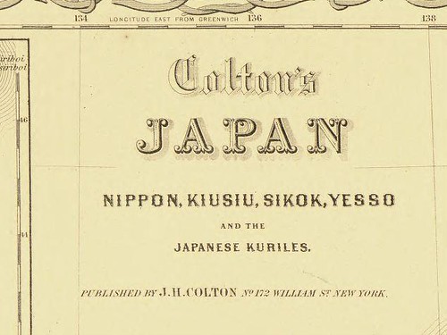
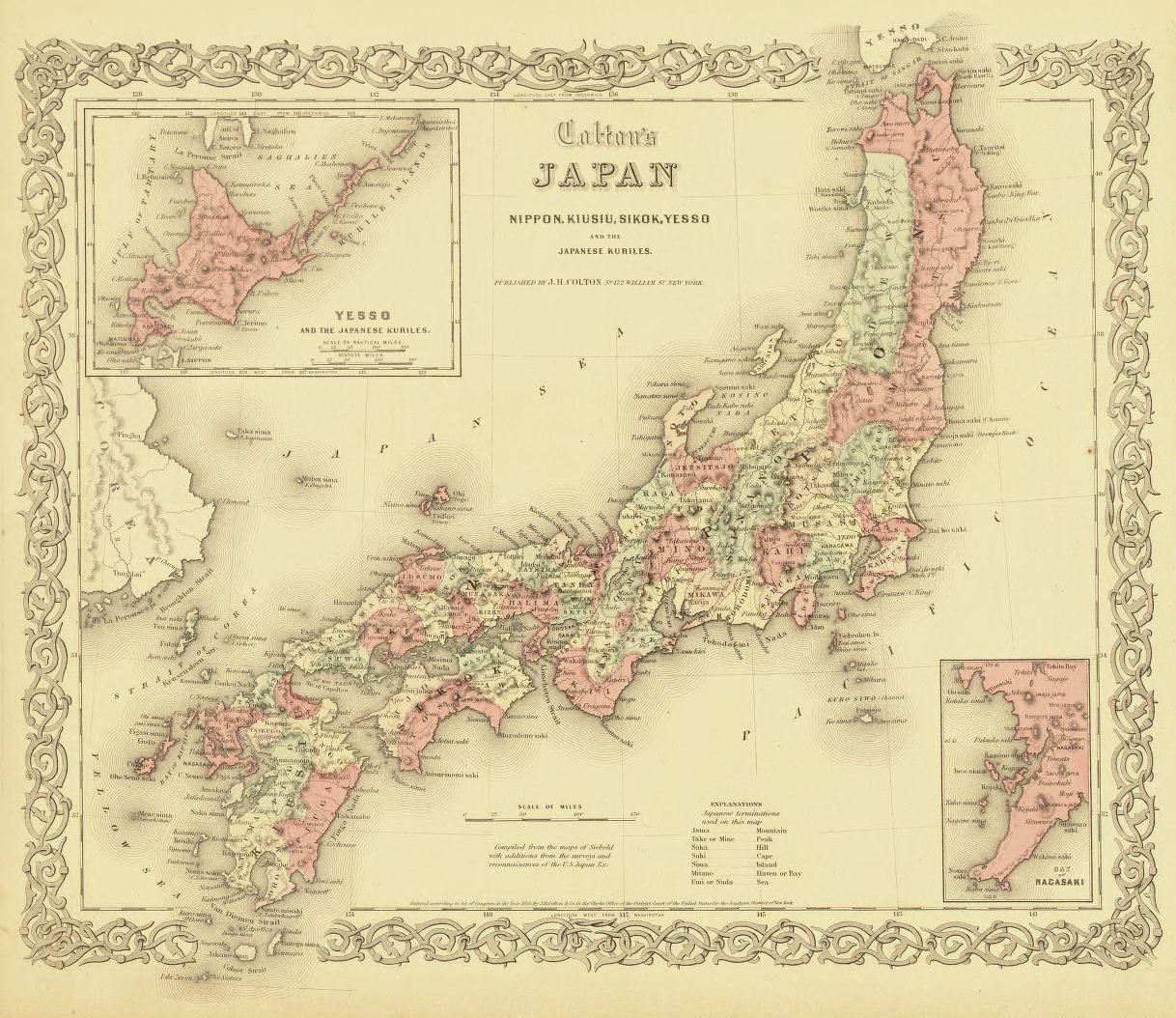
 Below is a map of Japan published by Joseph Hutchin Colton of New York in 1855. An explanation at the bottom of the map says that it was "compiled from the maps of Siebold with additions from the surveys and reconnaisances of the U.S., Japan Ex." The map is stored in the US Library of Congess.
Since Colton's map of Japan was compiled from the maps of Siebold, it included Siebold's non-existent island of "Argonante," which was also labeled on this map as "Taka sima." (The non-existent island of "Argonante" was the result of a mismapping of Ulleungdo by the British ship Argonaut in 1789.) The map also shows Korea's real Ulleungdo labeled as both "Matsu sima" and "Dagelet Island."
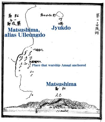
At the time, the Japanese believed Takeshima (竹島) to be the Korean island of Ulleungdo (鬱陵島) and Matsushima (松島) to be a Japanese Island (Liancourt Rocks); however, the mismapping of the islands on Western maps, such as this one, caused confusion for Japanese mapmakers (See 1875 Map , 1882 Map, & 1894 Map) and government officials. Finally, the Japanese government sent the Japanese warship Amagi to the area in 1880 to conduct a survey and clear up the confusion (1880 survey). The Amagi reported that Matsushima (松島) was actually the Korean island of Ulleungdo, which also had a neighboring island named "Takeshima" (竹嶼), which is pronounced as "Jukseo" or "Jukdo" in Korean. (1880 Survey Map)
As a result of the 1880 survey, Japan changed the Japanese name for the Korean island of Ulleungdo from "Takeshima" (竹島) to "Matsushima" (松島), and the name of Japan's old Matsushima (Liancourt Rocks) to "Liancourt Rocks." When Japan incorporated Liancourt Rocks in 1905, they renamed it "Takeshima" (竹島), which was the old Japanese name for Korea's Ulleungdo.


As far as I know, there are no detail explanation of Sebold's mismapping.
ReplyDeleteThese days I thought why Philip Van Sebold mismapping Takeshima-Argonaut and Matsushima-Dagelet.
(see. Japan by Sebold,1840). I thought he may saw 三国通覧図説 by 林子平 and 赤水圖?
三国通覧圖説
改正日本輿地路程全図 with Sebold's stanp on Raiden museum.
First of all, He had a map based on the information of Hayashi Shihei's 朝鮮八道総圖 with one Ulluengdo=Usanguk=Isotake island in His colelction.
朝鮮八道総圖 in Sebold collection.
I guess it is because he have 朝鮮八道総圖 and other Ru-chu琉球 map and Sakharin樺太 map on his "Japan" volume 20 that he may saw 林子平's another map of 三国通覧圖説.which has two ulluengdo. one might be copied from 八道総圖 and the other seems to be Japanese Ulluengdo detail map like this
or other Korean map of Ulluengdo with Jukdo like this.
三国通覧圖説
"Japan"volume 20.Sebold
Second, he has also Japanse map 日本辺界略図 with Takeshima and Matsushima.
日本辺界略図 in Sebold collection.
Original version of 日本辺界略図 on 1809 has no "Takeshima" and "Matsushima". but Sebold other added those because Sebold's 日本辺界略図 draw it.
it is appear that he bring 改正日本輿地路程全図 which draw Takeshima and Matsushima.
Even though Im not sure whether he saw 三国通覧図説 or not, so he might consider "Takeshima竹嶋"(actually Ulluengdo) on the 三国通覧図説 is "Matsushima" on the 改正日本輿地路程全図.
Then he saw European map which draws Argonaut and Dagelet on European Maps. So he may consider Argonaut is Ulleungdo-Usanguk-Isotake and "Matsushima" is Takeshima-Ulleungdo(actually real Ulleungdo) of 林子平 map(actually real Ulleungdo)
(Above is just my hypothesis) and those map confision occures I guess.