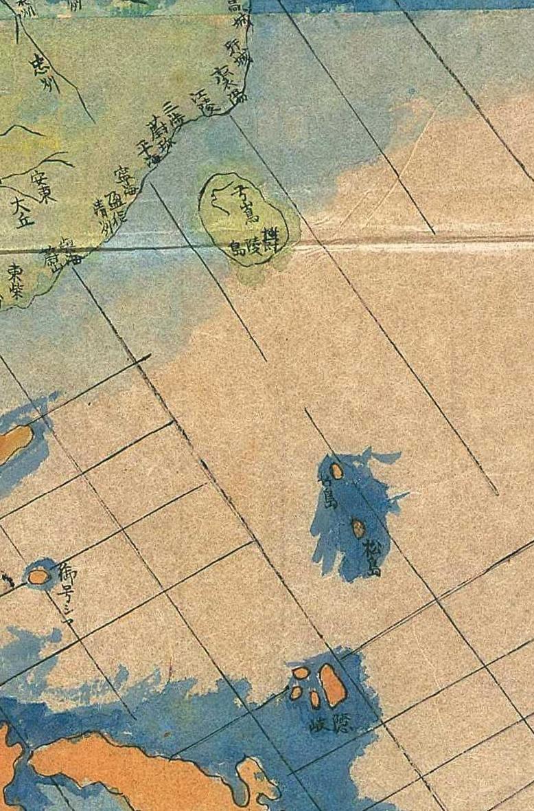
The following 1796 map shows Ulleungdo as Korean territory, labeled as both "Ulleungdo" (蔚陵島) and "Usando" (亐山島). It also shows Takeshima (竹島) and Matsushima (松島) as Japanese territory. Takeshima was the name the Japanese used for Ulleungdo, and Matsushima was the name they used for Liancourt Rocks (Dokdo). In Korean, the Chinese character 亐 has two pronunciations: 울/ul/ and 우/u/.
Can anyone give me more information on the map. I found the link to the map
HERE, and you can find the map, itself,
HERE. I think we have already talked about this map before, but I cannot find the post.
HERE is information on the map, but it is in Japanese.
The Explanation of this map on Meiji Uni's Ashida Library says,
ReplyDelete"The map is a copy of the chart possesed by Ando Jiro(安藤次郎) from Nagoya, who was a researcher of Japan-Russia negotiation history in 1940. It is a synthesized map which cover Japan, Qing, Manchuria and Russia, based on various maps from Netherlands, Russia and Ming with stories of the experience told by Mogami 最上徳内(Mogami Tokunai), an explorer of Ezo. That is why there are words of Russian, Latin along with Chinese."
I think 弓嵩 came from 于山島.
ReplyDelete弓嵩 ≒ 亏嶌 ≒ 亐嶌 ≒ '于''山''島' ≒ 子山島
That's my wild guess.
This map shows the perceptional disorder in Japan. They didn't know the Ulleung and 'Old Takeshima' was pointing the same island.
And, it shows us their concept that 竹島, 松島 ware recognised as one pair. So, reasonably, 松島 was subordinate island to 竹島.