It appears on the following satellite photo of Ulleungdo, so why not Daum's photo?

Jukdo also appears on Google's map of Ulleungdo below.
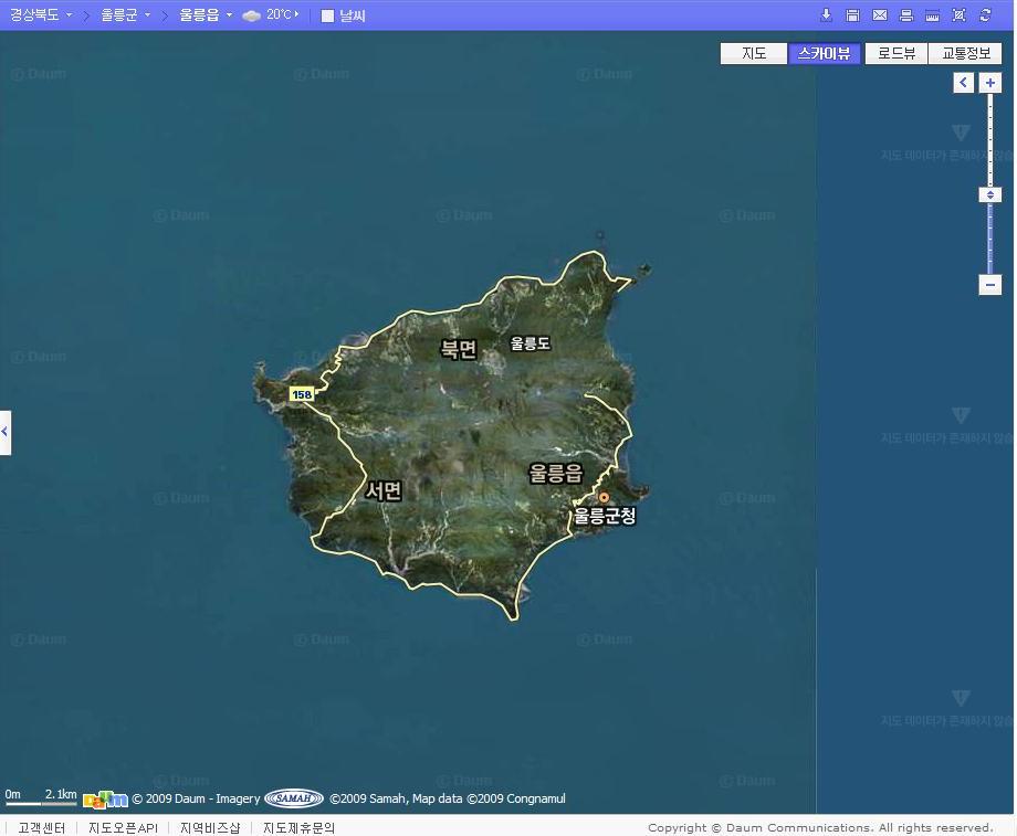
One strange thing is that the Daum map of Ulleungdo shows Jukdo (竹島 - 죽도), but not the Daum satellite photo. I wonder if it was judged to be too sensitive to show so detailed a photo?

Jukdo is the island that Koreans during the Joseon period called "Usando" (于山島 - 우산도). Many Koreans today claim that Usando was the old Korean name for Liancourt Rocks, which Koreans call "Dokdo" (獨島 - 독도) and Japanese call "Takeshima" (竹島), but Korea's old maps and documents show that Usando was Ulleungdo's neighboring island of Jukdo.
A suspicious person might think that Jukdo was deliberately removed from the Korean satellite photo to keep Koreans from suspecting the Korean claim that Usando was Dokdo (Liancourt Rocks).
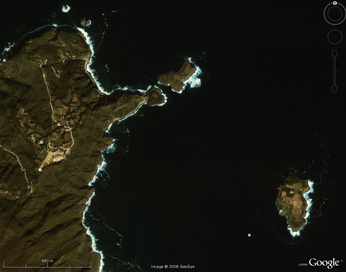
Also, why does "Sea Lion Rock" (가재바위) not appear off the southern tip of Ulleungdo in the satellite photo? The name is there, but I do not see a rock. "Gajae" (가재) is the name for "sea lion" (gangchi - 강치) in the Ulleungdo dialect and was written as "Gaji" (可支 - 가지) during Korea's Joseon period. Japanese maps from the early 1900s HERE showed the rock, and a Western document from the 1800s described it. Here is a reference to the rock from the 1864 Bristish publiction "China Pilot":
MATSUSIMA, or Dagelet island, is a collection of sharp conical hills, well clothed with wood, supporting an imposing peak in the centre, in lat. 37°30′N., long. 130°53′E. It is 18 miles in circumference, and in shape approximates a semicircle, the northern side, its diameter, running nearly E. by N. and W. by S. 6.25 miles. From each end the coast trends rather abruptly to the southward, curving gradually to the east and west, with several slight sinuosities until meeting at Seal Point, the south extreme of the island, off which is a small rock.What's really strange is that the rock appears on the Daum map of "Seal Point," but not on the satellite photo.

Again, a suspicious person might think the rock was destroyed because someone was afraid that some Koreans might suspect it to be the place referred to as "Gajido" (可支島 - 가지도) in some inspection reports of Ulleungdo in the 1700s. Some Koreans claim that Gajido was an old name for Liancourt Rocks (Dokdo / Takeshima), rather than a place around Ulleungdo, but they have no documents or maps to support their claim.
Daum Sokbo area (Jukdo,Gwaneumdo,Samseon rocks
ReplyDeleteDaum Seal point
Suppliment;
Comparison Usando-Jukdo(Boussole rock) beetween 青邱圖(1834) and Landsat data.
What a stopgap measure they are taking! Oh my my...
ReplyDeleteKorean people, they are treating you as kindergarten children!
They are hiding truth from your eyes! Be careful!
But if there is something they are eager to hide, the truth is always hiding behind that.
ReplyDeleteThank you, GTOMR. I have added your overlays to the posts.
ReplyDeleteBy the way where they will built Airport on Ulluengdo?
ReplyDeletehttp://www.kjclub.com/jp/exchange/photo/read.php?uid=1733&fid=1733&thread=1000000&idx=1&page=1&tname=exc_board_53&number=1504
GTOMR,
ReplyDeleteThe Korean on the picture says they plan to level the peak on the southern tip of the island to get the dirt and rocks to fill in the coastline for the airport. That peak was called "Seal Point" on old Western maps of Ulleungdo.
It seems that Koreans will not be satisfied until every inch of that beautiful shoreline is covered in concret.
Thanks Gerry
ReplyDeleteI think the purpose of construction of airport on Ulluengdo is not only for militarism but also wipe-out Seal Point on Ulluengdo.
By the way,This is new ASTER DATA, 1-acre(30m) scale elevation data of Ulluengdo.
ReplyDeleteIt is nine times density than Space Shuttle data, SRTM3 (3arc,90m).
(ASTER GDEM is a product of METI and NASA)