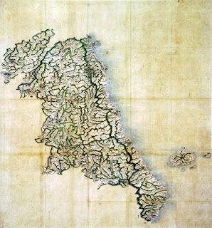
The map to the left shows Korea's Gangwon Province and the island of Ulleungdo (鬱陵島) with its neighboring island of Usando (于山). The map is stored in the Hye-jong Museum of Korea's Gyeonghui University.
The date of the map is listed as unknown, but the map resembles other Korean maps made in the late 1800s. The shape of Ulleungdo's neighboring island of Usando, for example, is similar in shape to THIS MAP, which was made sometime between 1888 and 1895.
One of the difference between the two maps is that the 1888-1995 map shows Ulleungdo with six neighboring islands, and this map shows it with only four.
Below is the portion of the map showing Ulleungdo with its neighboring island of Usan (于山). Usando (于山島) was the old name for Ulleungdo's neighboring island of Jukdo, which is about 2 kilometers off Ulleungdo's east shore.


 "
"


