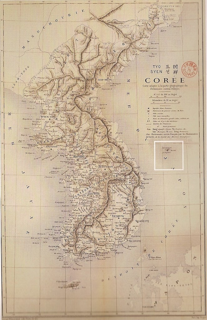
Notice below the full map that there is a cutout of Ulleungdo (Oul-neung-to) that shows Ulleungdo's neighboring island of Jukdo (竹島) labelled as "Ou-san," which was the French pronunciation for Usan (于山). This map is more evidence that Usando (于山島) was Ulleungdo's neighboring island of Jukdo (竹島), not Liancourt Rocks (Dokdo/Takeshima).

This is a copy of the map you posted about two weeks ago.
ReplyDeleteIt's a combination of western maps and Korean maps that were copied from old Chosun maps.
Nothing much at all
Steve Barber (Dokdo-takeshima),
ReplyDeleteI do not remember posting the above 1880 map before, so I think you may be confusing it with the map Kaneganese posted HERE, which was a similar but different map made in 1874 by a different person (C. C. Dallet).
I'm not confusing the maps Gerry.
ReplyDeleteWhat I'm saying is the author of this map clearly traced the aforementioned map drawn by Dallet.
Check the islands form and locations again Gerry.