 Dec. 24th edition of Japan's San-in Chuo Shimpo(山陰中央新報) (cache) reported that the new evidence which debunks pro-Korean's distorted claim was found, again.
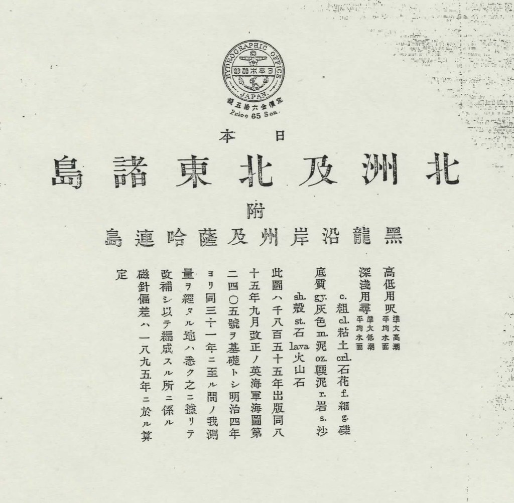
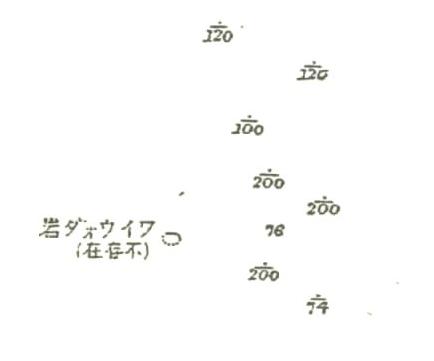
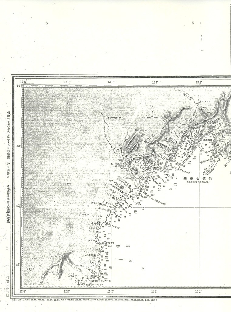
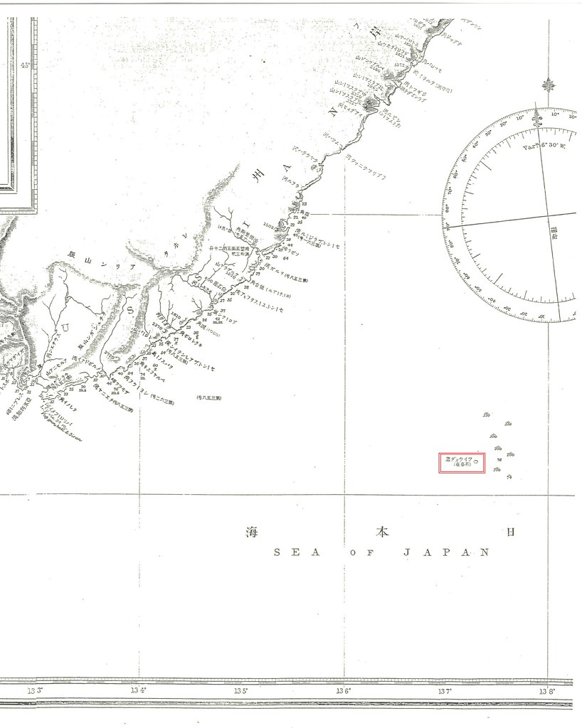
"The Sea Chart of Hokkaido and Northeastern Islands(北洲及北東諸島)" was made by Hydorographic Office of Japan(日本水路部), basing on the British Navy's seachart, in 1893 originally, just a year before the 1894 version of "Choson Seaway (朝鮮水路誌)" was published. The map plots Waywoda rock near Okushiri island of Japan's Hokkaido and it also shows the trace Japanese Navy did fathomed to survey around the area, but labelled as "non-existant" just like British "China Sea Directory" reported. The location is exactly the place 1894 "Choson Seaway" reported and it is clearly far outside of Korean territory at a glance.
Pro-Korean scholars like Prof. Hori Kazuo(1987) wrongfully claimed as follows and pro-Korean scholars have been blindlessly following his unrealistic claim even up until now.
"しかし、海図は地理的な認識を示すだけなので、海図中の島の所属については、その解説書たる水路誌を重視しなければならない。"(p105)
----------------------------------------------
"However, marine charts usually show geographical features and do not specify sovereign rights to islands in them. As for sovereign rights to islands, therefore, one has to consult a guide to sea routes, an expounder of a chart.(p105)"
----------------------------------------------
"However, marine charts usually show geographical features and do not specify sovereign rights to islands in them. As for sovereign rights to islands, therefore, one has to consult a guide to sea routes, an expounder of a chart.(p105)"
"そして他方、日本海軍の『朝鮮水路誌』一八九四年版と九十九年版には、鬱陵島と並んでリアンコールト列岩が載せられている。つまり十九世紀末に、日本海軍の水路部当局が竹島=独島を朝鮮領だと認識していたことは、疑いのないところである。"(p106)
-----------------------------------------------
"Moreover, the 1894 and 1897 editions of the Chosen suiroshi (Korea's Sealanes) by the Japanese Navy show Liancourt Rocks/Tokdo,26) along with Ullungdo. There is no doubt the Japanese naval hydrographic anthorities were aware Takeshima/Tokdo belonged to Korea around the end of the 19th century."
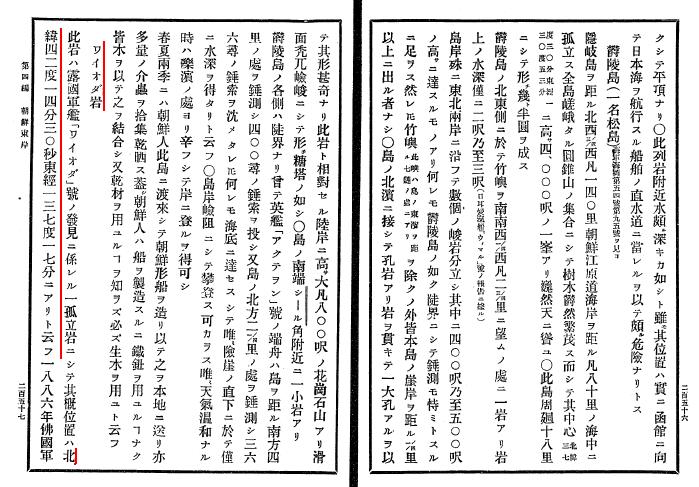
 First of all, waterway magazines are just "guide to sea routes" and they don't represent the "sovereign rights to islands". They are written for the safety of the voyages as well as seachart. In fact, Liancourt Rocks was listed along with Matsushima(Ulleungdo) and Waywoda rock as "dangerous rocks in the Sea of Japan(左ニ記載スルモノヲ除ク外日本海内絶エテ暗岩危礁ナシ)" for the safe voyages in 1894 "Choson Seaway". And Waywoda Rock was reported as situated in lat. 42°16′N., long.137°18′E. , way up north from Korean territorial limit in the first place. Pro-Korean always wrongfully refer to this book as one of the evidences Japanese considered Takeshima as Korean territory only because it was listed in the section "East Coast of Choson" of "Choson Seaway.", ignoring Waywoda rock, which is clearly outside of Korean territory, was also listed in the same section.
Moreover, the preface of this waterway magazine clearly depicts eastern limit of Korean territory is 130º 35' E.longitude, under the name of the Kimotsuki Kaneyuki (肝付兼行),a director of Hydrography Department. From this fact, we can see that Kimotsuki clearly recognized that Takeshima/Dokdo was outside of Korean territory when Nakai met him in 1904.
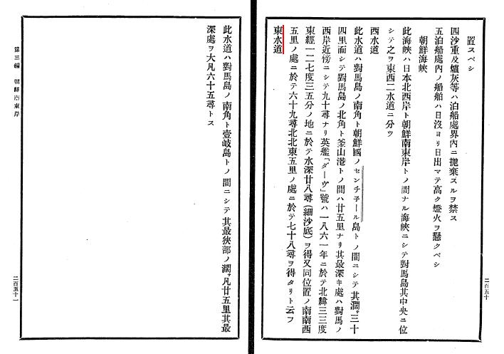
Lastly, Eastern Strait(東水道) of Choson Strait, between Tsushima and Iki(壱岐) of Nagasaki, Japan was also listed in the previous chapter(Chapter 3). You cannot claim that the strait between Tsushima and Iki also belong to Korea only because it is listed in the "Choson Seaway". It also proves that Liancourt Rocks in this waterway magazines were not for territorial issue, but only for the safety of voyages.
It is funny to see that the Prof. Hori's old unreliable thesis based on out-of-date resources, written more than 20 years ago, is still keep followed by Korean scholars and made them look stupid worldwidely.

Whats Waywoda Rock? Oh it must be referring to Dokdo as Matsushima an Takeshima do, too. Funny.
ReplyDeleteMatsushima is Dagelet(Ulleungdo) on the chart or watarway magazine.
ReplyDeleteSee here;
1860.Renseignements hydrographiques sur les ?les Bash?e, les ?les Formose et Lou-Tchou, la Cor?e, la Mer du Japon, les ?les du Japon (Ports d'Hakodaki, Ne-e-Gate, ... Yedo) et la Mer d'Okhotsk (French Edition)
1861.China Pilot Vol3 by Hydrographic Office
1863.JAPAN NIPON,KIUSIU & SIKOK KOREA 「Japan is compiled from a Japanese Government Map
1873(74?)China Sea Directory," 1st Edition Vol. 4 (1873)
1873.Preliminary Chart of Japan: Nipon, Kiusiu, and Sikok and part of the Korea Hydrographic Office
1878(1875) A directory for the navigation of the Indian Archipelago, China, and Japan, from the straits of Malacca and Sunda, and the passages east of Java. To Canton, Shanghai, the Yellow Sea, and Japan, with descriptions of the winds, monsoons, and currents, and general instructions for the various channels, harbours, etc
See:map @ P8
1894.China Sea Directory," 1st Edition Vol. 4
Un Touriste Dans L'extreme Orient 1882
ReplyDeleteJapon, Chine, Indo-chine et Tonkin (4 Aout 1881-24 Jannier 1882)
Edmondo Cotteau
(PDF P6)
Le 6 aout, nous apercevons a tribord la cote de Coree, sous la forme de haules collines ideues, trop eloignees pour qu'on puisse en distinguer les details.Nous passons beaucoup plus pres, a habord, de la petite ile Dagelet. Il y a quelques annees, un bateau danois y fit naufrage; son equipage pat se refngier sur L'ile Argonaute, indiquee dans ces parages par les anciennes cartes anglaises, n'existe pas
Corea, the hermit nation. I. Ancient and mediaeval history. II. Political and social Corea. III. Modern and recent history (1882)
ReplyDelete(P110)
From a point on the sea-coast nearby, in fair weather, the island cone of Dagelet is visible.
(P206)
Deer are very plentiful, and the best hartshorn for the pharmacy of China comes from these parts. Out in the sea, abut a degree and a half from the coart, lies and island, called by the Japanese Matsushima, or Pine Island, by the Coreans U-lon-to, and by Europeans, Dagelet, This island was first discovered by the French navigator, La Perouse, in June, 1787. In honor of an astronomer, it was named Dagelet Island. "It is very sttep, but covered with fine trees from the sea-shore to the summit. A rampart of bare rock, nearly as perpendicular as a wall. completely surrounds it, except seven sandy little coves at which it is possible to land." The grand central peak towers four sousand feet into the clouds. Firs, sycamores, and juniper trees around. Sea-bears and seals live in the water, and the few poor Coreans who inhabit the island dry the flesh of the seals and large quantities of petrels and haliotis, or sea-ears, for the markets or the main land. The island is occationally visited by Japanese junks and foreign whaling ships, as whales are plentiful in the surrounding waters. The Japanse obtained the timber for the public and other building at their new setlement at Gansan from this island.